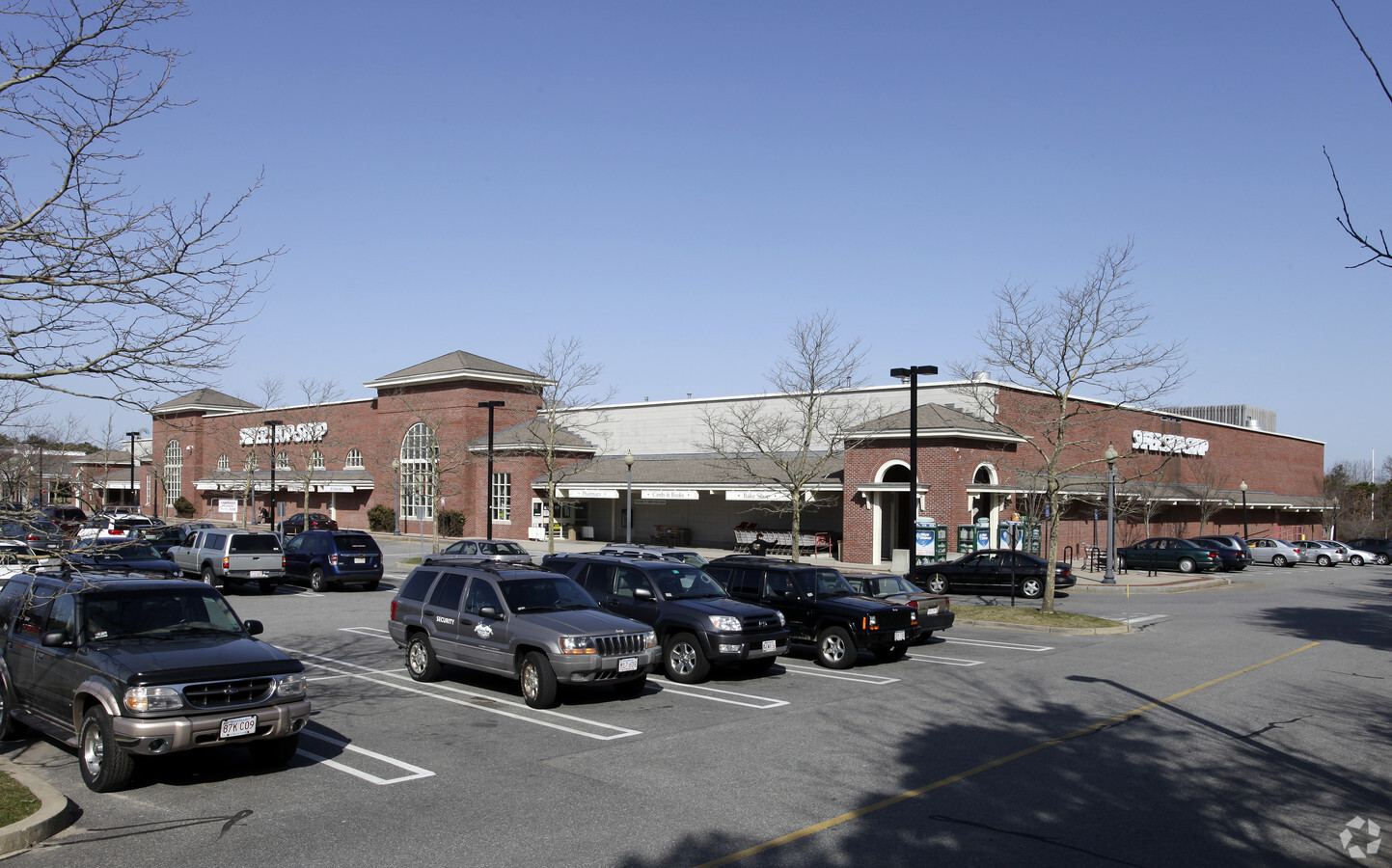
Property Record
39 Nathan Ellis Hwy, Mashpee, MA 02649
NEARBY LISTINGS FOR SALE OR LEASE
-
-
View all Mashpee listings for sale on LoopNet.com
Property Detail
39 Nathan Ellis Hwy
MASH-000074-000022
Barnstable
Commercialnec
Massachusetts
X
15.10 AC
25001C0751J
Cape Cod
2022
Other Market Areas
2024
Barnstable Town, MA
015002
DEMOGRAPHICS near 39 Nathan Ellis Hwy
1 Mile
3 Mile
5 Mile
2024 Total Population
2,792
17,318
39,161
2029 Population
2,841
17,733
40,197
Pop Growth 2024-2029
+ 1.76%
+ 2.40%
+ 2.65%
Average Age
50
49
49
2024 Total Households
1,326
7,712
16,874
HH Growth 2024-2029
+ 1.43%
+ 2.24%
+ 2.68%
Median Household Inc
$76,000
$84,766
$88,844
Avg Household Size
2.10
2.20
2.30
2024 Avg HH Vehicles
2.00
2.00
2.00
Median Home Value
$447,727
$457,111
$474,168
Median Year Built
1986
1985
1984
Nearby Places
- Restaurants
- Banks
- Shops
- Fitness
- Groceries
PUBLIC TRANSPORTATION
AIRPORT
Martha's Vineyard
DRIVE
WALK
Distance
Martha's Vineyard
85 min
27.2 mi
Freight Ports
Port of New Bedford Harbor
DRIVE
WALK
Distance
Port of New Bedford Harbor
58 min
41.1 mi
Nearby Properties
Address
Land Use
TOTAL SIZE
Lot Size
Zoning
Address
Land Use
TOTAL SIZE
Lot Size
Zoning
287 AC
R3
Address
Land Use
TOTAL SIZE
Lot Size
Zoning
12,713 SF
29.28 AC
C1
Address
Land Use
TOTAL SIZE
Lot Size
Zoning
10.94 AC
R3
Address
Land Use
TOTAL SIZE
Lot Size
Zoning
181,756 SF
135.43 AC
R5
Address
Land Use
TOTAL SIZE
Lot Size
Zoning
9 AC
C1
Address
Land Use
TOTAL SIZE
Lot Size
Zoning
24.40 AC
R3
Address
Land Use
TOTAL SIZE
Lot Size
Zoning
2,993 SF
67.60 AC
R3
Address
Land Use
TOTAL SIZE
Lot Size
Zoning
65,930 SF
3.97 AC
C1
Address
Land Use
TOTAL SIZE
Lot Size
Zoning
8,472 SF
14.29 AC
R
Address
Land Use
TOTAL SIZE
Lot Size
Zoning
2,429 SF
67.57 AC
R
Address
Land Use
TOTAL SIZE
Lot Size
Zoning
24.50 AC
C2
Address
Land Use
TOTAL SIZE
Lot Size
Zoning
4.66 AC
R
Address
Land Use
TOTAL SIZE
Lot Size
Zoning
27.80 AC
R3
Address
Land Use
TOTAL SIZE
Lot Size
Zoning
13.30 AC
I1
Address
Land Use
TOTAL SIZE
Lot Size
Zoning
41,386 SF
7.59 AC
AGA
Address
Land Use
TOTAL SIZE
Lot Size
Zoning
8,544 SF
20.31 AC
R3
Address
Land Use
TOTAL SIZE
Lot Size
Zoning
31,520 SF
3.89 AC
I1
Address
Land Use
TOTAL SIZE
Lot Size
Zoning
6.27 AC
R3
Address
Land Use
TOTAL SIZE
Lot Size
Zoning
8,910 SF
31.84 AC
R5
Address
Land Use
TOTAL SIZE
Lot Size
Zoning
1.26 AC
R3
Address
Land Use
TOTAL SIZE
Lot Size
Zoning
34.48 AC
R
Address
Land Use
TOTAL SIZE
Lot Size
Zoning
Address
Land Use
TOTAL SIZE
Lot Size
Zoning
158.42 AC
R
Address
Land Use
TOTAL SIZE
Lot Size
Zoning
5.13 AC
Address
Land Use
TOTAL SIZE
Lot Size
Zoning
28.88 AC
R
Address
Land Use
TOTAL SIZE
Lot Size
Zoning
22.50 AC
R
Address
Land Use
TOTAL SIZE
Lot Size
Zoning
229.61 AC
R3
Address
Land Use
TOTAL SIZE
Lot Size
Zoning
1.56 AC
R
Address
Land Use
TOTAL SIZE
Lot Size
Zoning
2 AC
R
The World's #1 Commercial Real Estate Marketplace
Connect with us
© 2025 CoStar Group
The information above has been obtained from sources believed reliable. While we do not doubt its accuracy we have not verified it and make no guarantee, warranty or representation about it. It is your responsibility to independently confirm its accuracy and completeness. Any projections, opinions, assumptions, or estimates used are for example only and do not represent the current or future performance of the property. The value of this transaction to you depends on tax and other factors which should be evaluated by your tax, financial, and legal advisors. You and your advisors should conduct a careful, independent investigation of the property to determine to your satisfaction the suitability of the property for your needs.