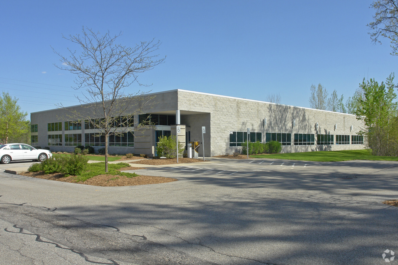
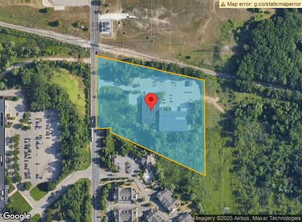
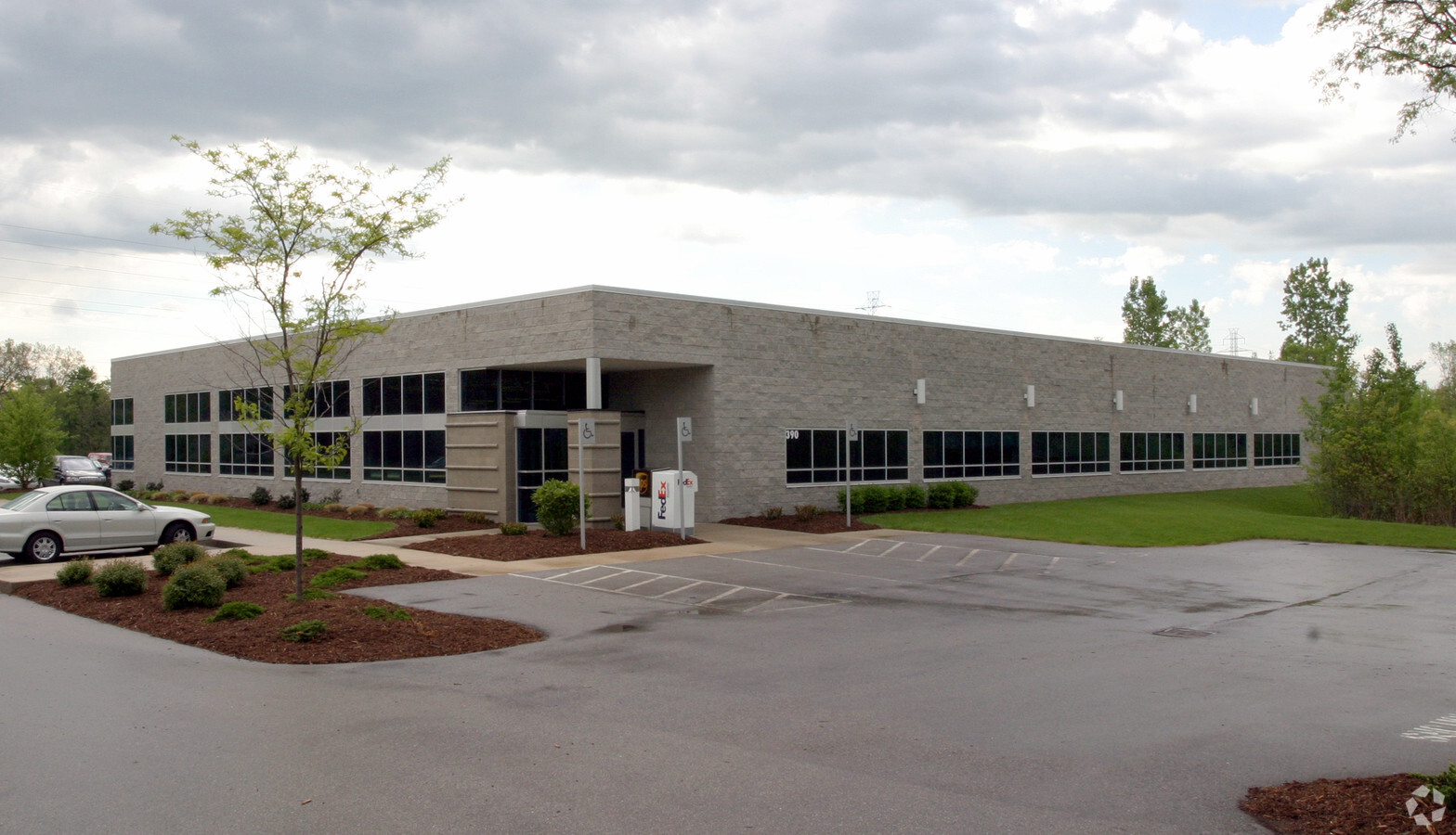
Property Record
390 Spaulding Ave Se, Ada, MI 49301
NEARBY LISTINGS FOR SALE OR LEASE
Property Detail
390 Spaulding Ave Se
Grand Rapids-Wyoming, MI
Grand Rapids
41-15-30-451-005
PART OF W 1/2 SE 1/4 COM AT S 1/4 COR OF SEC TH N 0D 23M 07S W ALONG N&S 1/4 LINE 768.50 FT TH N 0D 23M 07S W ALONG N&S 1/4
Commercialnec
Kent
2023
Michigan
2024
7.01 AC
011902
Ada/Lowell
39,312 SF
West Michigan
DEMOGRAPHICS near 390 Spaulding Ave Se
1 Mile
3 Mile
5 Mile
2024 Total Population
4,945
29,599
103,263
2029 Population
4,987
29,935
104,154
Pop Growth 2024-2029
+ 0.85%
+ 1.14%
+ 0.86%
Average Age
40
40
39
2024 Total Households
1,750
10,268
39,024
HH Growth 2024-2029
+ 0.86%
+ 1.24%
+ 0.85%
Median Household Inc
$123,326
$115,711
$95,877
Avg Household Size
2.80
2.70
2.50
2024 Avg HH Vehicles
2.00
2.00
2.00
Median Home Value
$388,162
$391,141
$350,552
Median Year Built
2000
1989
1977
Nearby Places
- Restaurants
- Banks
- Shops
- Fitness
- Groceries
PUBLIC TRANSPORTATION
COMMUTER RAIL
Grand Rapids Vernon J. Ehlers Station (Pere Marquette - Amtrak)
DRIVE
WALK
Distance
Grand Rapids Vernon J. Ehlers Station (Pere Marquette - Amtrak)
13 min
9.4 mi
AIRPORT
Gerald R Ford International
DRIVE
WALK
Distance
Gerald R Ford International
19 min
8.3 mi
Freight Ports
Port Milwaukee
DRIVE
WALK
Distance
Port Milwaukee
315 min
270.7 mi
Nearby Properties
Address
Land Use
TOTAL SIZE
Lot Size
Zoning
Address
Land Use
TOTAL SIZE
Lot Size
Zoning
277.36 AC
I
Address
Land Use
TOTAL SIZE
Lot Size
Zoning
126,805 SF
9.36 AC
C4
Address
Land Use
TOTAL SIZE
Lot Size
Zoning
709,488 SF
106.95 AC
LI
Address
Land Use
TOTAL SIZE
Lot Size
Zoning
151,708 SF
7.22 AC
C4
Address
Land Use
TOTAL SIZE
Lot Size
Zoning
Address
Land Use
TOTAL SIZE
Lot Size
Zoning
226,877 SF
22.40 AC
R2
Address
Land Use
TOTAL SIZE
Lot Size
Zoning
91,907 SF
11.25 AC
R-1
Address
Land Use
TOTAL SIZE
Lot Size
Zoning
138,278 SF
35.63 AC
R-1
Address
Land Use
TOTAL SIZE
Lot Size
Zoning
8.97 AC
Address
Land Use
TOTAL SIZE
Lot Size
Zoning
32,366 SF
34.78 AC
R-1
Address
Land Use
TOTAL SIZE
Lot Size
Zoning
154,643 SF
10.96 AC
O-PUD
Address
Land Use
TOTAL SIZE
Lot Size
Zoning
183,583 SF
9.12 AC
R-1
Address
Land Use
TOTAL SIZE
Lot Size
Zoning
18.86 AC
MON-MDR
Address
Land Use
TOTAL SIZE
Lot Size
Zoning
23.01 AC
MON-MDR
Address
Land Use
TOTAL SIZE
Lot Size
Zoning
209,417 SF
19.51 AC
C4
Address
Land Use
TOTAL SIZE
Lot Size
Zoning
105,029 SF
5.65 AC
C
Address
Land Use
TOTAL SIZE
Lot Size
Zoning
Address
Land Use
TOTAL SIZE
Lot Size
Zoning
117,572 SF
14.89 AC
B2
Address
Land Use
TOTAL SIZE
Lot Size
Zoning
247,984 SF
21.68 AC
B2
Address
Land Use
TOTAL SIZE
Lot Size
Zoning
Address
Land Use
TOTAL SIZE
Lot Size
Zoning
110,706 SF
23.76 AC
C4
Address
Land Use
TOTAL SIZE
Lot Size
Zoning
169,873 SF
12.33 AC
R4
Address
Land Use
TOTAL SIZE
Lot Size
Zoning
1,144 SF
4.15 AC
PUD
Address
Land Use
TOTAL SIZE
Lot Size
Zoning
67,400 SF
6.43 AC
O-PUD
Address
Land Use
TOTAL SIZE
Lot Size
Zoning
83,464 SF
3.28 AC
SD-PRD
Address
Land Use
TOTAL SIZE
Lot Size
Zoning
33,540 SF
5.67 AC
PO
Address
Land Use
TOTAL SIZE
Lot Size
Zoning
86,280 SF
14.50 AC
MON-MDR
Address
Land Use
TOTAL SIZE
Lot Size
Zoning
31,736 SF
3.76 AC
C4
Address
Land Use
TOTAL SIZE
Lot Size
Zoning
42,095 SF
3.87 AC
SR
Address
Land Use
TOTAL SIZE
Lot Size
Zoning
81,762 SF
9.26 AC
C-PUD
The World's #1 Commercial Real Estate Marketplace
Connect with us
© 2025 CoStar Group
The information above has been obtained from sources believed reliable. While we do not doubt its accuracy we have not verified it and make no guarantee, warranty or representation about it. It is your responsibility to independently confirm its accuracy and completeness. Any projections, opinions, assumptions, or estimates used are for example only and do not represent the current or future performance of the property. The value of this transaction to you depends on tax and other factors which should be evaluated by your tax, financial, and legal advisors. You and your advisors should conduct a careful, independent investigation of the property to determine to your satisfaction the suitability of the property for your needs.