Property Record
3900 E Mustard Way, Springfield, MO 65803

NEARBY LISTINGS FOR SALE OR LEASE
Property Detail
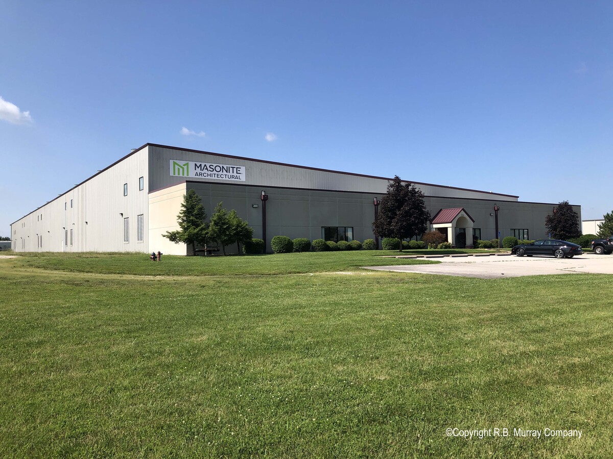
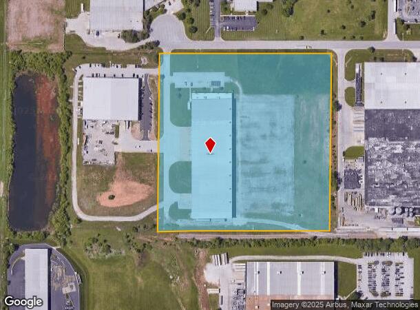
3900 E Mustard Way
Springfield, MO
Partnership Industrial Center Phase 5
12-03-400-053
PARTNERSHIP INDUSTRIAL CTR PHASE 5 LOT 1 (EX W 400 FT) & CONTICO INTERNATIONAL INC A REPL LOT 1 PARTNERSHIP INDUSTRIAL CTR
Manufacturinglight
Greene
X
Missouri
29077C0352E
1-2
2024
14.30 AC
2024
Northeast
003702
Springfield
99,186 SF
DEMOGRAPHICS near 3900 E Mustard Way
1 Mile
3 Mile
5 Mile
2024 Total Population
170
13,978
71,783
2029 Population
180
14,497
74,579
Pop Growth 2024-2029
+ 5.88%
+ 3.71%
+ 3.90%
Average Age
41
40
39
2024 Total Households
67
6,222
30,758
HH Growth 2024-2029
+ 5.97%
+ 3.81%
+ 4.11%
Median Household Inc
$110,416
$51,001
$47,548
Avg Household Size
2.50
2.20
2.10
2024 Avg HH Vehicles
2.00
2.00
2.00
Median Home Value
$338,095
$212,969
$187,069
Median Year Built
2010
1984
1974
Nearby Places
- Restaurants
- Banks
- Shops
- Fitness
- Groceries
PUBLIC TRANSPORTATION
AIRPORT
Springfield-Branson Ntl
DRIVE
WALK
Distance
Springfield-Branson Ntl
28 min
15.8 mi
Freight Ports
Tulsa Port of Inola
DRIVE
WALK
Distance
Tulsa Port of Inola
201 min
178.1 mi
SALE & LEASE HISTORY
LISTING DATE
SALE/LEASE

Jul 16, 2021
For Sale
Nearby Properties
Address
Land Use
TOTAL SIZE
Lot Size
Zoning
Address
Land Use
TOTAL SIZE
Lot Size
Zoning
35.56 AC
INC
Address
Land Use
TOTAL SIZE
Lot Size
Zoning
20.01 AC
Address
Land Use
TOTAL SIZE
Lot Size
Zoning
22.01 AC
INC.
Address
Land Use
TOTAL SIZE
Lot Size
Zoning
617,990 SF
49.88 AC
INC
Address
Land Use
TOTAL SIZE
Lot Size
Zoning
1,728,457 SF
123.60 AC
INC
Address
Land Use
TOTAL SIZE
Lot Size
Zoning
5.47 AC
INC
Address
Land Use
TOTAL SIZE
Lot Size
Zoning
18.35 AC
Address
Land Use
TOTAL SIZE
Lot Size
Zoning
340,000 SF
37.93 AC
INC
Address
Land Use
TOTAL SIZE
Lot Size
Zoning
359,020 SF
14 AC
INC
Address
Land Use
TOTAL SIZE
Lot Size
Zoning
24.54 AC
INC.
Address
Land Use
TOTAL SIZE
Lot Size
Zoning
349,216 SF
29.46 AC
INC
Address
Land Use
TOTAL SIZE
Lot Size
Zoning
13.88 AC
INC
Address
Land Use
TOTAL SIZE
Lot Size
Zoning
805,370 SF
54.30 AC
INC
Address
Land Use
TOTAL SIZE
Lot Size
Zoning
37.01 AC
INC
Address
Land Use
TOTAL SIZE
Lot Size
Zoning
143,774 SF
5.85 AC
INC
Address
Land Use
TOTAL SIZE
Lot Size
Zoning
20.10 AC
INC
Address
Land Use
TOTAL SIZE
Lot Size
Zoning
290,844 SF
20.78 AC
INC
Address
Land Use
TOTAL SIZE
Lot Size
Zoning
127,740 SF
27.70 AC
INC
Address
Land Use
TOTAL SIZE
Lot Size
Zoning
31.56 AC
INC
Address
Land Use
TOTAL SIZE
Lot Size
Zoning
328,252 SF
18.67 AC
INC
Address
Land Use
TOTAL SIZE
Lot Size
Zoning
491,910 SF
49.03 AC
INC
Address
Land Use
TOTAL SIZE
Lot Size
Zoning
256,172 SF
19.03 AC
INC
Address
Land Use
TOTAL SIZE
Lot Size
Zoning
2.75 AC
INC
Address
Land Use
TOTAL SIZE
Lot Size
Zoning
92,702 SF
42.54 AC
INC
Address
Land Use
TOTAL SIZE
Lot Size
Zoning
70,284 SF
22.88 AC
INC
Address
Land Use
TOTAL SIZE
Lot Size
Zoning
11.68 AC
INC
Address
Land Use
TOTAL SIZE
Lot Size
Zoning
323,771 SF
31.48 AC
INC
Address
Land Use
TOTAL SIZE
Lot Size
Zoning
79.50 AC
INC
Address
Land Use
TOTAL SIZE
Lot Size
Zoning
4.62 AC
INC
Address
Land Use
TOTAL SIZE
Lot Size
Zoning
16.03 AC
INC
The World's #1 Commercial Real Estate Marketplace
Connect with us
© 2025 CoStar Group
The information above has been obtained from sources believed reliable. While we do not doubt its accuracy we have not verified it and make no guarantee, warranty or representation about it. It is your responsibility to independently confirm its accuracy and completeness. Any projections, opinions, assumptions, or estimates used are for example only and do not represent the current or future performance of the property. The value of this transaction to you depends on tax and other factors which should be evaluated by your tax, financial, and legal advisors. You and your advisors should conduct a careful, independent investigation of the property to determine to your satisfaction the suitability of the property for your needs.