Property Record
3900 Industrial Rd, Harrisburg, PA 17110


NEARBY LISTINGS FOR SALE OR LEASE
Property Detail
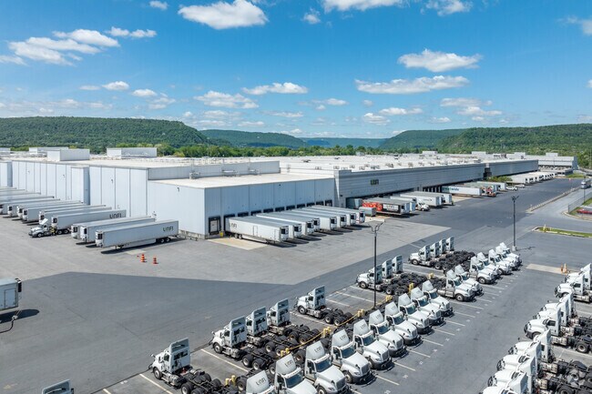
3900 Industrial Rd
14-041-031
Bonnyview
Warehouse
Dauphin
A
Pennsylvania
42043C0317D
47.78 AC
2025
Harrisburg Area East
2025
Philadelphia
021100
Harrisburg-Carlisle, PA
638,721 SF
DEMOGRAPHICS near 3900 Industrial Rd
1 Mile
3 Mile
5 Mile
2024 Total Population
5,103
53,236
159,750
2029 Population
5,256
55,118
165,500
Pop Growth 2024-2029
+ 3.00%
+ 3.54%
+ 3.60%
Average Age
41
40
40
2024 Total Households
2,036
23,036
67,319
HH Growth 2024-2029
+ 3.05%
+ 3.62%
+ 3.75%
Median Household Inc
$93,881
$65,942
$64,325
Avg Household Size
2.40
2.20
2.30
2024 Avg HH Vehicles
2.00
2.00
2.00
Median Home Value
$196,842
$171,208
$186,234
Median Year Built
1970
1964
1964
Nearby Places
Map Layers
Map Styles
 Street
 Aerial
- Restaurants
- Banks
- Shops
- Fitness
- Groceries
PUBLIC TRANSPORTATION
COMMUTER RAIL
Harrisburg (Keystone Service - Amtrak, Pennsylvanian - Amtrak)
DRIVE
WALK
Distance
Harrisburg (Keystone Service - Amtrak, Pennsylvanian - Amtrak)
12 min
4.7 mi
AIRPORT
Harrisburg International
DRIVE
WALK
Distance
Harrisburg International
27 min
14.5 mi
Freight Ports
Port of Baltimore
DRIVE
WALK
Distance
Port of Baltimore
120 min
85.3 mi
SALE & LEASE HISTORY
LISTING DATE
SALE/LEASE

Sep 25, 2016
For Lease
Aug 07, 2019
For Sale
Nearby Properties
Address
Land Use
TOTAL SIZE
Lot Size
Zoning
Address
Land Use
TOTAL SIZE
Lot Size
Zoning
615,797 SF
59.70 AC
Address
Land Use
TOTAL SIZE
Lot Size
Zoning
3,025 SF
274.13 AC
Address
Land Use
TOTAL SIZE
Lot Size
Zoning
35.15 AC
Address
Land Use
TOTAL SIZE
Lot Size
Zoning
577,075 SF
39.55 AC
Address
Land Use
TOTAL SIZE
Lot Size
Zoning
1,155,340 SF
3.94 AC
Address
Land Use
TOTAL SIZE
Lot Size
Zoning
329,377 SF
1.66 AC
Address
Land Use
TOTAL SIZE
Lot Size
Zoning
30.87 AC
Address
Land Use
TOTAL SIZE
Lot Size
Zoning
125,255 SF
26.65 AC
Address
Land Use
TOTAL SIZE
Lot Size
Zoning
192,390 SF
43.19 AC
Address
Land Use
TOTAL SIZE
Lot Size
Zoning
242,534 SF
47.26 AC
Address
Land Use
TOTAL SIZE
Lot Size
Zoning
228,141 SF
42.50 AC
Address
Land Use
TOTAL SIZE
Lot Size
Zoning
112,388 SF
38.01 AC
Address
Land Use
TOTAL SIZE
Lot Size
Zoning
226,101 SF
46.29 AC
Address
Land Use
TOTAL SIZE
Lot Size
Zoning
132,080 SF
4.74 AC
Address
Land Use
TOTAL SIZE
Lot Size
Zoning
1,989 SF
16.62 AC
Address
Land Use
TOTAL SIZE
Lot Size
Zoning
665,098 SF
14 AC
Address
Land Use
TOTAL SIZE
Lot Size
Zoning
Address
Land Use
TOTAL SIZE
Lot Size
Zoning
9.88 AC
Address
Land Use
TOTAL SIZE
Lot Size
Zoning
51,300 SF
11.36 AC
Address
Land Use
TOTAL SIZE
Lot Size
Zoning
246,276 SF
27.26 AC
Address
Land Use
TOTAL SIZE
Lot Size
Zoning
24.77 AC
Address
Land Use
TOTAL SIZE
Lot Size
Zoning
378,512 SF
2.96 AC
Address
Land Use
TOTAL SIZE
Lot Size
Zoning
16.61 AC
Address
Land Use
TOTAL SIZE
Lot Size
Zoning
114,044 SF
23.13 AC
Address
Land Use
TOTAL SIZE
Lot Size
Zoning
29,125 SF
11.77 AC
Address
Land Use
TOTAL SIZE
Lot Size
Zoning
15.58 AC
Address
Land Use
TOTAL SIZE
Lot Size
Zoning
1,702 SF
3.44 AC
Address
Land Use
TOTAL SIZE
Lot Size
Zoning
66,864 SF
26.25 AC
Address
Land Use
TOTAL SIZE
Lot Size
Zoning
78,525 SF
15.50 AC
The World's #1 Commercial Real Estate Marketplace
Connect with us
© 2026 CoStar Group
The information above has been obtained from sources believed reliable. While we do not doubt its accuracy we have not verified it and make no guarantee, warranty or representation about it. It is your responsibility to independently confirm its accuracy and completeness. Any projections, opinions, assumptions, or estimates used are for example only and do not represent the current or future performance of the property. The value of this transaction to you depends on tax and other factors which should be evaluated by your tax, financial, and legal advisors. You and your advisors should conduct a careful, independent investigation of the property to determine to your satisfaction the suitability of the property for your needs.