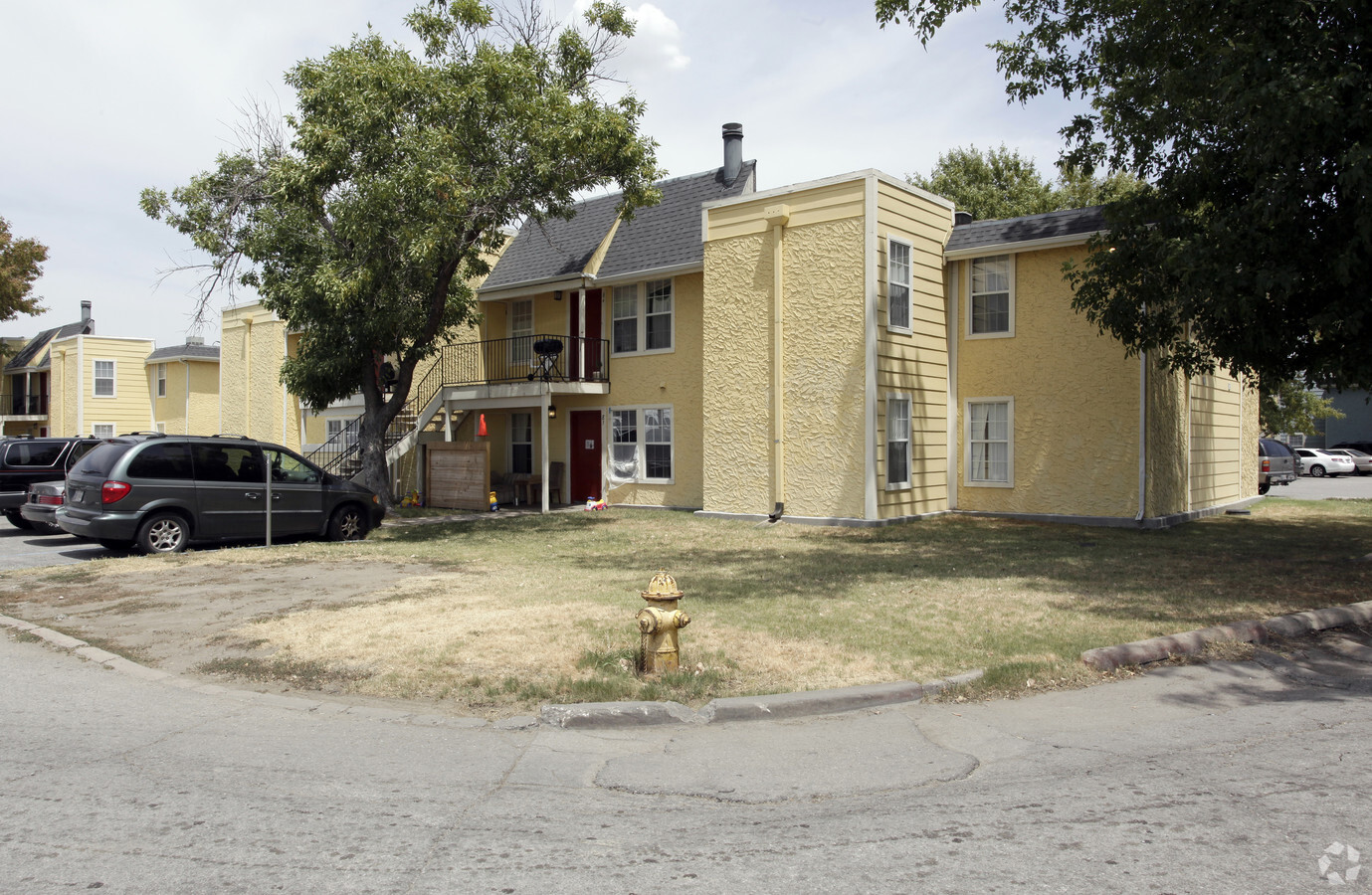
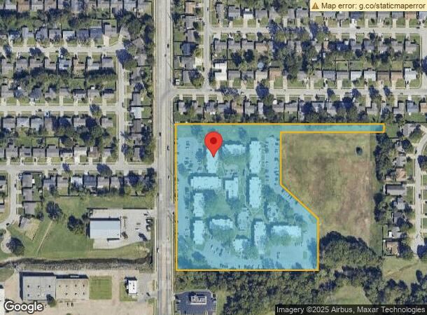
Property Record
3901 S Garnett Rd, Tulsa, OK 74146
NEARBY LISTINGS FOR SALE OR LEASE
Property Detail
3901 S Garnett Rd
Tulsa, OK
4100 East
77980-94-20-23670
PRT LT 1 & PRT VAC ST & PRT RES A BEG SWC LT 1 TH N659.81 E940.40 S35 W467.06 S30 TO SL VAC 38 ST S212.19 SE226.74 S230.81 W639.07 POB BLK 1
Multifamilydwelling
Tulsa
AE
Oklahoma
40143C0376M
1
2023
8.72 AC
2024
Outer East Tulsa
009006
Tulsa
135,588 SF
DEMOGRAPHICS near 3901 S Garnett Rd
1 Mile
3 Mile
5 Mile
2024 Total Population
15,065
88,002
211,683
2029 Population
15,422
90,588
218,439
Pop Growth 2024-2029
+ 2.37%
+ 2.94%
+ 3.19%
Average Age
32
36
38
2024 Total Households
5,531
33,908
85,989
HH Growth 2024-2029
+ 2.50%
+ 2.99%
+ 3.28%
Median Household Inc
$37,349
$47,320
$55,154
Avg Household Size
2.60
2.50
2.40
2024 Avg HH Vehicles
2.00
2.00
2.00
Median Home Value
$120,700
$142,542
$166,495
Median Year Built
1976
1976
1976
Nearby Places
- Restaurants
- Banks
- Shops
- Fitness
- Groceries
PUBLIC TRANSPORTATION
AIRPORT
Tulsa International
DRIVE
WALK
Distance
Tulsa International
18 min
11.3 mi
Freight Ports
Tulsa Port Of Catoosa
DRIVE
WALK
Distance
Tulsa Port Of Catoosa
21 min
15.1 mi
Nearby Properties
Address
Land Use
TOTAL SIZE
Lot Size
Zoning
Address
Land Use
TOTAL SIZE
Lot Size
Zoning
184,679 SF
33.97 AC
AG
Address
Land Use
TOTAL SIZE
Lot Size
Zoning
80,431 SF
9.51 AC
IL
Address
Land Use
TOTAL SIZE
Lot Size
Zoning
350,741 SF
28.01 AC
CS
Address
Land Use
TOTAL SIZE
Lot Size
Zoning
25,173 SF
155.93 AC
RS3
Address
Land Use
TOTAL SIZE
Lot Size
Zoning
53,094 SF
11.11 AC
CO
Address
Land Use
TOTAL SIZE
Lot Size
Zoning
55,283 SF
39.50 AC
SR
Address
Land Use
TOTAL SIZE
Lot Size
Zoning
112,556 SF
11.07 AC
CH
Address
Land Use
TOTAL SIZE
Lot Size
Zoning
625 SF
78.96 AC
RS3
Address
Land Use
TOTAL SIZE
Lot Size
Zoning
73,294 SF
10.08 AC
RS3
Address
Land Use
TOTAL SIZE
Lot Size
Zoning
222,768 SF
20.24 AC
CS
Address
Land Use
TOTAL SIZE
Lot Size
Zoning
248,722 SF
15.01 AC
RM
Address
Land Use
TOTAL SIZE
Lot Size
Zoning
25,604 SF
25.15 AC
IL
Address
Land Use
TOTAL SIZE
Lot Size
Zoning
57,630 SF
35.09 AC
IL
Address
Land Use
TOTAL SIZE
Lot Size
Zoning
33,332 SF
2.92 AC
CO
Address
Land Use
TOTAL SIZE
Lot Size
Zoning
78,096 SF
3.20 AC
RM2
Address
Land Use
TOTAL SIZE
Lot Size
Zoning
41,057 SF
5.45 AC
IL
Address
Land Use
TOTAL SIZE
Lot Size
Zoning
239,868 SF
14.84 AC
CG
Address
Land Use
TOTAL SIZE
Lot Size
Zoning
268,496 SF
19.31 AC
CN
Address
Land Use
TOTAL SIZE
Lot Size
Zoning
80,020 SF
2.96 AC
RM2
Address
Land Use
TOTAL SIZE
Lot Size
Zoning
94,348 SF
11.20 AC
CO
Address
Land Use
TOTAL SIZE
Lot Size
Zoning
79,442 SF
2.74 AC
RM1
Address
Land Use
TOTAL SIZE
Lot Size
Zoning
94,952 SF
8.57 AC
IL
Address
Land Use
TOTAL SIZE
Lot Size
Zoning
317,996 SF
17.24 AC
CS
Address
Land Use
TOTAL SIZE
Lot Size
Zoning
41,410 SF
3.07 AC
RS3
Address
Land Use
TOTAL SIZE
Lot Size
Zoning
252,887 SF
80.92 AC
OL
Address
Land Use
TOTAL SIZE
Lot Size
Zoning
367,352 SF
17.83 AC
CG
Address
Land Use
TOTAL SIZE
Lot Size
Zoning
31,200 SF
2.45 AC
IL
Address
Land Use
TOTAL SIZE
Lot Size
Zoning
28,465 SF
6.71 AC
RS3
Address
Land Use
TOTAL SIZE
Lot Size
Zoning
24,113 SF
3.54 AC
CS
Address
Land Use
TOTAL SIZE
Lot Size
Zoning
309,169 SF
75.37 AC
IL
The World's #1 Commercial Real Estate Marketplace
Connect with us
© 2025 CoStar Group
The information above has been obtained from sources believed reliable. While we do not doubt its accuracy we have not verified it and make no guarantee, warranty or representation about it. It is your responsibility to independently confirm its accuracy and completeness. Any projections, opinions, assumptions, or estimates used are for example only and do not represent the current or future performance of the property. The value of this transaction to you depends on tax and other factors which should be evaluated by your tax, financial, and legal advisors. You and your advisors should conduct a careful, independent investigation of the property to determine to your satisfaction the suitability of the property for your needs.