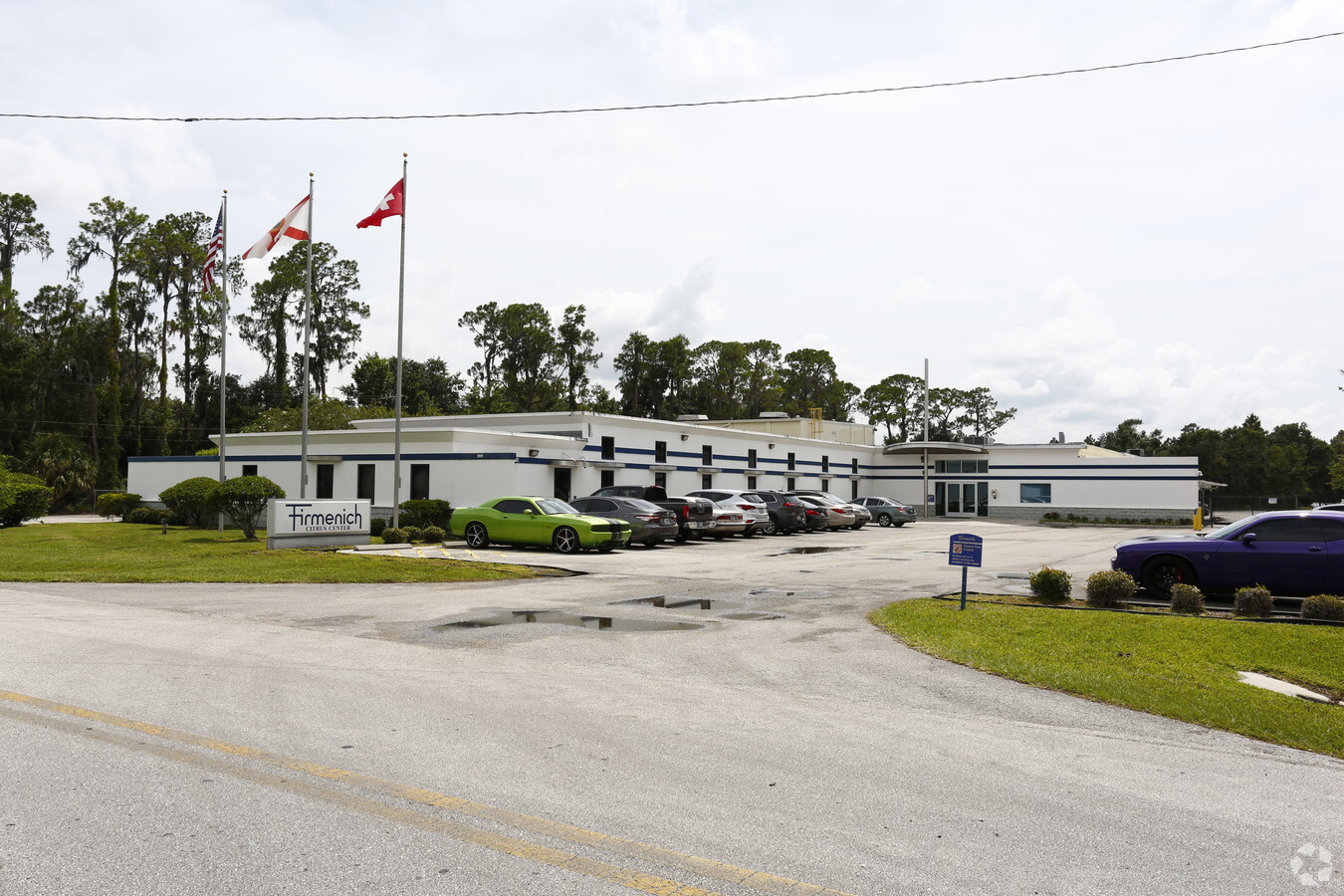
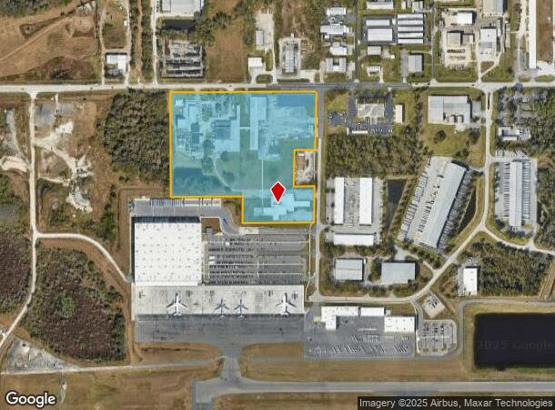
Property Record
3919 Kidron Rd, Lakeland, FL 33811

NEARBY LISTINGS FOR SALE OR LEASE
Property Detail
3919 Kidron Rd
23-29-05-000000-031070
Lakeland Industrial Park
Lightindustrial
EG NE COR OF NE1/4 OF NW1/4 RUN W 857.99 FT S 40 FT TO POB RUN S 790.89 FT E 273.07 FT N 790.96 FT W 277.75 FT TO POB & BEG 23.79 FT W & 40.01 FT S OF NE COR OF NE1/4 OF NW1/4 RUN S01-08-20W 441.08 FT W 245 FT S 110 FT W 305.28 FT N 550.96 FT E 555.5
A
Polk
12105C0460G
Florida
2023
21.50 AC
2023
Polk County
011902
Tampa/St Petersburg
144,369 SF
Lakeland-Winter Haven, FL
DEMOGRAPHICS near 3919 Kidron Rd
1 Mile
3 Mile
5 Mile
2024 Total Population
1,319
15,299
89,203
2029 Population
1,560
17,986
105,142
Pop Growth 2024-2029
+ 18.27%
+ 17.56%
+ 17.87%
Average Age
49
40
40
2024 Total Households
589
5,557
34,848
HH Growth 2024-2029
+ 18.17%
+ 17.76%
+ 18.16%
Median Household Inc
$101,071
$76,357
$60,659
Avg Household Size
2.20
2.70
2.50
2024 Avg HH Vehicles
2.00
2.00
2.00
Median Home Value
$250,615
$265,240
$209,749
Median Year Built
2004
1995
1985
Nearby Places
- Restaurants
- Banks
- Shops
- Fitness
- Groceries
PUBLIC TRANSPORTATION
COMMUTER RAIL
Lakeland (Silver Star - Amtrak)
DRIVE
WALK
Distance
Lakeland (Silver Star - Amtrak)
14 min
7.9 mi
Freight Ports
Port of Tampa Bay
DRIVE
WALK
Distance
Port of Tampa Bay
45 min
32.1 mi
Nearby Properties
Address
Land Use
TOTAL SIZE
Lot Size
Zoning
Address
Land Use
TOTAL SIZE
Lot Size
Zoning
2,095,234 SF
102.45 AC
PUD
Address
Land Use
TOTAL SIZE
Lot Size
Zoning
1,494,080 SF
116.77 AC
Address
Land Use
TOTAL SIZE
Lot Size
Zoning
1,210,880 SF
405.82 AC
PUD
Address
Land Use
TOTAL SIZE
Lot Size
Zoning
518,028 SF
195.69 AC
Address
Land Use
TOTAL SIZE
Lot Size
Zoning
595,473 SF
47.29 AC
Address
Land Use
TOTAL SIZE
Lot Size
Zoning
805,336 SF
52.50 AC
PD
Address
Land Use
TOTAL SIZE
Lot Size
Zoning
779,760 SF
67.03 AC
PD
Address
Land Use
TOTAL SIZE
Lot Size
Zoning
711,568 SF
43.33 AC
PD
Address
Land Use
TOTAL SIZE
Lot Size
Zoning
508,310 SF
37.34 AC
M-1A
Address
Land Use
TOTAL SIZE
Lot Size
Zoning
655,123 SF
45.28 AC
Address
Land Use
TOTAL SIZE
Lot Size
Zoning
492,960 SF
22.09 AC
Address
Land Use
TOTAL SIZE
Lot Size
Zoning
599,280 SF
35.27 AC
GI
Address
Land Use
TOTAL SIZE
Lot Size
Zoning
519,750 SF
25.62 AC
Address
Land Use
TOTAL SIZE
Lot Size
Zoning
602,125 SF
43.97 AC
Address
Land Use
TOTAL SIZE
Lot Size
Zoning
417,250 SF
14.59 AC
Address
Land Use
TOTAL SIZE
Lot Size
Zoning
566,274 SF
33.79 AC
GI
Address
Land Use
TOTAL SIZE
Lot Size
Zoning
296,264 SF
26.74 AC
Address
Land Use
TOTAL SIZE
Lot Size
Zoning
491,333 SF
135.58 AC
Address
Land Use
TOTAL SIZE
Lot Size
Zoning
387,165 SF
37 AC
I2
Address
Land Use
TOTAL SIZE
Lot Size
Zoning
220,510 SF
37.15 AC
PD
Address
Land Use
TOTAL SIZE
Lot Size
Zoning
349,920 SF
22.21 AC
Address
Land Use
TOTAL SIZE
Lot Size
Zoning
297,907 SF
21.43 AC
I
Address
Land Use
TOTAL SIZE
Lot Size
Zoning
300,411 SF
18.77 AC
PD
Address
Land Use
TOTAL SIZE
Lot Size
Zoning
328,863 SF
38.93 AC
M-1A
Address
Land Use
TOTAL SIZE
Lot Size
Zoning
297,907 SF
22.41 AC
M-1A
Address
Land Use
TOTAL SIZE
Lot Size
Zoning
432,087 SF
626.03 AC
PUD
Address
Land Use
TOTAL SIZE
Lot Size
Zoning
441,480 SF
24.28 AC
Address
Land Use
TOTAL SIZE
Lot Size
Zoning
333,560 SF
44.88 AC
IND
Address
Land Use
TOTAL SIZE
Lot Size
Zoning
187,247 SF
10.19 AC
PD
Address
Land Use
TOTAL SIZE
Lot Size
Zoning
181,400 SF
17.06 AC
PD
The World's #1 Commercial Real Estate Marketplace
Connect with us
© 2025 CoStar Group
The information above has been obtained from sources believed reliable. While we do not doubt its accuracy we have not verified it and make no guarantee, warranty or representation about it. It is your responsibility to independently confirm its accuracy and completeness. Any projections, opinions, assumptions, or estimates used are for example only and do not represent the current or future performance of the property. The value of this transaction to you depends on tax and other factors which should be evaluated by your tax, financial, and legal advisors. You and your advisors should conduct a careful, independent investigation of the property to determine to your satisfaction the suitability of the property for your needs.