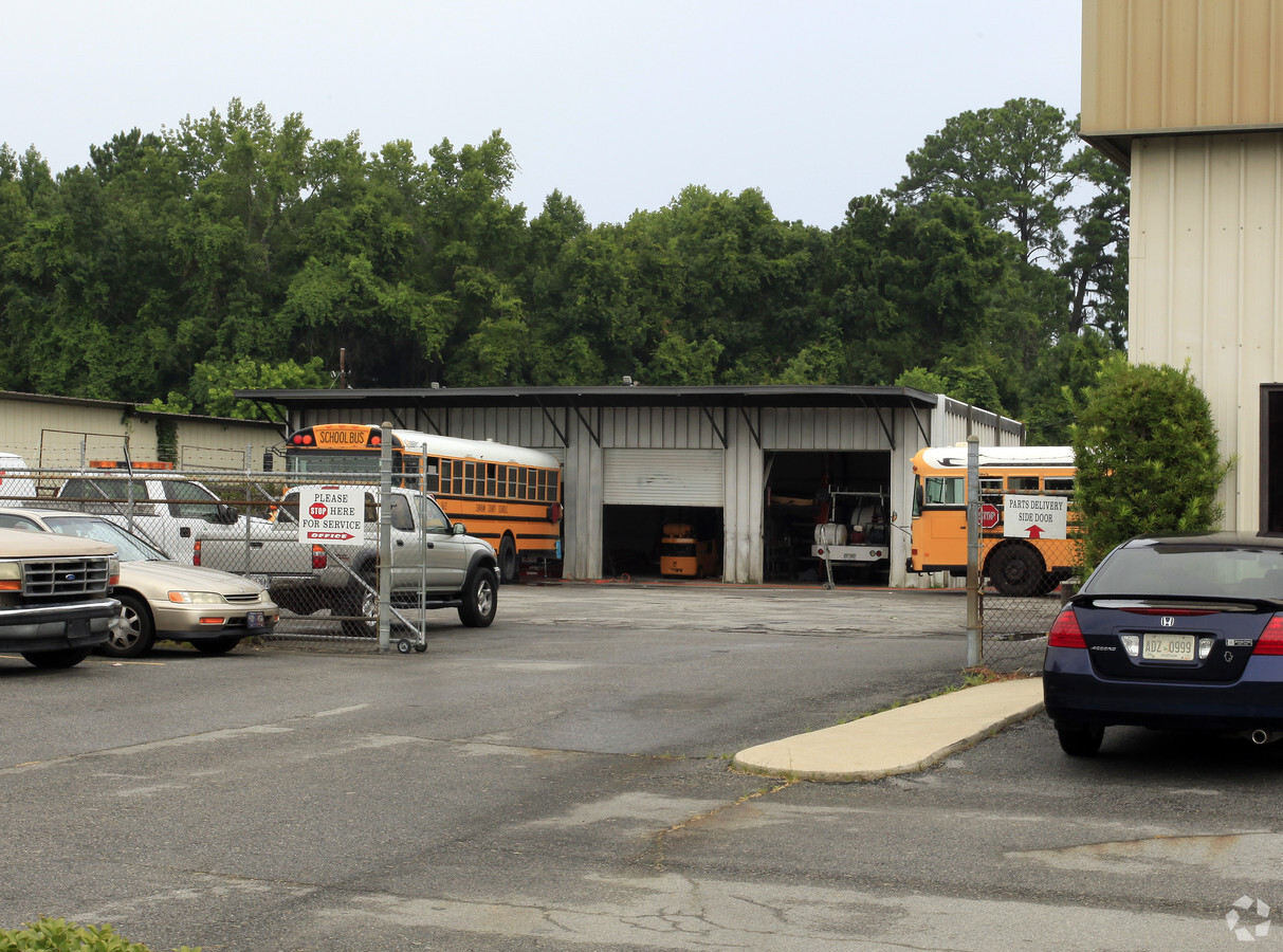
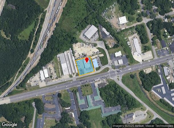
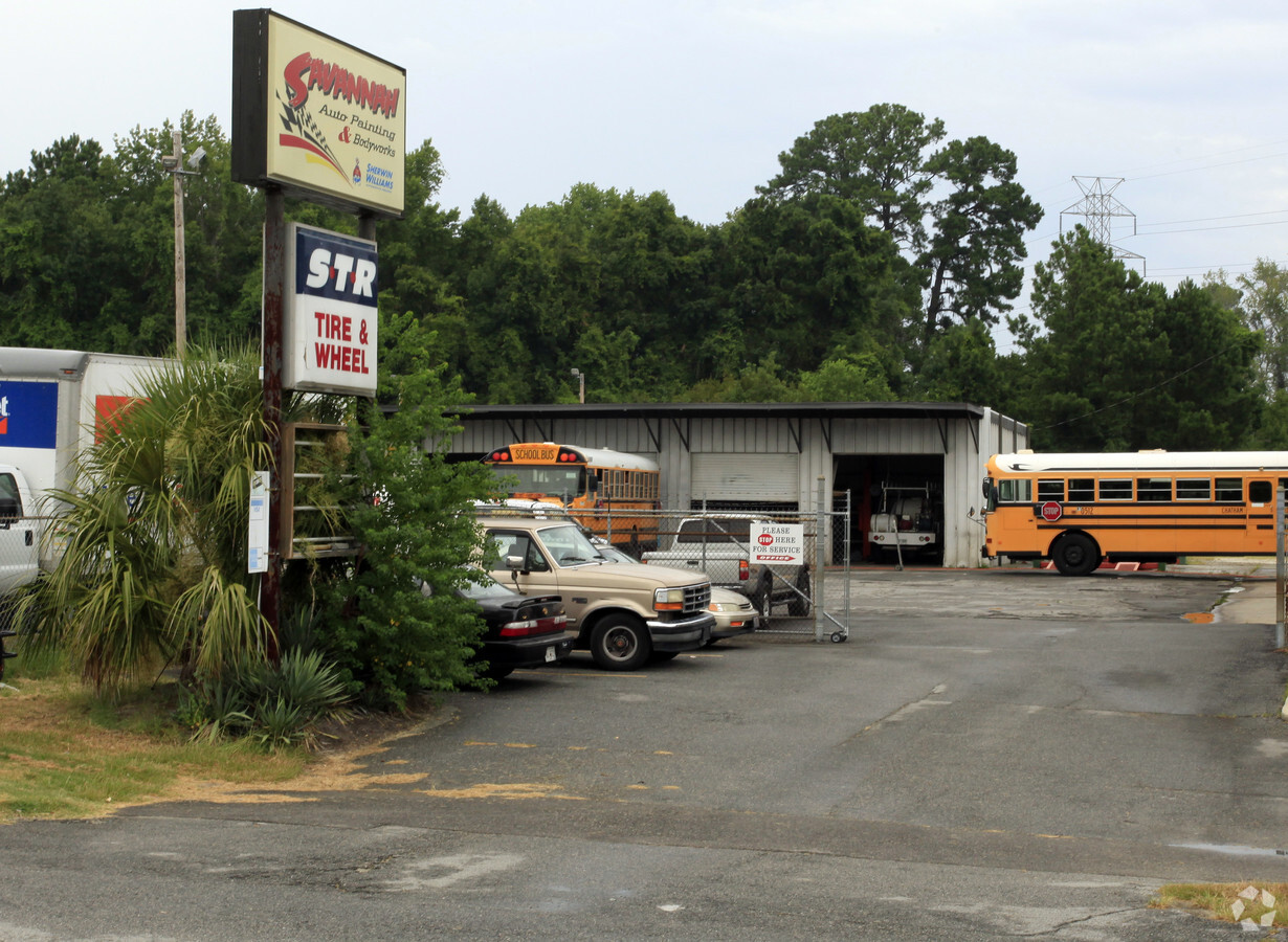
Property Record
3920 Ogeechee Rd, Savannah, GA 31405
NEARBY LISTINGS FOR SALE OR LEASE
Property Detail
3920 Ogeechee Rd
Savannah, GA
Industrial Park
2079201004B
LOT E-6 OGEECHEE INDUSTRIAL PARK PH 3
Autorepair
Chatham
X
Georgia
13051C0142G
e-6
2023
0.75 AC
2024
Greater Savannah
010502
Savannah
5,734 SF
DEMOGRAPHICS near 3920 Ogeechee Rd
1 Mile
3 Mile
5 Mile
2024 Total Population
4,455
35,261
126,324
2029 Population
4,754
36,969
132,040
Pop Growth 2024-2029
+ 6.71%
+ 4.84%
+ 4.52%
Average Age
37
38
38
2024 Total Households
2,031
13,232
52,141
HH Growth 2024-2029
+ 7.43%
+ 5.32%
+ 4.81%
Median Household Inc
$41,381
$41,047
$49,460
Avg Household Size
2.10
2.30
2.20
2024 Avg HH Vehicles
2.00
2.00
1.00
Median Home Value
$157,939
$142,191
$198,325
Median Year Built
2003
1975
1969
Nearby Places
- Restaurants
- Banks
- Shops
- Fitness
- Groceries
PUBLIC TRANSPORTATION
COMMUTER RAIL
Savannah (Palmetto - Amtrak, Silver Meteor - Amtrak, Silver Star - Amtrak)
DRIVE
WALK
Distance
Savannah (Palmetto - Amtrak, Silver Meteor - Amtrak, Silver Star - Amtrak)
8 min
4.0 mi
AIRPORT
Savannah/Hilton Head International
DRIVE
WALK
Distance
Savannah/Hilton Head International
18 min
8.8 mi
Hilton Head
DRIVE
WALK
Distance
Hilton Head
64 min
40.8 mi
Freight Ports
Georgia Ports - Savannah
DRIVE
WALK
Distance
Georgia Ports - Savannah
13 min
6.7 mi
Nearby Properties
Address
Land Use
TOTAL SIZE
Lot Size
Zoning
Address
Land Use
TOTAL SIZE
Lot Size
Zoning
1,400 SF
6.97 AC
D-X
Address
Land Use
TOTAL SIZE
Lot Size
Zoning
270.14 AC
I-1
Address
Land Use
TOTAL SIZE
Lot Size
Zoning
50.60 AC
Address
Land Use
TOTAL SIZE
Lot Size
Zoning
3,515 SF
61.21 AC
I1
Address
Land Use
TOTAL SIZE
Lot Size
Zoning
489,483 SF
35 AC
PUDB
Address
Land Use
TOTAL SIZE
Lot Size
Zoning
479,600 SF
28.24 AC
IH
Address
Land Use
TOTAL SIZE
Lot Size
Zoning
2.49 AC
BN
Address
Land Use
TOTAL SIZE
Lot Size
Zoning
21,316 SF
26.07 AC
PUDM18
Address
Land Use
TOTAL SIZE
Lot Size
Zoning
32,190 SF
22.11 AC
PUDBR
Address
Land Use
TOTAL SIZE
Lot Size
Zoning
39.64 AC
M-CO
Address
Land Use
TOTAL SIZE
Lot Size
Zoning
34,224 SF
20 AC
C-1
Address
Land Use
TOTAL SIZE
Lot Size
Zoning
384,000 SF
48.45 AC
I-H
Address
Land Use
TOTAL SIZE
Lot Size
Zoning
810 SF
20 AC
Address
Land Use
TOTAL SIZE
Lot Size
Zoning
33,432 SF
16.38 AC
PUDB
Address
Land Use
TOTAL SIZE
Lot Size
Zoning
67,656 SF
59.88 AC
M
Address
Land Use
TOTAL SIZE
Lot Size
Zoning
29,304 SF
27.20 AC
R3
Address
Land Use
TOTAL SIZE
Lot Size
Zoning
265,482 SF
18.85 AC
I-H
Address
Land Use
TOTAL SIZE
Lot Size
Zoning
29.78 AC
R6
Address
Land Use
TOTAL SIZE
Lot Size
Zoning
251,630 SF
20.78 AC
M
Address
Land Use
TOTAL SIZE
Lot Size
Zoning
11,888 SF
24.99 AC
I-H
Address
Land Use
TOTAL SIZE
Lot Size
Zoning
3,848 SF
9.14 AC
PBG
Address
Land Use
TOTAL SIZE
Lot Size
Zoning
4,832 SF
6.43 AC
I-L
Address
Land Use
TOTAL SIZE
Lot Size
Zoning
115,859 SF
1.85 AC
Address
Land Use
TOTAL SIZE
Lot Size
Zoning
73,992 SF
11.89 AC
PUDBR
Address
Land Use
TOTAL SIZE
Lot Size
Zoning
14.78 AC
R6
Address
Land Use
TOTAL SIZE
Lot Size
Zoning
14,700 SF
31.59 AC
R6
Address
Land Use
TOTAL SIZE
Lot Size
Zoning
6,336 SF
9.82 AC
R2
Address
Land Use
TOTAL SIZE
Lot Size
Zoning
22,886 SF
230.12 AC
P-RA
Address
Land Use
TOTAL SIZE
Lot Size
Zoning
600 SF
13.61 AC
I-H
Address
Land Use
TOTAL SIZE
Lot Size
Zoning
20,884 SF
9.88 AC
R2
The World's #1 Commercial Real Estate Marketplace
Connect with us
© 2025 CoStar Group
The information above has been obtained from sources believed reliable. While we do not doubt its accuracy we have not verified it and make no guarantee, warranty or representation about it. It is your responsibility to independently confirm its accuracy and completeness. Any projections, opinions, assumptions, or estimates used are for example only and do not represent the current or future performance of the property. The value of this transaction to you depends on tax and other factors which should be evaluated by your tax, financial, and legal advisors. You and your advisors should conduct a careful, independent investigation of the property to determine to your satisfaction the suitability of the property for your needs.