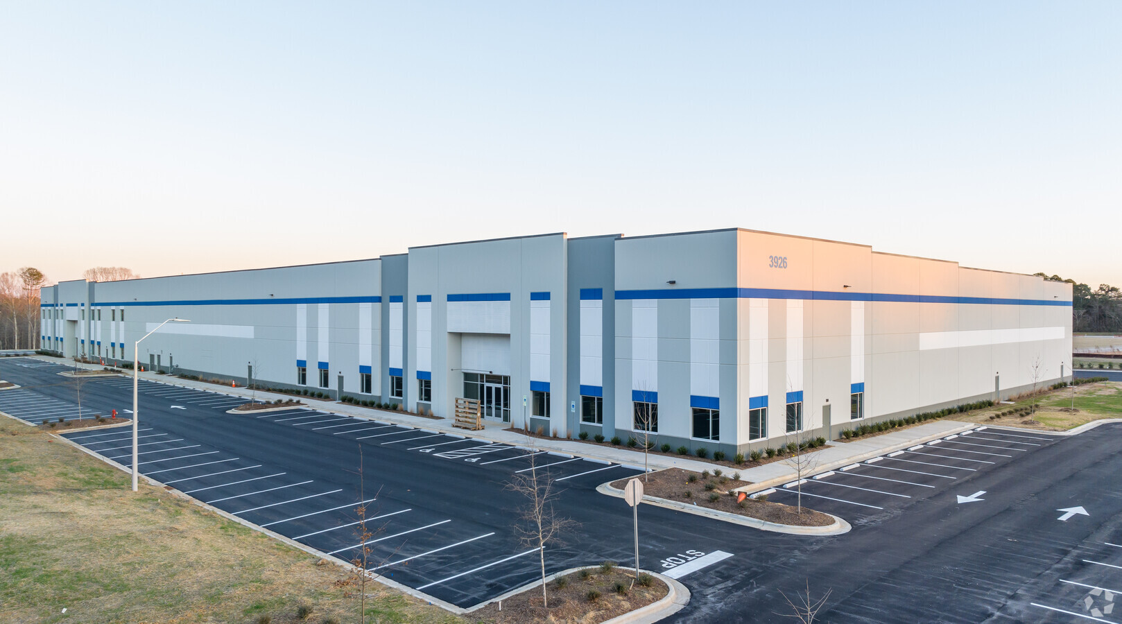
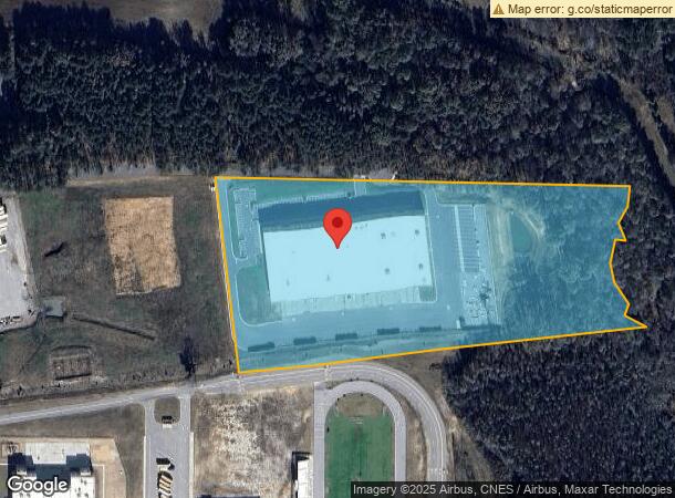
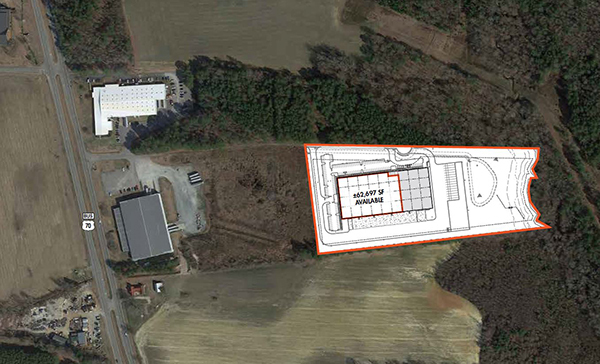
Property Record
3926 Us 70 Bus Hwy W, Clayton, NC 27520
NEARBY LISTINGS FOR SALE OR LEASE
-
-
View all Clayton listings for lease on LoopNet.com
Property Detail
3926 Us 70 Bus Hwy W
Raleigh, NC
Recombination Plat Property Of R Steve H
17J08001D
HARGIS 89/169
Warehouse
Johnston
AE
North Carolina
3720168600K
2
2024
12.52 AC
2024
Johnston County
040904
Raleigh/Durham
86,155 SF
DEMOGRAPHICS near 3926 Us 70 Bus Hwy W
1 Mile
3 Mile
5 Mile
2024 Total Population
1,133
10,869
34,667
2029 Population
1,343
13,188
42,255
Pop Growth 2024-2029
+ 18.53%
+ 21.34%
+ 21.89%
Average Age
39
40
40
2024 Total Households
371
3,666
12,272
HH Growth 2024-2029
+ 18.33%
+ 21.39%
+ 22.01%
Median Household Inc
$63,894
$64,348
$61,947
Avg Household Size
2.70
2.70
2.70
2024 Avg HH Vehicles
2.00
2.00
2.00
Median Home Value
$188,685
$222,569
$249,357
Median Year Built
1984
1996
1996
Nearby Places
- Restaurants
- Banks
- Shops
- Fitness
- Groceries
PUBLIC TRANSPORTATION
COMMUTER RAIL
Selma (Carolinian - Amtrak, Palmetto - Amtrak)
DRIVE
WALK
Distance
Selma (Carolinian - Amtrak, Palmetto - Amtrak)
17 min
9.1 mi
Freight Ports
Port of Wilmington
DRIVE
WALK
Distance
Port of Wilmington
142 min
113.3 mi
SALE & LEASE HISTORY
LISTING DATE
SALE/LEASE

May 10, 2022
For Lease
Nearby Properties
Address
Land Use
TOTAL SIZE
Lot Size
Zoning
Address
Land Use
TOTAL SIZE
Lot Size
Zoning
581,400 SF
169.67 AC
COM
Address
Land Use
TOTAL SIZE
Lot Size
Zoning
70,104 SF
47.87 AC
MUP
Address
Land Use
TOTAL SIZE
Lot Size
Zoning
8,887 SF
325.79 AC
RAG
Address
Land Use
TOTAL SIZE
Lot Size
Zoning
173,567 SF
16.12 AC
IND
Address
Land Use
TOTAL SIZE
Lot Size
Zoning
95,394 SF
97.56 AC
IND
Address
Land Use
TOTAL SIZE
Lot Size
Zoning
10,728 SF
15.09 AC
RAG
Address
Land Use
TOTAL SIZE
Lot Size
Zoning
17,600 SF
RAG
Address
Land Use
TOTAL SIZE
Lot Size
Zoning
62,617 SF
6.01 AC
RAG
Address
Land Use
TOTAL SIZE
Lot Size
Zoning
11,666 SF
15.29 AC
RAG
Address
Land Use
TOTAL SIZE
Lot Size
Zoning
40,360 SF
11.57 AC
RES
Address
Land Use
TOTAL SIZE
Lot Size
Zoning
25,580 SF
4.50 AC
IND
Address
Land Use
TOTAL SIZE
Lot Size
Zoning
1,952 SF
42.70 AC
IND
Address
Land Use
TOTAL SIZE
Lot Size
Zoning
20,745 SF
6 AC
RAG
Address
Land Use
TOTAL SIZE
Lot Size
Zoning
3,712 SF
3.90 AC
RES
Address
Land Use
TOTAL SIZE
Lot Size
Zoning
69,450 SF
7.40 AC
IND
Address
Land Use
TOTAL SIZE
Lot Size
Zoning
36,916 SF
6.89 AC
IND
Address
Land Use
TOTAL SIZE
Lot Size
Zoning
56,161 SF
20.38 AC
IND
Address
Land Use
TOTAL SIZE
Lot Size
Zoning
11,922 SF
RAG
Address
Land Use
TOTAL SIZE
Lot Size
Zoning
1,397 SF
431.46 AC
RAG
Address
Land Use
TOTAL SIZE
Lot Size
Zoning
84,840 SF
20.11 AC
IND
Address
Land Use
TOTAL SIZE
Lot Size
Zoning
11,752 SF
5 AC
RAG
Address
Land Use
TOTAL SIZE
Lot Size
Zoning
12,120 SF
10.20 AC
COM
Address
Land Use
TOTAL SIZE
Lot Size
Zoning
14,894 SF
5.95 AC
RAG
Address
Land Use
TOTAL SIZE
Lot Size
Zoning
6,242 SF
2.06 AC
COM
Address
Land Use
TOTAL SIZE
Lot Size
Zoning
11,338 SF
15.61 AC
RAG
Address
Land Use
TOTAL SIZE
Lot Size
Zoning
1,232 SF
257.49 AC
COM
Address
Land Use
TOTAL SIZE
Lot Size
Zoning
1,904 SF
55.57 AC
RAG
Address
Land Use
TOTAL SIZE
Lot Size
Zoning
33,070 SF
14.40 AC
IND
Address
Land Use
TOTAL SIZE
Lot Size
Zoning
49,170 SF
3.77 AC
IND
The World's #1 Commercial Real Estate Marketplace
Connect with us
© 2025 CoStar Group
The information above has been obtained from sources believed reliable. While we do not doubt its accuracy we have not verified it and make no guarantee, warranty or representation about it. It is your responsibility to independently confirm its accuracy and completeness. Any projections, opinions, assumptions, or estimates used are for example only and do not represent the current or future performance of the property. The value of this transaction to you depends on tax and other factors which should be evaluated by your tax, financial, and legal advisors. You and your advisors should conduct a careful, independent investigation of the property to determine to your satisfaction the suitability of the property for your needs.