Property Record
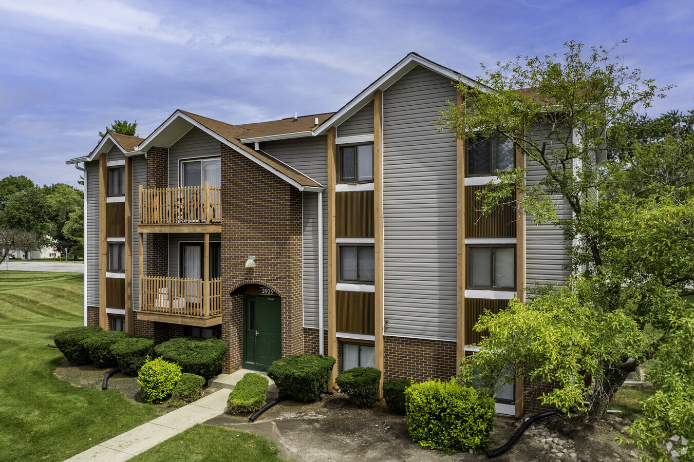
3944 W 77Th Pl, Merrillville, IN 46410
NEARBY LISTINGS FOR SALE OR LEASE
-
-
View all Merrillville listings for sale on LoopNet.com
Property Detail
3944 W 77Th Pl
Chicago-Naperville-Elgin, IL-IN-WI
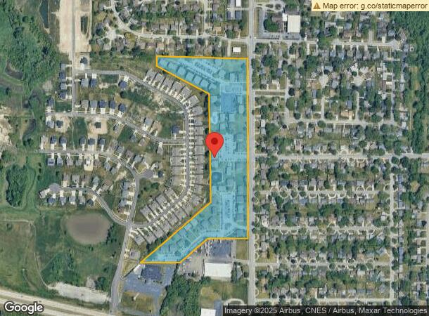
Broadmooor Pud
45-12-19-128-002.000-030
BROADMOOOR PUD LOTS 1 TO 46 & PRIVATE DRIVES
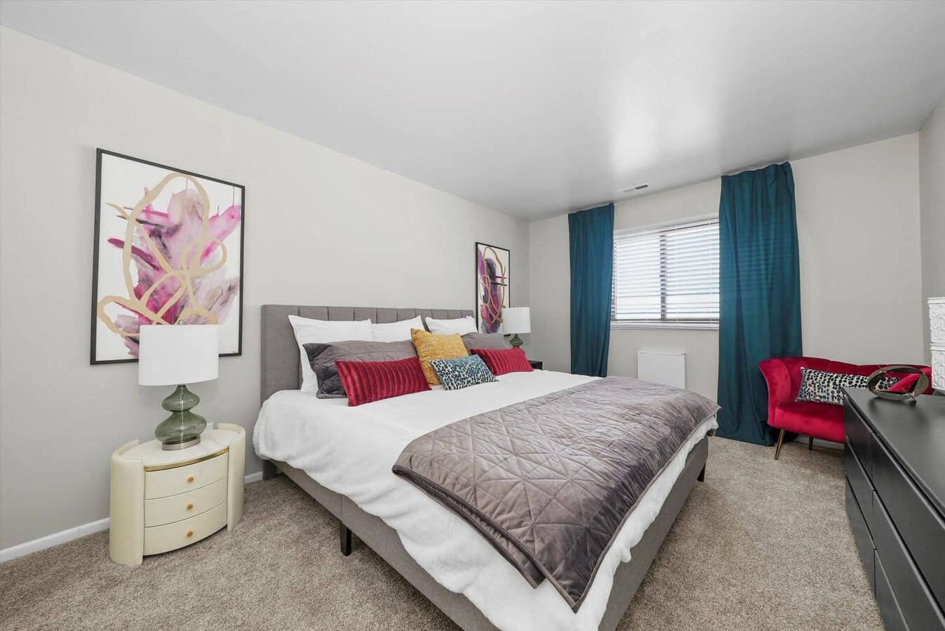
Apartment
Lake
X
Indiana
18089C0232E
1-46
2023
15.31 AC
2024
South Lake County
042501
Chicago
289,840 SF
DEMOGRAPHICS near 3944 W 77Th Pl
1 Mile
3 Mile
5 Mile
2024 Total Population
9,399
48,297
123,099
2029 Population
9,353
48,199
123,662
Pop Growth 2024-2029
(0.49%)
(0.20%)
+ 0.46%
Average Age
38
41
41
2024 Total Households
3,652
19,116
48,868
HH Growth 2024-2029
(0.49%)
(0.17%)
+ 0.39%
Median Household Inc
$69,578
$72,059
$69,411
Avg Household Size
2.50
2.40
2.40
2024 Avg HH Vehicles
2.00
2.00
2.00
Median Home Value
$194,069
$213,085
$216,198
Median Year Built
1977
1982
1976
Nearby Places
- Restaurants
- Banks
- Shops
- Fitness
- Groceries
PUBLIC TRANSPORTATION
COMMUTER RAIL
Dyer Amtrak (Cardinal - Amtrak)
DRIVE
WALK
Distance
Dyer Amtrak (Cardinal - Amtrak)
17 min
9.1 mi
AIRPORT
Chicago Midway International
DRIVE
WALK
Distance
Chicago Midway International
59 min
37.4 mi
Freight Ports
Port Milwaukee
DRIVE
WALK
Distance
Port Milwaukee
162 min
123.7 mi
Nearby Properties
Address
Land Use
TOTAL SIZE
Lot Size
Zoning
Address
Land Use
TOTAL SIZE
Lot Size
Zoning
206,854 SF
8.38 AC
Address
Land Use
TOTAL SIZE
Lot Size
Zoning
536,896 SF
20.08 AC
Address
Land Use
TOTAL SIZE
Lot Size
Zoning
377,878 SF
21.58 AC
Address
Land Use
TOTAL SIZE
Lot Size
Zoning
365,748 SF
17.44 AC
R33
Address
Land Use
TOTAL SIZE
Lot Size
Zoning
236,904 SF
11.30 AC
R33
Address
Land Use
TOTAL SIZE
Lot Size
Zoning
116,352 SF
9 AC
Address
Land Use
TOTAL SIZE
Lot Size
Zoning
116,352 SF
8.08 AC
Address
Land Use
TOTAL SIZE
Lot Size
Zoning
132,147 SF
44.38 AC
R33
Address
Land Use
TOTAL SIZE
Lot Size
Zoning
190,352 SF
12.36 AC
Address
Land Use
TOTAL SIZE
Lot Size
Zoning
304,429 SF
84.07 AC
Address
Land Use
TOTAL SIZE
Lot Size
Zoning
237,291 SF
33.51 AC
R33
Address
Land Use
TOTAL SIZE
Lot Size
Zoning
87,264 SF
7.74 AC
Address
Land Use
TOTAL SIZE
Lot Size
Zoning
92,823 SF
8.56 AC
Address
Land Use
TOTAL SIZE
Lot Size
Zoning
45,397 SF
14.48 AC
Address
Land Use
TOTAL SIZE
Lot Size
Zoning
125,172 SF
5.57 AC
R33
Address
Land Use
TOTAL SIZE
Lot Size
Zoning
216,197 SF
13.89 AC
Address
Land Use
TOTAL SIZE
Lot Size
Zoning
109,220 SF
6.42 AC
Address
Land Use
TOTAL SIZE
Lot Size
Zoning
66,464 SF
43.30 AC
Address
Land Use
TOTAL SIZE
Lot Size
Zoning
52,896 SF
4.06 AC
R33
Address
Land Use
TOTAL SIZE
Lot Size
Zoning
41,015 SF
4.87 AC
Address
Land Use
TOTAL SIZE
Lot Size
Zoning
103,356 SF
7 AC
Address
Land Use
TOTAL SIZE
Lot Size
Zoning
67,708 SF
3.08 AC
R33
Address
Land Use
TOTAL SIZE
Lot Size
Zoning
26,738 SF
4.67 AC
Address
Land Use
TOTAL SIZE
Lot Size
Zoning
42,090 SF
4.04 AC
Address
Land Use
TOTAL SIZE
Lot Size
Zoning
40,062 SF
3.39 AC
Address
Land Use
TOTAL SIZE
Lot Size
Zoning
56,664 SF
3.03 AC
R33
Address
Land Use
TOTAL SIZE
Lot Size
Zoning
49,184 SF
28.68 AC
Address
Land Use
TOTAL SIZE
Lot Size
Zoning
81,568 SF
9.31 AC
Address
Land Use
TOTAL SIZE
Lot Size
Zoning
29,654 SF
7.81 AC
R33
The World's #1 Commercial Real Estate Marketplace
Connect with us
© 2025 CoStar Group
The information above has been obtained from sources believed reliable. While we do not doubt its accuracy we have not verified it and make no guarantee, warranty or representation about it. It is your responsibility to independently confirm its accuracy and completeness. Any projections, opinions, assumptions, or estimates used are for example only and do not represent the current or future performance of the property. The value of this transaction to you depends on tax and other factors which should be evaluated by your tax, financial, and legal advisors. You and your advisors should conduct a careful, independent investigation of the property to determine to your satisfaction the suitability of the property for your needs.