Property Record
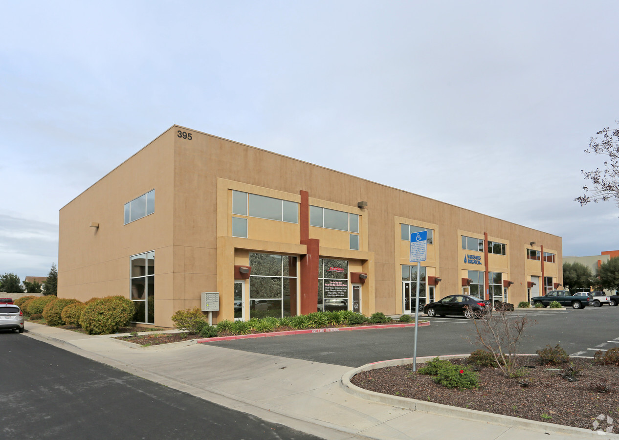
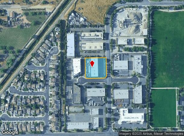
395 Carrol Ct, Brentwood, CA 94513

NEARBY LISTINGS FOR SALE OR LEASE
Property Detail
395 Carrol Ct
Oakland-Hayward-Berkeley, CA
Sunset Industrial Complex Ii
018-200-024-0
T8842 L13
Industrialpark
Contra Costa
X
California
06013C0354G
13
2023
1.02 AC
2024
Antioch/Pittsburg
303106
East Bay/Oakland
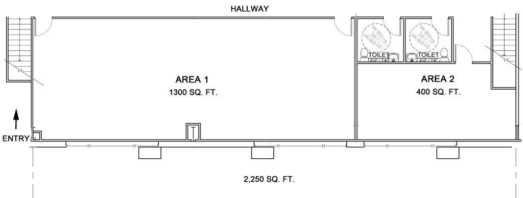
15,680 SF
DEMOGRAPHICS near 395 Carrol Ct
1 Mile
3 Mile
5 Mile
2024 Total Population
8,033
79,648
149,100
2029 Population
8,040
79,446
149,350
Pop Growth 2024-2029
+ 0.09%
(0.25%)
+ 0.17%
Average Age
37
37
39
2024 Total Households
2,414
23,946
46,364
HH Growth 2024-2029
0.00%
(0.32%)
+ 0.17%
Median Household Inc
$106,793
$126,864
$122,626
Avg Household Size
3.30
3.30
3.20
2024 Avg HH Vehicles
3.00
3.00
2.00
Median Home Value
$768,572
$731,690
$712,844
Median Year Built
2005
2001
2000
Nearby Places
- Restaurants
- Banks
- Shops
- Fitness
- Groceries
PUBLIC TRANSPORTATION
AIRPORT
Stockton Metro
DRIVE
WALK
Distance
Stockton Metro
50 min
33.0 mi
Freight Ports
Port of Stockton
DRIVE
WALK
Distance
Port of Stockton
46 min
30.5 mi
SALE & LEASE HISTORY
LISTING DATE
SALE/LEASE

Sep 25, 2016
For Lease
Sep 25, 2016
For Lease
Feb 22, 2022
For Lease
Nearby Properties
Address
Land Use
TOTAL SIZE
Lot Size
Zoning
Address
Land Use
TOTAL SIZE
Lot Size
Zoning
19,211 SF
14.43 AC
Address
Land Use
TOTAL SIZE
Lot Size
Zoning
145,503 SF
25.05 AC
Address
Land Use
TOTAL SIZE
Lot Size
Zoning
55.08 AC
Address
Land Use
TOTAL SIZE
Lot Size
Zoning
14,968 SF
7.07 AC
Address
Land Use
TOTAL SIZE
Lot Size
Zoning
479,414 SF
30.53 AC
Address
Land Use
TOTAL SIZE
Lot Size
Zoning
117,486 SF
7.26 AC
Address
Land Use
TOTAL SIZE
Lot Size
Zoning
8.65 AC
Address
Land Use
TOTAL SIZE
Lot Size
Zoning
15,000 SF
17.17 AC
Address
Land Use
TOTAL SIZE
Lot Size
Zoning
59,066 SF
3.88 AC
Address
Land Use
TOTAL SIZE
Lot Size
Zoning
443,591 SF
23.43 AC
Address
Land Use
TOTAL SIZE
Lot Size
Zoning
115,013 SF
6.54 AC
Address
Land Use
TOTAL SIZE
Lot Size
Zoning
97,310 SF
5.85 AC
Address
Land Use
TOTAL SIZE
Lot Size
Zoning
59,083 SF
3.39 AC
Address
Land Use
TOTAL SIZE
Lot Size
Zoning
13,468 SF
8.77 AC
Address
Land Use
TOTAL SIZE
Lot Size
Zoning
12,410 SF
5.38 AC
Address
Land Use
TOTAL SIZE
Lot Size
Zoning
62,441 SF
5.65 AC
Address
Land Use
TOTAL SIZE
Lot Size
Zoning
65,898 SF
8.72 AC
Address
Land Use
TOTAL SIZE
Lot Size
Zoning
40,995 SF
10.59 AC
Address
Land Use
TOTAL SIZE
Lot Size
Zoning
96,956 SF
10.49 AC
Address
Land Use
TOTAL SIZE
Lot Size
Zoning
32,198 SF
1.08 AC
Address
Land Use
TOTAL SIZE
Lot Size
Zoning
16.82 AC
Address
Land Use
TOTAL SIZE
Lot Size
Zoning
141,295 SF
5.79 AC
Address
Land Use
TOTAL SIZE
Lot Size
Zoning
12.20 AC
Address
Land Use
TOTAL SIZE
Lot Size
Zoning
58,039 SF
9.92 AC
Address
Land Use
TOTAL SIZE
Lot Size
Zoning
47,642 SF
3.10 AC
Address
Land Use
TOTAL SIZE
Lot Size
Zoning
39,418 SF
3.08 AC
Address
Land Use
TOTAL SIZE
Lot Size
Zoning
62,861 SF
27.55 AC
Address
Land Use
TOTAL SIZE
Lot Size
Zoning
36,915 SF
6.90 AC
Address
Land Use
TOTAL SIZE
Lot Size
Zoning
18,700 SF
19.01 AC
Address
Land Use
TOTAL SIZE
Lot Size
Zoning
1,107 SF
425.97 AC
The World's #1 Commercial Real Estate Marketplace
Connect with us
© 2025 CoStar Group
The information above has been obtained from sources believed reliable. While we do not doubt its accuracy we have not verified it and make no guarantee, warranty or representation about it. It is your responsibility to independently confirm its accuracy and completeness. Any projections, opinions, assumptions, or estimates used are for example only and do not represent the current or future performance of the property. The value of this transaction to you depends on tax and other factors which should be evaluated by your tax, financial, and legal advisors. You and your advisors should conduct a careful, independent investigation of the property to determine to your satisfaction the suitability of the property for your needs.