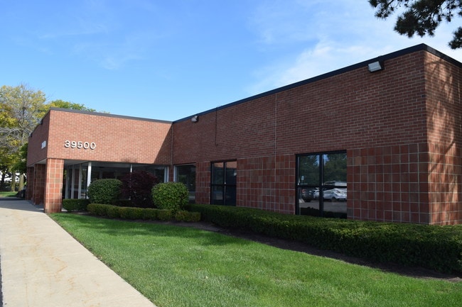
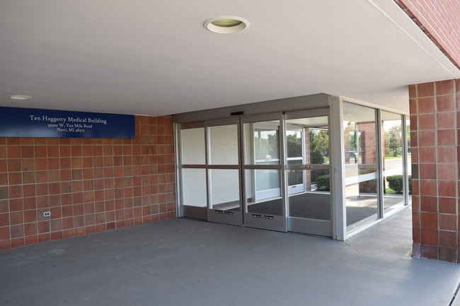
Property Record
39500 W 10 Mile Rd, Novi, MI 48375


Current Lease Availabilities
NEARBY LISTINGS FOR SALE OR LEASE
Property Detail
39500 W 10 Mile Rd
22-24-476-033
T1N, R8E, SEC 24PART OF SE 1/4 BEG AT PT DIST S 88-26-40 W 460.02 FT FROM SE SEC COR,TH S 88-26-40 W 125.05 FT, TH N 00-05-22
Commercialnec
Oakland
X
Michigan
26163C0035E
4.18 AC
2023
Central I-96 Corridor
2023
Detroit
136601
Detroit-Warren-Dearborn, MI
23,328 SF
DEMOGRAPHICS near 39500 W 10 Mile Rd
1 Mile
3 Mile
5 Mile
2024 Total Population
7,256
63,477
181,917
2029 Population
7,135
62,535
178,392
Pop Growth 2024-2029
(1.67%)
(1.48%)
(1.94%)
Average Age
40
41
43
2024 Total Households
3,001
27,139
75,783
HH Growth 2024-2029
(1.70%)
(1.50%)
(1.91%)
Median Household Inc
$85,648
$101,708
$101,785
Avg Household Size
2.30
2.30
2.30
2024 Avg HH Vehicles
2.00
2.00
2.00
Median Home Value
$246,582
$342,987
$336,610
Median Year Built
1977
1983
1982
Nearby Places
Map Layers
Map Styles
 Street
 Aerial
- Restaurants
- Banks
- Shops
- Fitness
- Groceries
PUBLIC TRANSPORTATION
AIRPORT
Detroit Metro Wayne County
DRIVE
WALK
Distance
Detroit Metro Wayne County
35 min
25.4 mi
Windsor International
DRIVE
WALK
Distance
Windsor International
58 min
35.8 mi
Nearby Properties
Address
Land Use
TOTAL SIZE
Lot Size
Zoning
Address
Land Use
TOTAL SIZE
Lot Size
Zoning
1,393,561 SF
123.23 AC
AI
Address
Land Use
TOTAL SIZE
Lot Size
Zoning
486,998 SF
24.18 AC
R-C
Address
Land Use
TOTAL SIZE
Lot Size
Zoning
886 SF
26.58 AC
GATEWY
Address
Land Use
TOTAL SIZE
Lot Size
Zoning
57.28 AC
RM-1
Address
Land Use
TOTAL SIZE
Lot Size
Zoning
152,130 SF
64.46 AC
R-C
Address
Land Use
TOTAL SIZE
Lot Size
Zoning
24.08 AC
BV
Address
Land Use
TOTAL SIZE
Lot Size
Zoning
507,334 SF
49.09 AC
II
Address
Land Use
TOTAL SIZE
Lot Size
Zoning
406,560 SF
46.04 AC
AI
Address
Land Use
TOTAL SIZE
Lot Size
Zoning
9.72 AC
OS-1
Address
Land Use
TOTAL SIZE
Lot Size
Zoning
42.06 AC
RM-1
Address
Land Use
TOTAL SIZE
Lot Size
Zoning
1,792 SF
59.30 AC
OST
Address
Land Use
TOTAL SIZE
Lot Size
Zoning
321,204 SF
26.06 AC
BI
Address
Land Use
TOTAL SIZE
Lot Size
Zoning
38 AC
RM-1
Address
Land Use
TOTAL SIZE
Lot Size
Zoning
14,463 SF
26.97 AC
TC-1
Address
Land Use
TOTAL SIZE
Lot Size
Zoning
325,281 SF
36.25 AC
AI
Address
Land Use
TOTAL SIZE
Lot Size
Zoning
327,206 SF
29.93 AC
AI
Address
Land Use
TOTAL SIZE
Lot Size
Zoning
433,306 SF
39.80 AC
II
Address
Land Use
TOTAL SIZE
Lot Size
Zoning
312,634 SF
20.19 AC
AI
Address
Land Use
TOTAL SIZE
Lot Size
Zoning
63,152 SF
14 AC
R-C
Address
Land Use
TOTAL SIZE
Lot Size
Zoning
103,882 SF
34.97 AC
TC
Address
Land Use
TOTAL SIZE
Lot Size
Zoning
278,387 SF
22.51 AC
II
Address
Land Use
TOTAL SIZE
Lot Size
Zoning
289,722 SF
7.34 AC
C-2
Address
Land Use
TOTAL SIZE
Lot Size
Zoning
226,753 SF
27.92 AC
AI
Address
Land Use
TOTAL SIZE
Lot Size
Zoning
228,748 SF
25.06 AC
AI
Address
Land Use
TOTAL SIZE
Lot Size
Zoning
30.32 AC
RM-1
Address
Land Use
TOTAL SIZE
Lot Size
Zoning
97,000 SF
18.75 AC
R-C
Address
Land Use
TOTAL SIZE
Lot Size
Zoning
Address
Land Use
TOTAL SIZE
Lot Size
Zoning
194,953 SF
35.27 AC
BV
Address
Land Use
TOTAL SIZE
Lot Size
Zoning
214,242 SF
22.40 AC
AI
Address
Land Use
TOTAL SIZE
Lot Size
Zoning
264,994 SF
19.75 AC
AI
The World's #1 Commercial Real Estate Marketplace
Connect with us
© 2025 CoStar Group
The information above has been obtained from sources believed reliable. While we do not doubt its accuracy we have not verified it and make no guarantee, warranty or representation about it. It is your responsibility to independently confirm its accuracy and completeness. Any projections, opinions, assumptions, or estimates used are for example only and do not represent the current or future performance of the property. The value of this transaction to you depends on tax and other factors which should be evaluated by your tax, financial, and legal advisors. You and your advisors should conduct a careful, independent investigation of the property to determine to your satisfaction the suitability of the property for your needs.