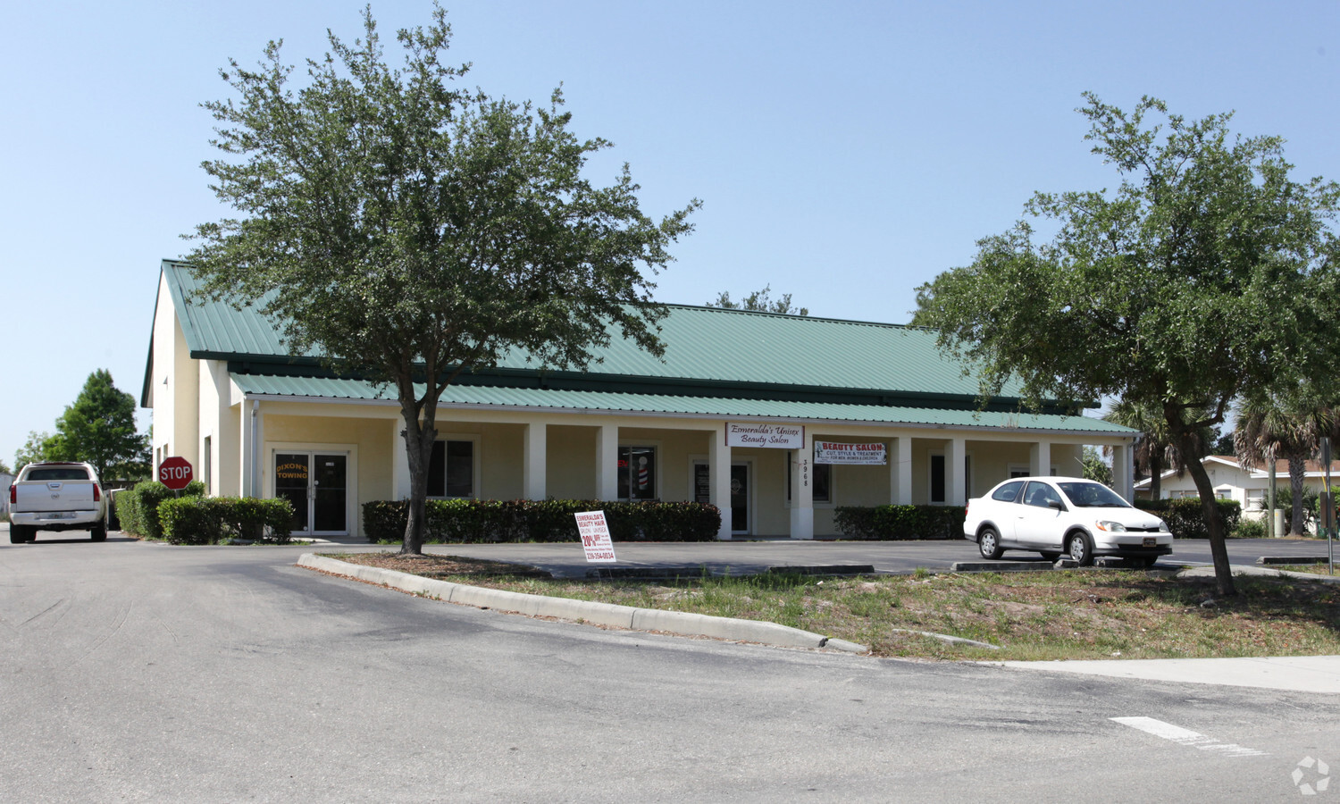
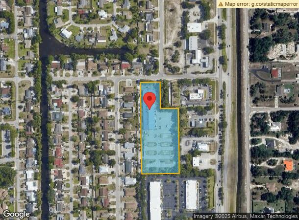
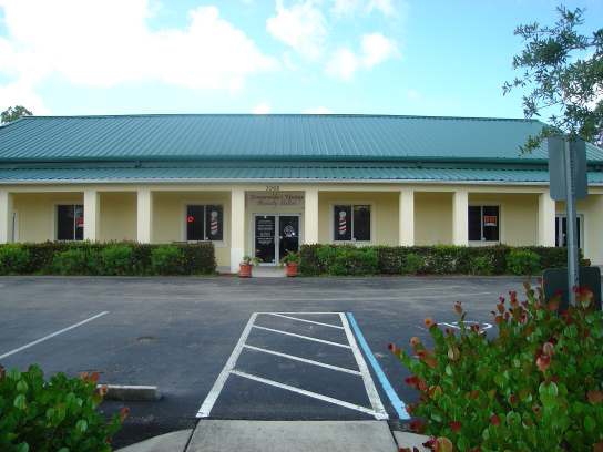
Property Record
3968 20Th Pl Sw, Naples, FL 34116

NEARBY LISTINGS FOR SALE OR LEASE
Property Detail
3968 20Th Pl Sw
Naples-Immokalee-Marco Island, FL
Golden Gate City Unit 2
35779420009
GOLDEN GATE UNIT 2 BLK 75 W 143FT OF N 190FT OF BLK 75, PLUS W 270FT OF S 465FT OF N 655FT OF BLK 75
Religious
Collier
AH
Florida
12021C0404J
9
0
3.51 AC
2023
Golden Gate
010421
Southwest Florida
25,346 SF
DEMOGRAPHICS near 3968 20Th Pl Sw
1 Mile
3 Mile
5 Mile
2024 Total Population
9,546
38,064
95,958
2029 Population
10,304
41,493
106,829
Pop Growth 2024-2029
+ 7.94%
+ 9.01%
+ 11.33%
Average Age
37
39
45
2024 Total Households
2,988
12,722
37,779
HH Growth 2024-2029
+ 7.16%
+ 8.54%
+ 11.24%
Median Household Inc
$61,456
$65,474
$72,038
Avg Household Size
3.00
2.80
2.40
2024 Avg HH Vehicles
2.00
2.00
2.00
Median Home Value
$303,086
$317,746
$371,147
Median Year Built
1986
1992
1997
Nearby Places
- Restaurants
- Banks
- Shops
- Fitness
- Groceries
PUBLIC TRANSPORTATION
AIRPORT
Southwest Florida International
DRIVE
WALK
Distance
Southwest Florida International
41 min
31.6 mi
Freight Ports
Port Everglades
DRIVE
WALK
Distance
Port Everglades
114 min
101.7 mi
Nearby Properties
Address
Land Use
TOTAL SIZE
Lot Size
Zoning
Address
Land Use
TOTAL SIZE
Lot Size
Zoning
363,413 SF
33.78 AC
Address
Land Use
TOTAL SIZE
Lot Size
Zoning
185,464 SF
68.94 AC
A
Address
Land Use
TOTAL SIZE
Lot Size
Zoning
251,849 SF
27.42 AC
PUD
Address
Land Use
TOTAL SIZE
Lot Size
Zoning
194,882 SF
17.30 AC
PUD
Address
Land Use
TOTAL SIZE
Lot Size
Zoning
174,840 SF
28.34 AC
PUD
Address
Land Use
TOTAL SIZE
Lot Size
Zoning
93,756 SF
11.53 AC
PUD
Address
Land Use
TOTAL SIZE
Lot Size
Zoning
219,443 SF
18.05 AC
PUD
Address
Land Use
TOTAL SIZE
Lot Size
Zoning
126,448 SF
13.74 AC
PUD
Address
Land Use
TOTAL SIZE
Lot Size
Zoning
122,929 SF
17.58 AC
PUD
Address
Land Use
TOTAL SIZE
Lot Size
Zoning
203,622 SF
23.95 AC
MPUD
Address
Land Use
TOTAL SIZE
Lot Size
Zoning
88,178 SF
14.77 AC
PUD
Address
Land Use
TOTAL SIZE
Lot Size
Zoning
4,529 SF
165.08 AC
GC
Address
Land Use
TOTAL SIZE
Lot Size
Zoning
263,863 SF
20.32 AC
PUD
Address
Land Use
TOTAL SIZE
Lot Size
Zoning
104,183 SF
17.87 AC
PUD
Address
Land Use
TOTAL SIZE
Lot Size
Zoning
98,464 SF
9.99 AC
PUD
Address
Land Use
TOTAL SIZE
Lot Size
Zoning
277,227 SF
12.05 AC
PUD
Address
Land Use
TOTAL SIZE
Lot Size
Zoning
52,787 SF
6.84 AC
Address
Land Use
TOTAL SIZE
Lot Size
Zoning
72,033 SF
19.01 AC
RSF-3
Address
Land Use
TOTAL SIZE
Lot Size
Zoning
129,930 SF
4.33 AC
PUD
Address
Land Use
TOTAL SIZE
Lot Size
Zoning
46,068 SF
8.02 AC
RSF-3
Address
Land Use
TOTAL SIZE
Lot Size
Zoning
60,719 SF
12.54 AC
C-1
Address
Land Use
TOTAL SIZE
Lot Size
Zoning
106,881 SF
5.23 AC
PUD
Address
Land Use
TOTAL SIZE
Lot Size
Zoning
109,140 SF
26.94 AC
RSF-3
Address
Land Use
TOTAL SIZE
Lot Size
Zoning
104,263 SF
4.78 AC
C3
Address
Land Use
TOTAL SIZE
Lot Size
Zoning
18,044 SF
310.97 AC
A
Address
Land Use
TOTAL SIZE
Lot Size
Zoning
41,168 SF
2.98 AC
RSF-5
Address
Land Use
TOTAL SIZE
Lot Size
Zoning
108,208 SF
6.16 AC
RT
Address
Land Use
TOTAL SIZE
Lot Size
Zoning
51,076 SF
5.20 AC
RMF12
Address
Land Use
TOTAL SIZE
Lot Size
Zoning
49,788 SF
2.89 AC
PUD
Address
Land Use
TOTAL SIZE
Lot Size
Zoning
78,454 SF
19.27 AC
E
The World's #1 Commercial Real Estate Marketplace
Connect with us
© 2025 CoStar Group
The information above has been obtained from sources believed reliable. While we do not doubt its accuracy we have not verified it and make no guarantee, warranty or representation about it. It is your responsibility to independently confirm its accuracy and completeness. Any projections, opinions, assumptions, or estimates used are for example only and do not represent the current or future performance of the property. The value of this transaction to you depends on tax and other factors which should be evaluated by your tax, financial, and legal advisors. You and your advisors should conduct a careful, independent investigation of the property to determine to your satisfaction the suitability of the property for your needs.