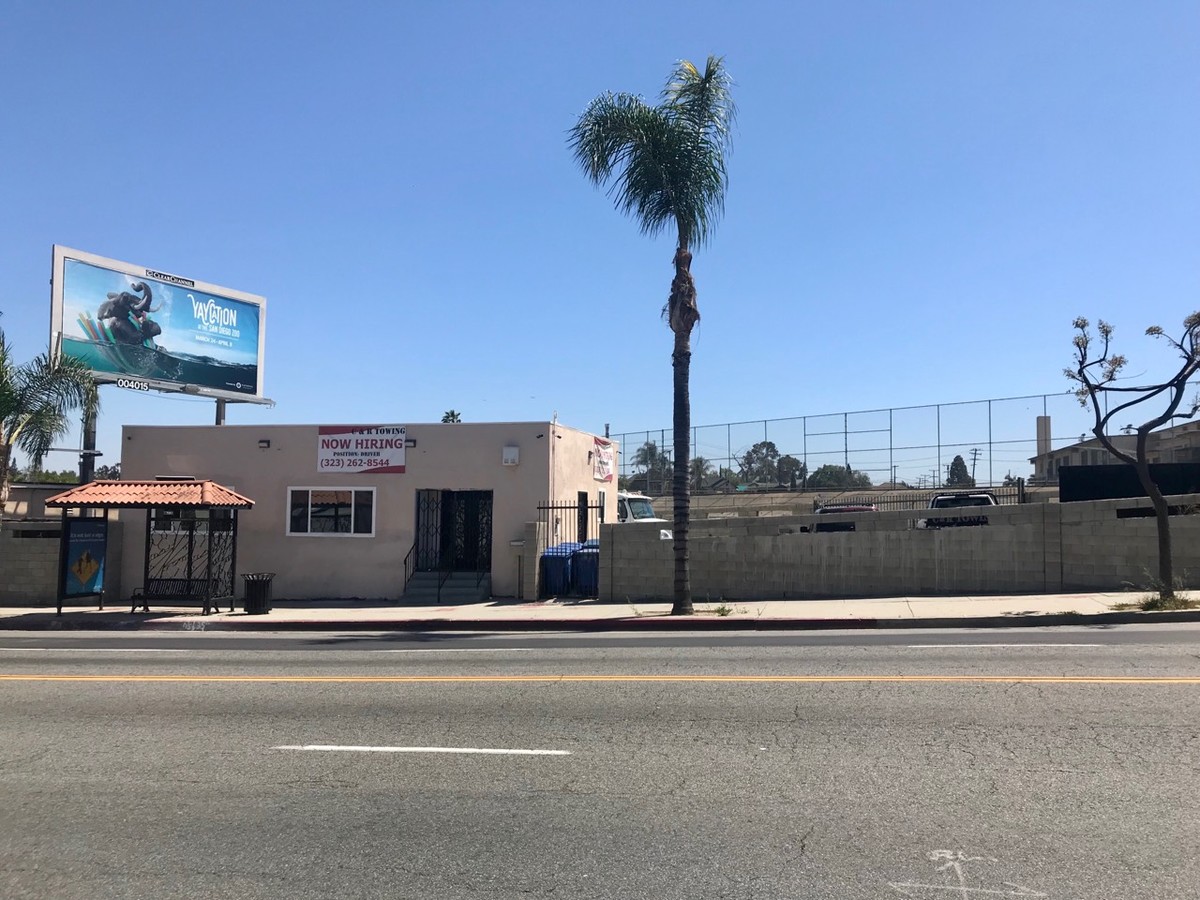
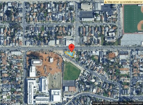
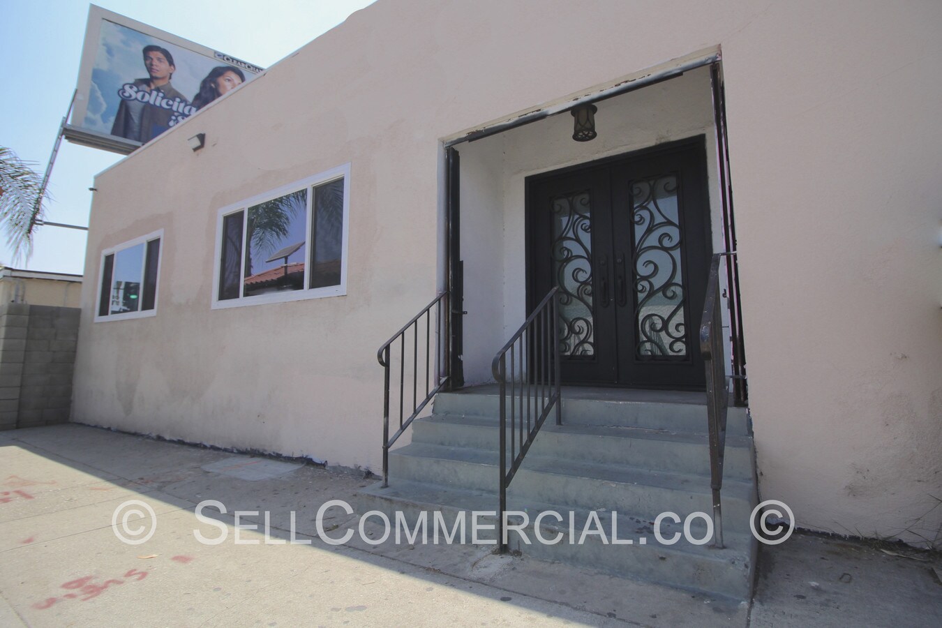
Property Record
3968 E Cesar E Chavez Ave, Los Angeles, CA 90063

NEARBY LISTINGS FOR SALE OR LEASE
Property Detail
3968 E Cesar E Chavez Ave
Los Angeles-Long Beach-Glendale, CA
1037
5233-022-001
TRACT NO 1037 LOT ON S LINE OF BROOKLYN AVE COM S 89 4630 W 46.72 FT FROM MOST E COR OF LOT 1 TH S 89 4630 W 116.34 FT TH S ON A CURVE CONCAVE TO E RADIUS EQUALS 10 FT 25.83 FT TH S 58 1330 E BEG PART OF LOT/SEC 1
Storemultistory
Los Angeles
X
California
06037C1641F
1
2024
0.13 AC
2024
Southeast Los Angeles
531102
Los Angeles
1,000 SF
DEMOGRAPHICS near 3968 E Cesar E Chavez Ave
1 Mile
3 Mile
5 Mile
2024 Total Population
40,546
257,731
752,634
2029 Population
38,801
246,390
722,921
Pop Growth 2024-2029
(4.30%)
(4.40%)
(3.95%)
Average Age
36
38
39
2024 Total Households
10,560
72,774
244,780
HH Growth 2024-2029
(4.58%)
(4.64%)
(3.78%)
Median Household Inc
$54,646
$59,397
$62,194
Avg Household Size
3.70
3.40
2.90
2024 Avg HH Vehicles
2.00
2.00
2.00
Median Home Value
$610,517
$688,277
$718,496
Median Year Built
1948
1950
1958
Nearby Places
- Restaurants
- Banks
- Shops
- Fitness
- Groceries
PUBLIC TRANSPORTATION
COMMUTER RAIL
Union Station (91 Line - Southern California Regional Rail Authority (Metrolink), Antelope Valley Line - Southern California Regional Rail Authority (Metrolink), Orange County Line - Southern California Regional Rail Authority (Metrolink), Riverside Line - Southern California Regional Rail Authority (Metrolink), San Bernardino Line - Southern California Regional Rail Authority (Metrolink), Ventura County Line - Southern California Regional Rail Authority (Metrolink))
DRIVE
WALK
Distance
Union Station (91 Line - Southern California Regional Rail Authority (Metrolink), Antelope Valley Line - Southern California Regional Rail Authority (Metrolink), Orange County Line - Southern California Regional Rail Authority (Metrolink), Riverside Line - Southern California Regional Rail Authority (Metrolink), San Bernardino Line - Southern California Regional Rail Authority (Metrolink), Ventura County Line - Southern California Regional Rail Authority (Metrolink))
9 min
3.7 mi
Cal State La Metrolink Station (Metrolink San Bernardino Line - Metrolink Trains)
DRIVE
WALK
Distance
Cal State La Metrolink Station (Metrolink San Bernardino Line - Metrolink Trains)
11 min
7.7 mi
AIRPORT
Long Beach (Daugherty Field)
DRIVE
WALK
Distance
Long Beach (Daugherty Field)
27 min
18.4 mi
Bob Hope
DRIVE
WALK
Distance
Bob Hope
26 min
18.9 mi
Los Angeles International
DRIVE
WALK
Distance
Los Angeles International
31 min
19.9 mi
Freight Ports
Port of Long Beach
DRIVE
WALK
Distance
Port of Long Beach
28 min
21.2 mi
SALE & LEASE HISTORY
LISTING DATE
SALE/LEASE

May 08, 2018
For Sale
Nearby Properties
Address
Land Use
TOTAL SIZE
Lot Size
Zoning
Address
Land Use
TOTAL SIZE
Lot Size
Zoning
635,233 SF
12.02 AC
LAR5
Address
Land Use
TOTAL SIZE
Lot Size
Zoning
513,825 SF
4.28 AC
LAC2
Address
Land Use
TOTAL SIZE
Lot Size
Zoning
444,139 SF
3.63 AC
LAM3
Address
Land Use
TOTAL SIZE
Lot Size
Zoning
479,272 SF
16.14 AC
LAM3
Address
Land Use
TOTAL SIZE
Lot Size
Zoning
327,061 SF
2.18 AC
LAM3
Address
Land Use
TOTAL SIZE
Lot Size
Zoning
1,989,496 SF
29.88 AC
LAM1
Address
Land Use
TOTAL SIZE
Lot Size
Zoning
271,020 SF
18.93 AC
CMM2*
Address
Land Use
TOTAL SIZE
Lot Size
Zoning
328,737 SF
7.92 AC
LAC2
Address
Land Use
TOTAL SIZE
Lot Size
Zoning
354,299 SF
2.18 AC
LAC2
Address
Land Use
TOTAL SIZE
Lot Size
Zoning
150,608 SF
0.88 AC
LAC2
Address
Land Use
TOTAL SIZE
Lot Size
Zoning
693,282 SF
30.34 AC
CMM2*
Address
Land Use
TOTAL SIZE
Lot Size
Zoning
527,173 SF
12.36 AC
CMM2*
Address
Land Use
TOTAL SIZE
Lot Size
Zoning
557,445 SF
14.08 AC
CMM2YY
Address
Land Use
TOTAL SIZE
Lot Size
Zoning
252,559 SF
2.87 AC
LAC2
Address
Land Use
TOTAL SIZE
Lot Size
Zoning
621,121 SF
13.06 AC
CMM2*
Address
Land Use
TOTAL SIZE
Lot Size
Zoning
260,714 SF
9.99 AC
VEM*
Address
Land Use
TOTAL SIZE
Lot Size
Zoning
75,589 SF
0.98 AC
LAC2
Address
Land Use
TOTAL SIZE
Lot Size
Zoning
303,030 SF
7.14 AC
CMM2-M1*
Address
Land Use
TOTAL SIZE
Lot Size
Zoning
198,958 SF
7.50 AC
LCM2*
Address
Land Use
TOTAL SIZE
Lot Size
Zoning
1,086,660 SF
26.15 AC
LAM3
Address
Land Use
TOTAL SIZE
Lot Size
Zoning
116,109 SF
0.92 AC
LACM
Address
Land Use
TOTAL SIZE
Lot Size
Zoning
500,495 SF
16.23 AC
CMM2*
Address
Land Use
TOTAL SIZE
Lot Size
Zoning
112,242 SF
1.64 AC
LAM3
Address
Land Use
TOTAL SIZE
Lot Size
Zoning
175,443 SF
7.18 AC
BLCM*
Address
Land Use
TOTAL SIZE
Lot Size
Zoning
172,072 SF
1.82 AC
LAC2
Address
Land Use
TOTAL SIZE
Lot Size
Zoning
342,940 SF
6.21 AC
LAM2
Address
Land Use
TOTAL SIZE
Lot Size
Zoning
39,602 SF
2.22 AC
LAM3
Address
Land Use
TOTAL SIZE
Lot Size
Zoning
726,275 SF
14.41 AC
VEM*
Address
Land Use
TOTAL SIZE
Lot Size
Zoning
149,846 SF
5.85 AC
VEM*
Address
Land Use
TOTAL SIZE
Lot Size
Zoning
99,563 SF
1.29 AC
LAM3
The World's #1 Commercial Real Estate Marketplace
Connect with us
© 2025 CoStar Group
The information above has been obtained from sources believed reliable. While we do not doubt its accuracy we have not verified it and make no guarantee, warranty or representation about it. It is your responsibility to independently confirm its accuracy and completeness. Any projections, opinions, assumptions, or estimates used are for example only and do not represent the current or future performance of the property. The value of this transaction to you depends on tax and other factors which should be evaluated by your tax, financial, and legal advisors. You and your advisors should conduct a careful, independent investigation of the property to determine to your satisfaction the suitability of the property for your needs.