Property Record
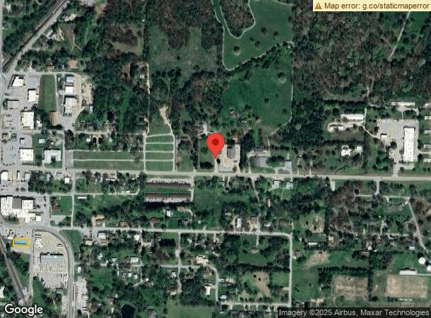
3Rd St, Decatur, AR 72722
NEARBY LISTINGS FOR SALE OR LEASE
-
-
View all Decatur listings for sale on LoopNet.com
Property Detail
3Rd St
Fayetteville-Springdale-Rogers, AR-MO
Corner Springs Add-Decatur
08-00257-000
PLAT 11/13/1893 B-70 & PT VACATED ALLEYS ORD 94-03(FILED 94-63188) A PART OF A VACATED ALLEY LOCATED IN CORNER SPRINGS ADDITION TO THE CITY OF DECATUR, BENTON COUNTY, ARKANSAS, VACATED PER ORDINANCE NO. 94-03, DATED AUGUST 8, 1994, AND FILED FOR RECO
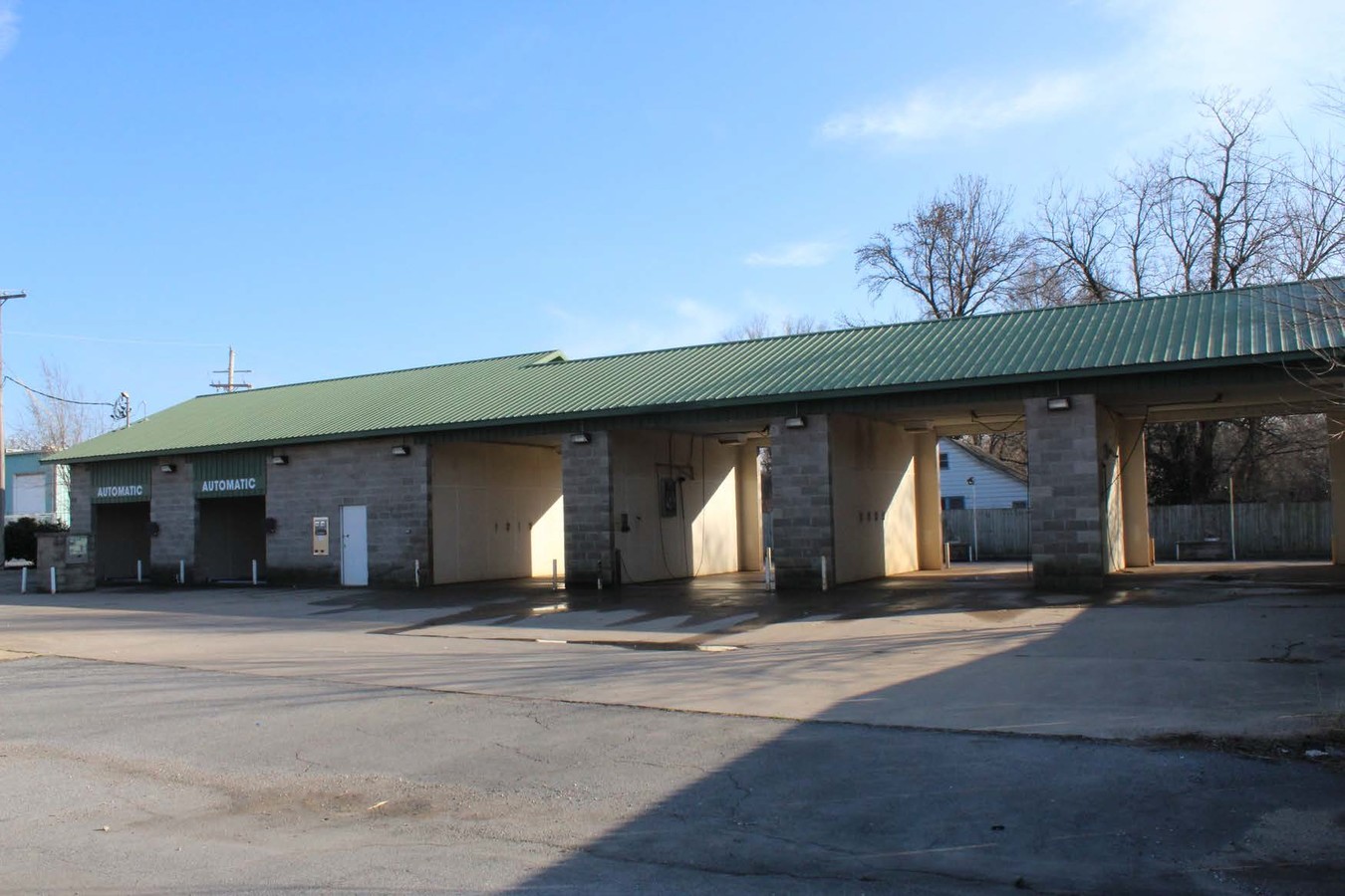
Carwash
Benton
A
Arkansas
05007C0205J
12
2024
0.18 AC
2024
Outlying Benton County
020906
Fayetteville/Springdale/Rogers
3,422 SF
DEMOGRAPHICS near 3Rd St
1 Mile
3 Mile
5 Mile
2024 Total Population
1,584
2,617
6,675
2029 Population
1,848
3,055
7,791
Pop Growth 2024-2029
+ 16.67%
+ 16.74%
+ 16.72%
Average Age
37
38
38
2024 Total Households
558
925
2,402
HH Growth 2024-2029
+ 16.67%
+ 16.65%
+ 16.69%
Median Household Inc
$76,649
$75,873
$63,091
Avg Household Size
2.80
2.80
2.70
2024 Avg HH Vehicles
2.00
2.00
2.00
Median Home Value
$189,208
$190,707
$176,384
Median Year Built
1986
1986
1987
Nearby Places
- Restaurants
- Banks
- Shops
- Fitness
- Groceries
PUBLIC TRANSPORTATION
AIRPORT
Northwest Arkansas Ntl
DRIVE
WALK
Distance
Northwest Arkansas Ntl
33 min
15.3 mi
Freight Ports
Tulsa Port of Inola
DRIVE
WALK
Distance
Tulsa Port of Inola
92 min
77.8 mi
SALE & LEASE HISTORY
LISTING DATE
SALE/LEASE

Mar 03, 2017
For Sale
Nearby Properties
Address
Land Use
TOTAL SIZE
Lot Size
Zoning
Address
Land Use
TOTAL SIZE
Lot Size
Zoning
346,788 SF
276.17 AC
Address
Land Use
TOTAL SIZE
Lot Size
Zoning
58,602 SF
41.78 AC
Address
Land Use
TOTAL SIZE
Lot Size
Zoning
1,260 SF
1.16 AC
Address
Land Use
TOTAL SIZE
Lot Size
Zoning
14,521 SF
111.82 AC
Address
Land Use
TOTAL SIZE
Lot Size
Zoning
69,480 SF
4.17 AC
Address
Land Use
TOTAL SIZE
Lot Size
Zoning
46,164 SF
1.70 AC
Address
Land Use
TOTAL SIZE
Lot Size
Zoning
151,355 SF
13.52 AC
Address
Land Use
TOTAL SIZE
Lot Size
Zoning
70,192 SF
2.44 AC
Address
Land Use
TOTAL SIZE
Lot Size
Zoning
34,200 SF
24.50 AC
Address
Land Use
TOTAL SIZE
Lot Size
Zoning
101,447 SF
10 AC
Address
Land Use
TOTAL SIZE
Lot Size
Zoning
31,299 SF
9.99 AC
Address
Land Use
TOTAL SIZE
Lot Size
Zoning
14,820 SF
6.68 AC
Address
Land Use
TOTAL SIZE
Lot Size
Zoning
8,095 SF
1.72 AC
Address
Land Use
TOTAL SIZE
Lot Size
Zoning
15,411 SF
3.10 AC
Address
Land Use
TOTAL SIZE
Lot Size
Zoning
25,592 SF
3.77 AC
Address
Land Use
TOTAL SIZE
Lot Size
Zoning
11,700 SF
0.28 AC
Address
Land Use
TOTAL SIZE
Lot Size
Zoning
41,216 SF
9.52 AC
Address
Land Use
TOTAL SIZE
Lot Size
Zoning
20,794 SF
3 AC
Address
Land Use
TOTAL SIZE
Lot Size
Zoning
14,112 SF
3.31 AC
Address
Land Use
TOTAL SIZE
Lot Size
Zoning
13,544 SF
0.26 AC
Address
Land Use
TOTAL SIZE
Lot Size
Zoning
13,502 SF
40.57 AC
Address
Land Use
TOTAL SIZE
Lot Size
Zoning
16,631 SF
6.61 AC
Address
Land Use
TOTAL SIZE
Lot Size
Zoning
73,379 SF
9.29 AC
Address
Land Use
TOTAL SIZE
Lot Size
Zoning
17,220 SF
1.67 AC
Address
Land Use
TOTAL SIZE
Lot Size
Zoning
26,656 SF
3.91 AC
Address
Land Use
TOTAL SIZE
Lot Size
Zoning
32,076 SF
1.67 AC
Address
Land Use
TOTAL SIZE
Lot Size
Zoning
17,320 SF
1.61 AC
Address
Land Use
TOTAL SIZE
Lot Size
Zoning
6,626 SF
0.62 AC
Address
Land Use
TOTAL SIZE
Lot Size
Zoning
9,866 SF
1.14 AC
Address
Land Use
TOTAL SIZE
Lot Size
Zoning
15,908 SF
9.99 AC
The World's #1 Commercial Real Estate Marketplace
Connect with us
© 2025 CoStar Group
The information above has been obtained from sources believed reliable. While we do not doubt its accuracy we have not verified it and make no guarantee, warranty or representation about it. It is your responsibility to independently confirm its accuracy and completeness. Any projections, opinions, assumptions, or estimates used are for example only and do not represent the current or future performance of the property. The value of this transaction to you depends on tax and other factors which should be evaluated by your tax, financial, and legal advisors. You and your advisors should conduct a careful, independent investigation of the property to determine to your satisfaction the suitability of the property for your needs.