Property Record
40 Fort Lewis Blvd, Salem, VA 24153


NEARBY LISTINGS FOR SALE OR LEASE
Property Detail
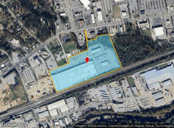
40 Fort Lewis Blvd
168-2-6
900
Industrialgeneral
22.87 AC TRACT RKE RESTAURANT SERVICE INC
AE
Salem City
51161C0136G
Virginia
2024
22.87 AC
2024
Southwest Roanoke
0102005032
Roanoke
348,269 SF
Roanoke, VA
DEMOGRAPHICS near 40 Fort Lewis Blvd
1 Mile
3 Mile
5 Mile
2024 Total Population
4,130
25,953
51,448
2029 Population
4,183
26,390
51,914
Pop Growth 2024-2029
+ 1.28%
+ 1.68%
+ 0.91%
Average Age
45
43
43
2024 Total Households
1,636
10,083
20,808
HH Growth 2024-2029
+ 1.41%
+ 1.81%
+ 0.97%
Median Household Inc
$90,109
$76,123
$71,326
Avg Household Size
2.50
2.40
2.30
2024 Avg HH Vehicles
2.00
2.00
2.00
Median Home Value
$263,979
$266,562
$245,649
Median Year Built
1975
1972
1971
Nearby Places
- Restaurants
- Banks
- Shops
- Fitness
- Groceries
PUBLIC TRANSPORTATION
AIRPORT
Roanoke/Blacksburg Regional (Woodrum Field)
DRIVE
WALK
Distance
Roanoke/Blacksburg Regional (Woodrum Field)
20 min
11.9 mi
Freight Ports
Virginia Port Authority - Richmond
DRIVE
WALK
Distance
Virginia Port Authority - Richmond
222 min
195.8 mi
Nearby Properties
Address
Land Use
TOTAL SIZE
Lot Size
Zoning
Address
Land Use
TOTAL SIZE
Lot Size
Zoning
52.04 AC
CUDRSF
Address
Land Use
TOTAL SIZE
Lot Size
Zoning
78,701 SF
31.20 AC
C2S
Address
Land Use
TOTAL SIZE
Lot Size
Zoning
254,638 SF
40.14 AC
RSF
Address
Land Use
TOTAL SIZE
Lot Size
Zoning
103,882 SF
93.53 AC
R1S
Address
Land Use
TOTAL SIZE
Lot Size
Zoning
3.78 AC
CUD
Address
Land Use
TOTAL SIZE
Lot Size
Zoning
6.24 AC
RMF
Address
Land Use
TOTAL SIZE
Lot Size
Zoning
95,357 SF
10.25 AC
RSF
Address
Land Use
TOTAL SIZE
Lot Size
Zoning
9.51 AC
CUD
Address
Land Use
TOTAL SIZE
Lot Size
Zoning
138,887 SF
13.03 AC
HBD
Address
Land Use
TOTAL SIZE
Lot Size
Zoning
394,937 SF
25.15 AC
I2
Address
Land Use
TOTAL SIZE
Lot Size
Zoning
864,046 SF
56.04 AC
HM
Address
Land Use
TOTAL SIZE
Lot Size
Zoning
100 SF
60.09 AC
RSF
Address
Land Use
TOTAL SIZE
Lot Size
Zoning
55,360 SF
1.58 AC
RB
Address
Land Use
TOTAL SIZE
Lot Size
Zoning
4.12 AC
RMF
Address
Land Use
TOTAL SIZE
Lot Size
Zoning
11.27 AC
RMF
Address
Land Use
TOTAL SIZE
Lot Size
Zoning
2.13 AC
DBD
Address
Land Use
TOTAL SIZE
Lot Size
Zoning
70,651 SF
11.63 AC
HM
Address
Land Use
TOTAL SIZE
Lot Size
Zoning
178,638 SF
12.01 AC
HBD
Address
Land Use
TOTAL SIZE
Lot Size
Zoning
24.54 AC
LM
Address
Land Use
TOTAL SIZE
Lot Size
Zoning
76,720 SF
4.90 AC
C2S
Address
Land Use
TOTAL SIZE
Lot Size
Zoning
63,191 SF
3.50 AC
HBD
Address
Land Use
TOTAL SIZE
Lot Size
Zoning
71,531 SF
1.77 AC
DBD
Address
Land Use
TOTAL SIZE
Lot Size
Zoning
88,087 SF
7.10 AC
HBD
Address
Land Use
TOTAL SIZE
Lot Size
Zoning
88,712 SF
5 AC
LM
Address
Land Use
TOTAL SIZE
Lot Size
Zoning
67,834 SF
0.79 AC
DBD
Address
Land Use
TOTAL SIZE
Lot Size
Zoning
10,770 SF
5.53 AC
RMF
Address
Land Use
TOTAL SIZE
Lot Size
Zoning
52,668 SF
1.86 AC
CUD
Address
Land Use
TOTAL SIZE
Lot Size
Zoning
43,032 SF
15.65 AC
R1S
Address
Land Use
TOTAL SIZE
Lot Size
Zoning
159,720 SF
30.20 AC
HM
The World's #1 Commercial Real Estate Marketplace
Connect with us
© 2025 CoStar Group
The information above has been obtained from sources believed reliable. While we do not doubt its accuracy we have not verified it and make no guarantee, warranty or representation about it. It is your responsibility to independently confirm its accuracy and completeness. Any projections, opinions, assumptions, or estimates used are for example only and do not represent the current or future performance of the property. The value of this transaction to you depends on tax and other factors which should be evaluated by your tax, financial, and legal advisors. You and your advisors should conduct a careful, independent investigation of the property to determine to your satisfaction the suitability of the property for your needs.