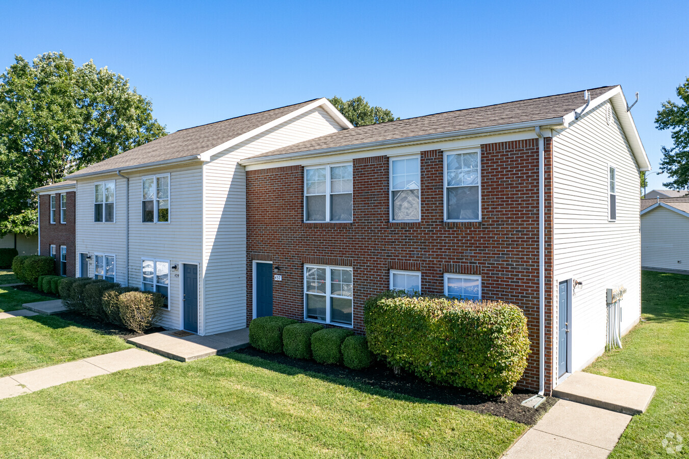
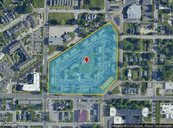
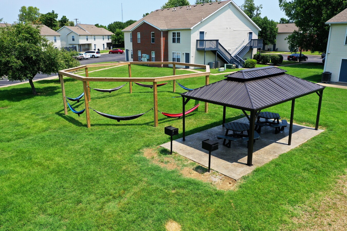
Property Record
400 Jeanette Benton Dr, Evansville, IN 47713
NEARBY LISTINGS FOR SALE OR LEASE
-
-
View all Evansville listings for sale on LoopNet.com
Property Detail
400 Jeanette Benton Dr
82-06-29-021-092.001-029
Brays Enlargement
Apartment
ALL OF BLKS 1, 2, 3 &PT LT 4 BRAY'S ENL ALSO PT BLK 1 OF GORDON'S ADDN & VAC STREETS & VAC ALLEYS
X
Vanderburgh
18163C0181E
Indiana
2023
9.22 AC
2023
Old Erie
001400
Evansville
4,160 SF
Evansville, IN-KY
DEMOGRAPHICS near 400 Jeanette Benton Dr
1 Mile
3 Mile
5 Mile
2024 Total Population
15,363
70,735
128,924
2029 Population
16,011
71,826
129,642
Pop Growth 2024-2029
+ 4.22%
+ 1.54%
+ 0.56%
Average Age
39
39
40
2024 Total Households
6,744
30,440
56,737
HH Growth 2024-2029
+ 4.45%
+ 1.60%
+ 0.56%
Median Household Inc
$37,190
$44,226
$48,249
Avg Household Size
2.10
2.20
2.20
2024 Avg HH Vehicles
1.00
2.00
2.00
Median Home Value
$75,111
$84,382
$118,573
Median Year Built
1948
1950
1961
Nearby Places
- Restaurants
- Banks
- Shops
- Fitness
- Groceries
PUBLIC TRANSPORTATION
AIRPORT
Evansville Regional
DRIVE
WALK
Distance
Evansville Regional
12 min
5.7 mi
Freight Ports
Port of Toledo
DRIVE
WALK
Distance
Port of Toledo
459 min
395.0 mi
SALE & LEASE HISTORY
LISTING DATE
SALE/LEASE

Dec 29, 2016
For Sale
Nearby Properties
Address
Land Use
TOTAL SIZE
Lot Size
Zoning
Address
Land Use
TOTAL SIZE
Lot Size
Zoning
84,660 SF
12.95 AC
Address
Land Use
TOTAL SIZE
Lot Size
Zoning
20,964 SF
1.35 AC
Address
Land Use
TOTAL SIZE
Lot Size
Zoning
169,860 SF
20.33 AC
Address
Land Use
TOTAL SIZE
Lot Size
Zoning
15,233 SF
3.31 AC
Address
Land Use
TOTAL SIZE
Lot Size
Zoning
117,580 SF
1.74 AC
Address
Land Use
TOTAL SIZE
Lot Size
Zoning
51,342 SF
4.42 AC
Address
Land Use
TOTAL SIZE
Lot Size
Zoning
21,831 SF
3.03 AC
Address
Land Use
TOTAL SIZE
Lot Size
Zoning
165,472 SF
1.38 AC
Address
Land Use
TOTAL SIZE
Lot Size
Zoning
23,108 SF
2.92 AC
Address
Land Use
TOTAL SIZE
Lot Size
Zoning
92,132 SF
1.68 AC
Address
Land Use
TOTAL SIZE
Lot Size
Zoning
223,202 SF
2.28 AC
Address
Land Use
TOTAL SIZE
Lot Size
Zoning
784,971 SF
15.37 AC
Address
Land Use
TOTAL SIZE
Lot Size
Zoning
20,286 SF
4.57 AC
Address
Land Use
TOTAL SIZE
Lot Size
Zoning
87,099 SF
2.28 AC
Address
Land Use
TOTAL SIZE
Lot Size
Zoning
25,595 SF
14.99 AC
Address
Land Use
TOTAL SIZE
Lot Size
Zoning
82,488 SF
1.90 AC
8
Address
Land Use
TOTAL SIZE
Lot Size
Zoning
61,652 SF
15.02 AC
Address
Land Use
TOTAL SIZE
Lot Size
Zoning
331,588 SF
0.96 AC
Address
Land Use
TOTAL SIZE
Lot Size
Zoning
83,218 SF
1.83 AC
Address
Land Use
TOTAL SIZE
Lot Size
Zoning
8,920 SF
2.62 AC
Address
Land Use
TOTAL SIZE
Lot Size
Zoning
11,286 SF
4.07 AC
Address
Land Use
TOTAL SIZE
Lot Size
Zoning
75,109 SF
1.64 AC
Address
Land Use
TOTAL SIZE
Lot Size
Zoning
94,551 SF
6.12 AC
Address
Land Use
TOTAL SIZE
Lot Size
Zoning
4,284 SF
13.14 AC
Address
Land Use
TOTAL SIZE
Lot Size
Zoning
229,140 SF
1.03 AC
Address
Land Use
TOTAL SIZE
Lot Size
Zoning
185,563 SF
12.47 AC
Address
Land Use
TOTAL SIZE
Lot Size
Zoning
1,800 SF
28.13 AC
Address
Land Use
TOTAL SIZE
Lot Size
Zoning
57,240 SF
1.79 AC
Address
Land Use
TOTAL SIZE
Lot Size
Zoning
69,144 SF
3.28 AC
The World's #1 Commercial Real Estate Marketplace
Connect with us
© 2025 CoStar Group
The information above has been obtained from sources believed reliable. While we do not doubt its accuracy we have not verified it and make no guarantee, warranty or representation about it. It is your responsibility to independently confirm its accuracy and completeness. Any projections, opinions, assumptions, or estimates used are for example only and do not represent the current or future performance of the property. The value of this transaction to you depends on tax and other factors which should be evaluated by your tax, financial, and legal advisors. You and your advisors should conduct a careful, independent investigation of the property to determine to your satisfaction the suitability of the property for your needs.