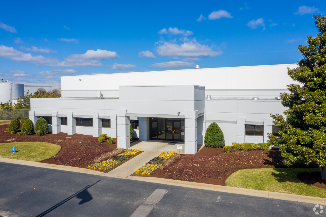
Property Record
400 New Sanford Rd, La Vergne, TN 37086

NEARBY LISTINGS FOR SALE OR LEASE
Property Detail
400 New Sanford Rd
Nashville-Davidson--Murfreesboro--Franklin, TN
Sanford Road Replat Of Lot 2
029-005.14-000
Rutherford
Warehouse
Tennessee
X
30.91 AC
47149C0105J
Southeast
536,732 SF
Nashville
DEMOGRAPHICS near 400 New Sanford Rd
1 Mile
3 Mile
5 Mile
2024 Total Population
5,608
46,540
120,040
2029 Population
6,363
52,791
134,141
Pop Growth 2024-2029
+ 13.46%
+ 13.43%
+ 11.75%
Average Age
35
36
36
2024 Total Households
2,049
16,373
41,518
HH Growth 2024-2029
+ 12.98%
+ 12.92%
+ 11.31%
Median Household Inc
$79,916
$78,724
$76,369
Avg Household Size
2.70
2.80
2.80
2024 Avg HH Vehicles
2.00
2.00
2.00
Median Home Value
$246,341
$272,950
$270,309
Median Year Built
2002
1999
2001
Nearby Places
- Restaurants
- Banks
- Shops
- Fitness
- Groceries
PUBLIC TRANSPORTATION
AIRPORT
Nashville International
DRIVE
WALK
Distance
Nashville International
25 min
14.5 mi
Freight Ports
Port of Mobile
DRIVE
WALK
Distance
Port of Mobile
499 min
453.3 mi
SALE & LEASE HISTORY
LISTING DATE
SALE/LEASE

Mar 29, 2018
For Lease
Feb 02, 2018
For Lease
Nearby Properties
Address
Land Use
TOTAL SIZE
Lot Size
Zoning
Address
Land Use
TOTAL SIZE
Lot Size
Zoning
302,040 SF
60 AC
Address
Land Use
TOTAL SIZE
Lot Size
Zoning
618,332 SF
45.75 AC
Address
Land Use
TOTAL SIZE
Lot Size
Zoning
564,124 SF
37.66 AC
Address
Land Use
TOTAL SIZE
Lot Size
Zoning
377,869 SF
26.47 AC
Address
Land Use
TOTAL SIZE
Lot Size
Zoning
4,709 SF
25.76 AC
RM14
Address
Land Use
TOTAL SIZE
Lot Size
Zoning
17,953 SF
14.92 AC
Address
Land Use
TOTAL SIZE
Lot Size
Zoning
5,352 SF
30 AC
RMF
Address
Land Use
TOTAL SIZE
Lot Size
Zoning
4,974 SF
18.91 AC
C2
Address
Land Use
TOTAL SIZE
Lot Size
Zoning
301,272 SF
26.09 AC
Address
Land Use
TOTAL SIZE
Lot Size
Zoning
588,845 SF
72.56 AC
Address
Land Use
TOTAL SIZE
Lot Size
Zoning
163,177 SF
39.68 AC
Address
Land Use
TOTAL SIZE
Lot Size
Zoning
202,737 SF
41 AC
Address
Land Use
TOTAL SIZE
Lot Size
Zoning
28,187 SF
14 AC
SP
Address
Land Use
TOTAL SIZE
Lot Size
Zoning
600,604 SF
47.70 AC
Address
Land Use
TOTAL SIZE
Lot Size
Zoning
526,143 SF
25.75 AC
IR
Address
Land Use
TOTAL SIZE
Lot Size
Zoning
132,470 SF
42.16 AC
Address
Land Use
TOTAL SIZE
Lot Size
Zoning
603,578 SF
47.11 AC
Address
Land Use
TOTAL SIZE
Lot Size
Zoning
484,476 SF
30.01 AC
Address
Land Use
TOTAL SIZE
Lot Size
Zoning
512,464 SF
42.43 AC
IR
Address
Land Use
TOTAL SIZE
Lot Size
Zoning
2,195,874 SF
135.70 AC
Address
Land Use
TOTAL SIZE
Lot Size
Zoning
12,156 SF
122.05 AC
IR
Address
Land Use
TOTAL SIZE
Lot Size
Zoning
212,268 SF
49 AC
Address
Land Use
TOTAL SIZE
Lot Size
Zoning
128,082 SF
19 AC
Address
Land Use
TOTAL SIZE
Lot Size
Zoning
304,456 SF
40.14 AC
Address
Land Use
TOTAL SIZE
Lot Size
Zoning
105,638 SF
20.23 AC
Address
Land Use
TOTAL SIZE
Lot Size
Zoning
3,142 SF
11.40 AC
C2
Address
Land Use
TOTAL SIZE
Lot Size
Zoning
121,104 SF
30 AC
Address
Land Use
TOTAL SIZE
Lot Size
Zoning
3,296 SF
14.63 AC
Address
Land Use
TOTAL SIZE
Lot Size
Zoning
22,500 SF
23.38 AC
RM16
Address
Land Use
TOTAL SIZE
Lot Size
Zoning
387,972 SF
27.30 AC
The World's #1 Commercial Real Estate Marketplace
Connect with us
© 2025 CoStar Group
The information above has been obtained from sources believed reliable. While we do not doubt its accuracy we have not verified it and make no guarantee, warranty or representation about it. It is your responsibility to independently confirm its accuracy and completeness. Any projections, opinions, assumptions, or estimates used are for example only and do not represent the current or future performance of the property. The value of this transaction to you depends on tax and other factors which should be evaluated by your tax, financial, and legal advisors. You and your advisors should conduct a careful, independent investigation of the property to determine to your satisfaction the suitability of the property for your needs.