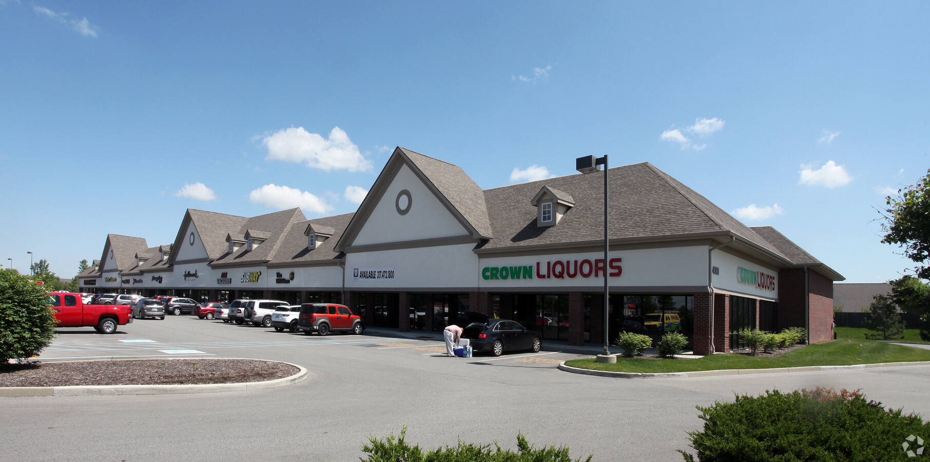
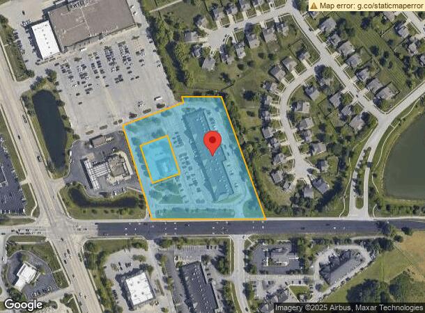
Property Record
4000 W 106Th St, Carmel, IN 46032
NEARBY LISTINGS FOR SALE OR LEASE
Property Detail
4000 W 106Th St
29-13-06-000-028.000-018
ACREAGE 4.87, SECTION 6, TOWNSHIP 17, RANGE 3
Regionalshoppingcenterormallwithanchorstore
Hamilton
X
Indiana
18057C0205G
4.87 AC
2023
Far North Hamilton Cnty
2024
Indianapolis
111010
Indianapolis-Carmel-Anderson, IN
32,600 SF
DEMOGRAPHICS near 4000 W 106Th St
1 Mile
3 Mile
5 Mile
2024 Total Population
3,950
43,183
124,027
2029 Population
4,407
46,609
131,512
Pop Growth 2024-2029
+ 11.57%
+ 7.93%
+ 6.03%
Average Age
40
41
39
2024 Total Households
1,521
17,721
48,686
HH Growth 2024-2029
+ 11.37%
+ 6.83%
+ 5.24%
Median Household Inc
$130,208
$99,340
$97,206
Avg Household Size
2.60
2.40
2.50
2024 Avg HH Vehicles
2.00
2.00
2.00
Median Home Value
$423,802
$430,839
$404,938
Median Year Built
2002
1992
1991
Nearby Places
- Restaurants
- Banks
- Shops
- Fitness
- Groceries
PUBLIC TRANSPORTATION
AIRPORT
Indianapolis International
DRIVE
WALK
Distance
Indianapolis International
41 min
24.1 mi
Freight Ports
Port of Toledo
DRIVE
WALK
Distance
Port of Toledo
268 min
225.6 mi
SALE & LEASE HISTORY
LISTING DATE
SALE/LEASE

Sep 25, 2016
For Lease
Oct 13, 2017
For Lease
Aug 16, 2017
For Lease
Nearby Properties
Address
Land Use
TOTAL SIZE
Lot Size
Zoning
Address
Land Use
TOTAL SIZE
Lot Size
Zoning
278,637 SF
43.98 AC
ZO01
Address
Land Use
TOTAL SIZE
Lot Size
Zoning
4,267 SF
21.06 AC
ZO01
Address
Land Use
TOTAL SIZE
Lot Size
Zoning
68,990 SF
188.21 AC
ZO01
Address
Land Use
TOTAL SIZE
Lot Size
Zoning
402,521 SF
153.38 AC
Address
Land Use
TOTAL SIZE
Lot Size
Zoning
18,569 SF
9.57 AC
ZO01
Address
Land Use
TOTAL SIZE
Lot Size
Zoning
10,380 SF
24 AC
ZO01
Address
Land Use
TOTAL SIZE
Lot Size
Zoning
1,470 SF
19.02 AC
ZO01
Address
Land Use
TOTAL SIZE
Lot Size
Zoning
34,863 SF
14.77 AC
ZO01
Address
Land Use
TOTAL SIZE
Lot Size
Zoning
5,434 SF
11.35 AC
ZO01
Address
Land Use
TOTAL SIZE
Lot Size
Zoning
9,076 SF
18 AC
ZO01
Address
Land Use
TOTAL SIZE
Lot Size
Zoning
168,710 SF
5.24 AC
ZO01
Address
Land Use
TOTAL SIZE
Lot Size
Zoning
12,023 SF
48.47 AC
ZO01
Address
Land Use
TOTAL SIZE
Lot Size
Zoning
351,756 SF
8.38 AC
Address
Land Use
TOTAL SIZE
Lot Size
Zoning
9,139 SF
13 AC
ZO01
Address
Land Use
TOTAL SIZE
Lot Size
Zoning
301,907 SF
43.90 AC
ZO01
Address
Land Use
TOTAL SIZE
Lot Size
Zoning
1,904 SF
45.69 AC
ZO01
Address
Land Use
TOTAL SIZE
Lot Size
Zoning
512,730 SF
21.80 AC
ZO01
Address
Land Use
TOTAL SIZE
Lot Size
Zoning
2,103 SF
11.67 AC
ZO01
Address
Land Use
TOTAL SIZE
Lot Size
Zoning
115,522 SF
10.38 AC
ZO01
Address
Land Use
TOTAL SIZE
Lot Size
Zoning
110,373 SF
47.98 AC
ZO01
Address
Land Use
TOTAL SIZE
Lot Size
Zoning
149,334 SF
15.89 AC
ZO01
Address
Land Use
TOTAL SIZE
Lot Size
Zoning
179,586 SF
10.23 AC
ZO01
Address
Land Use
TOTAL SIZE
Lot Size
Zoning
4,495 SF
19.62 AC
ZO01
Address
Land Use
TOTAL SIZE
Lot Size
Zoning
7,469 SF
24.52 AC
ZO01
Address
Land Use
TOTAL SIZE
Lot Size
Zoning
3,158 SF
14.16 AC
ZO01
Address
Land Use
TOTAL SIZE
Lot Size
Zoning
155,919 SF
28.92 AC
Address
Land Use
TOTAL SIZE
Lot Size
Zoning
17,218 SF
9.80 AC
ZO01
Address
Land Use
TOTAL SIZE
Lot Size
Zoning
148,940 SF
23.14 AC
ZO01
Address
Land Use
TOTAL SIZE
Lot Size
Zoning
123,575 SF
13.04 AC
Address
Land Use
TOTAL SIZE
Lot Size
Zoning
17,780 SF
18.99 AC
ZO01
The World's #1 Commercial Real Estate Marketplace
Connect with us
© 2025 CoStar Group
The information above has been obtained from sources believed reliable. While we do not doubt its accuracy we have not verified it and make no guarantee, warranty or representation about it. It is your responsibility to independently confirm its accuracy and completeness. Any projections, opinions, assumptions, or estimates used are for example only and do not represent the current or future performance of the property. The value of this transaction to you depends on tax and other factors which should be evaluated by your tax, financial, and legal advisors. You and your advisors should conduct a careful, independent investigation of the property to determine to your satisfaction the suitability of the property for your needs.