Property Record
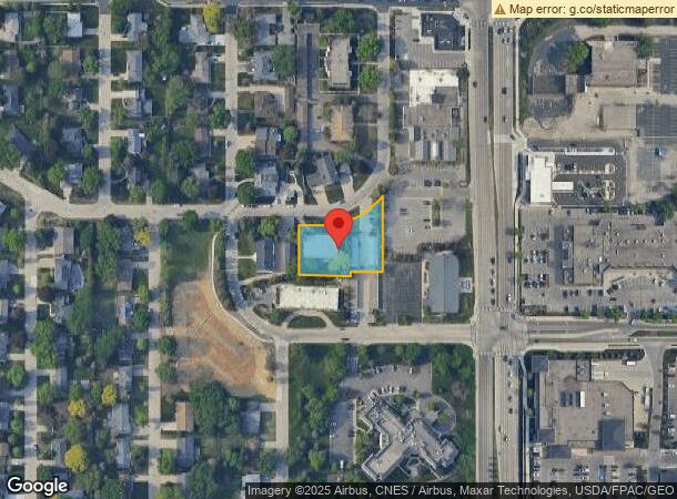
4001 Mavelle Dr, Minneapolis, MN 55435

NEARBY LISTINGS FOR SALE OR LEASE
Property Detail
4001 Mavelle Dr
Minneapolis-St. Paul-Bloomington, MN-WI
Stows Edgemoor Addn Block 9 Replat
31-028-24-11-0083
BLOCK 001 T STOWS EDGEMOOR ADDN BLOCK 9 REPLAT THAT PART OF LOT 3 LYING N OF A LINE PAR WITH AND 37 FT S FROM MOST NLY LINE OF SAID LOT ALSO THAT PART OF LOT 4 LYING E OF W 130 FT T IRREGULAR
Apartment
Hennepin
X
Minnesota
27053C0452F
3
2024
0.67 AC
2023
Edina
024003
Minneapolis/St Paul
4,109 SF
DEMOGRAPHICS near 4001 Mavelle Dr
1 Mile
3 Mile
5 Mile
2024 Total Population
16,910
105,120
276,442
2029 Population
16,924
103,642
271,769
Pop Growth 2024-2029
+ 0.08%
(1.41%)
(1.69%)
Average Age
45
43
41
2024 Total Households
8,504
45,230
118,655
HH Growth 2024-2029
+ 0.27%
(1.42%)
(1.74%)
Median Household Inc
$73,687
$100,044
$93,565
Avg Household Size
1.90
2.20
2.20
2024 Avg HH Vehicles
1.00
2.00
2.00
Median Home Value
$291,683
$395,386
$372,135
Median Year Built
1974
1964
1963
Nearby Places
- Restaurants
- Banks
- Shops
- Fitness
- Groceries
PUBLIC TRANSPORTATION
AIRPORT
Minneapolis-St Paul International/Wold-Chamberlain
DRIVE
WALK
Distance
Minneapolis-St Paul International/Wold-Chamberlain
14 min
8.2 mi
Freight Ports
Port Milwaukee
DRIVE
WALK
Distance
Port Milwaukee
383 min
345.3 mi
Nearby Properties
Address
Land Use
TOTAL SIZE
Lot Size
Zoning
Address
Land Use
TOTAL SIZE
Lot Size
Zoning
364,730 SF
13.40 AC
PCD3
Address
Land Use
TOTAL SIZE
Lot Size
Zoning
35.28 AC
Address
Land Use
TOTAL SIZE
Lot Size
Zoning
45.77 AC
Address
Land Use
TOTAL SIZE
Lot Size
Zoning
12,308 SF
1.25 AC
PCD3
Address
Land Use
TOTAL SIZE
Lot Size
Zoning
21.50 AC
Address
Land Use
TOTAL SIZE
Lot Size
Zoning
22,654 SF
5.22 AC
Address
Land Use
TOTAL SIZE
Lot Size
Zoning
79,717 SF
4.62 AC
Address
Land Use
TOTAL SIZE
Lot Size
Zoning
461,748 SF
5.87 AC
Address
Land Use
TOTAL SIZE
Lot Size
Zoning
1.50 AC
Address
Land Use
TOTAL SIZE
Lot Size
Zoning
3.51 AC
Address
Land Use
TOTAL SIZE
Lot Size
Zoning
1.74 AC
Address
Land Use
TOTAL SIZE
Lot Size
Zoning
8.55 AC
Address
Land Use
TOTAL SIZE
Lot Size
Zoning
50,484 SF
5.12 AC
Address
Land Use
TOTAL SIZE
Lot Size
Zoning
94,827 SF
5.86 AC
RMD
Address
Land Use
TOTAL SIZE
Lot Size
Zoning
25,780 SF
5.24 AC
Address
Land Use
TOTAL SIZE
Lot Size
Zoning
7,614 SF
2.01 AC
PCD3
Address
Land Use
TOTAL SIZE
Lot Size
Zoning
31,646 SF
5.85 AC
Address
Land Use
TOTAL SIZE
Lot Size
Zoning
8.80 AC
Address
Land Use
TOTAL SIZE
Lot Size
Zoning
435,796 SF
36.44 AC
Address
Land Use
TOTAL SIZE
Lot Size
Zoning
Address
Land Use
TOTAL SIZE
Lot Size
Zoning
60,320 SF
11.50 AC
Address
Land Use
TOTAL SIZE
Lot Size
Zoning
25,909 SF
6.09 AC
Address
Land Use
TOTAL SIZE
Lot Size
Zoning
22,119 SF
4.02 AC
Address
Land Use
TOTAL SIZE
Lot Size
Zoning
21.69 AC
Address
Land Use
TOTAL SIZE
Lot Size
Zoning
Address
Land Use
TOTAL SIZE
Lot Size
Zoning
Address
Land Use
TOTAL SIZE
Lot Size
Zoning
39,118 SF
3.48 AC
Address
Land Use
TOTAL SIZE
Lot Size
Zoning
5.83 AC
Address
Land Use
TOTAL SIZE
Lot Size
Zoning
21,740 SF
3.60 AC
Address
Land Use
TOTAL SIZE
Lot Size
Zoning
18,536 SF
3.67 AC
The World's #1 Commercial Real Estate Marketplace
Connect with us
© 2025 CoStar Group
The information above has been obtained from sources believed reliable. While we do not doubt its accuracy we have not verified it and make no guarantee, warranty or representation about it. It is your responsibility to independently confirm its accuracy and completeness. Any projections, opinions, assumptions, or estimates used are for example only and do not represent the current or future performance of the property. The value of this transaction to you depends on tax and other factors which should be evaluated by your tax, financial, and legal advisors. You and your advisors should conduct a careful, independent investigation of the property to determine to your satisfaction the suitability of the property for your needs.