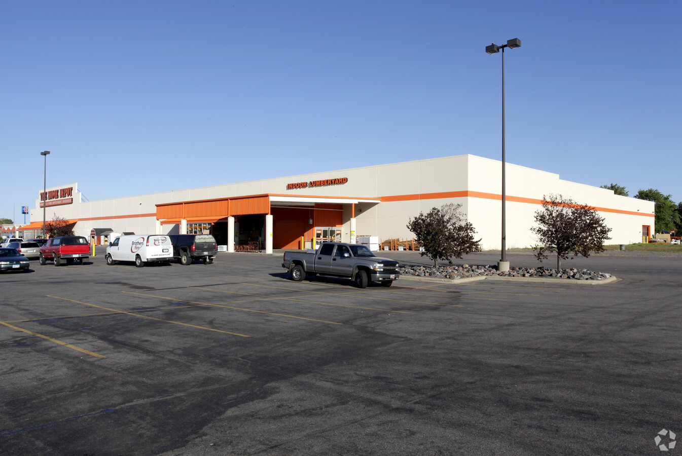
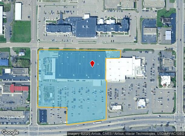
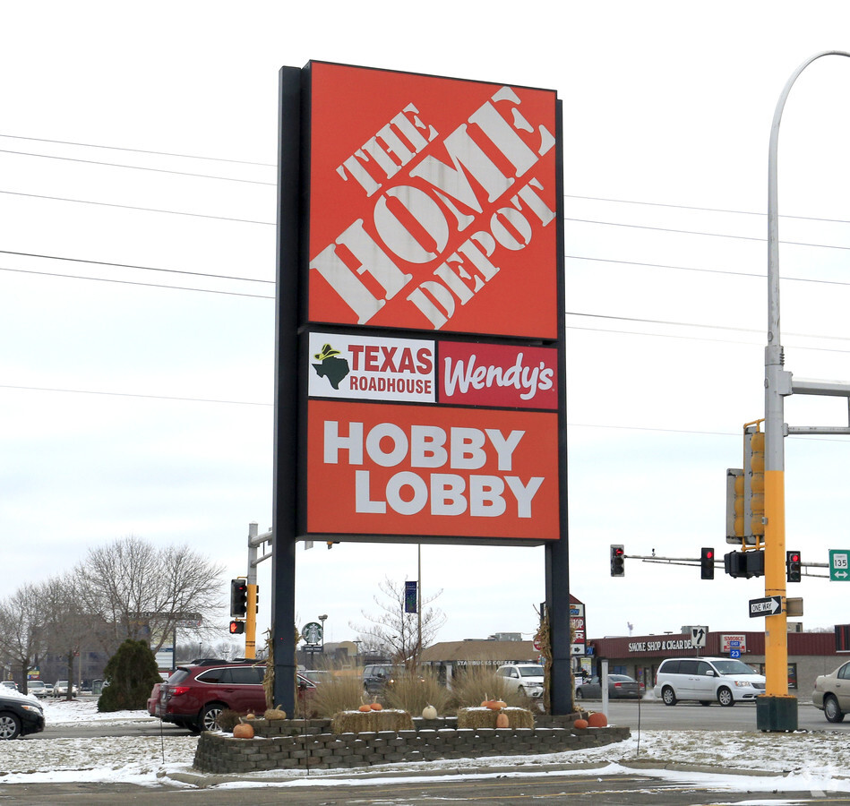
Property Record
401 2Nd St S, Waite Park, MN 56387
NEARBY LISTINGS FOR SALE OR LEASE
Property Detail
401 2Nd St S
Minneapolis/St Paul
Beumer Baird Plaza
St. Cloud, MN
& S 17' OF N 50' OF E 537.77' ALG HWY OF W 570.77' OF OLD HWY 23 ROW IN NE4SE4 17-124-28 BEUMER BAIRD PLAZA SECTION 17
98.60655.0705
Stearns
Wholesaleoutletdiscountstore
Minnesota
2023
2
2024
8.71 AC
000501
Stearns County
153,145 SF
DEMOGRAPHICS near 401 2Nd St S
1 Mile
3 Mile
5 Mile
2024 Total Population
8,128
49,369
110,011
2029 Population
8,444
51,139
113,728
Pop Growth 2024-2029
+ 3.89%
+ 3.59%
+ 3.38%
Average Age
39
38
37
2024 Total Households
3,549
20,461
43,563
HH Growth 2024-2029
+ 3.94%
+ 3.68%
+ 3.45%
Median Household Inc
$44,387
$55,821
$55,416
Avg Household Size
2.20
2.30
2.30
2024 Avg HH Vehicles
2.00
2.00
2.00
Median Home Value
$205,235
$183,520
$194,043
Median Year Built
1990
1983
1985
Nearby Places
- Restaurants
- Banks
- Shops
- Fitness
- Groceries
PUBLIC TRANSPORTATION
COMMUTER RAIL
St. Cloud Amtrak Station (Empire Builder - Amtrak)
DRIVE
WALK
Distance
St. Cloud Amtrak Station (Empire Builder - Amtrak)
10 min
4.6 mi
Freight Ports
Port Milwaukee
DRIVE
WALK
Distance
Port Milwaukee
451 min
405.7 mi
Nearby Properties
Address
Land Use
TOTAL SIZE
Lot Size
Zoning
Address
Land Use
TOTAL SIZE
Lot Size
Zoning
38.98 AC
Address
Land Use
TOTAL SIZE
Lot Size
Zoning
113,316 SF
31.99 AC
Address
Land Use
TOTAL SIZE
Lot Size
Zoning
52,983 SF
22 AC
Address
Land Use
TOTAL SIZE
Lot Size
Zoning
70,971 SF
11.40 AC
PUD57
Address
Land Use
TOTAL SIZE
Lot Size
Zoning
125,278 SF
11.01 AC
C5
Address
Land Use
TOTAL SIZE
Lot Size
Zoning
184,285 SF
26.79 AC
Address
Land Use
TOTAL SIZE
Lot Size
Zoning
115,298 SF
8.50 AC
R5
Address
Land Use
TOTAL SIZE
Lot Size
Zoning
233,354 SF
7.30 AC
R5
Address
Land Use
TOTAL SIZE
Lot Size
Zoning
113,268 SF
12 AC
PUD32
Address
Land Use
TOTAL SIZE
Lot Size
Zoning
5.34 AC
Address
Land Use
TOTAL SIZE
Lot Size
Zoning
146,285 SF
38.20 AC
Address
Land Use
TOTAL SIZE
Lot Size
Zoning
51.70 AC
PL20B2
Address
Land Use
TOTAL SIZE
Lot Size
Zoning
25,608 SF
6.96 AC
R5
Address
Land Use
TOTAL SIZE
Lot Size
Zoning
0.28 AC
I2
Address
Land Use
TOTAL SIZE
Lot Size
Zoning
36,393 SF
6.28 AC
Address
Land Use
TOTAL SIZE
Lot Size
Zoning
83,317 SF
6.43 AC
C5
Address
Land Use
TOTAL SIZE
Lot Size
Zoning
44,223 SF
12.32 AC
Address
Land Use
TOTAL SIZE
Lot Size
Zoning
165,878 SF
11.16 AC
PUD56
Address
Land Use
TOTAL SIZE
Lot Size
Zoning
11,700 SF
143.98 AC
Address
Land Use
TOTAL SIZE
Lot Size
Zoning
18,554 SF
8.41 AC
Address
Land Use
TOTAL SIZE
Lot Size
Zoning
7.70 AC
Address
Land Use
TOTAL SIZE
Lot Size
Zoning
32,074 SF
7.20 AC
PUD50
Address
Land Use
TOTAL SIZE
Lot Size
Zoning
22,425 SF
11.08 AC
Address
Land Use
TOTAL SIZE
Lot Size
Zoning
9,448 SF
5.10 AC
Address
Land Use
TOTAL SIZE
Lot Size
Zoning
5.89 AC
Address
Land Use
TOTAL SIZE
Lot Size
Zoning
80,210 SF
4.54 AC
C5
Address
Land Use
TOTAL SIZE
Lot Size
Zoning
20,450 SF
1 AC
Address
Land Use
TOTAL SIZE
Lot Size
Zoning
90,427 SF
9.40 AC
Address
Land Use
TOTAL SIZE
Lot Size
Zoning
136,500 SF
6.02 AC
R5
The World's #1 Commercial Real Estate Marketplace
Connect with us
© 2025 CoStar Group
The information above has been obtained from sources believed reliable. While we do not doubt its accuracy we have not verified it and make no guarantee, warranty or representation about it. It is your responsibility to independently confirm its accuracy and completeness. Any projections, opinions, assumptions, or estimates used are for example only and do not represent the current or future performance of the property. The value of this transaction to you depends on tax and other factors which should be evaluated by your tax, financial, and legal advisors. You and your advisors should conduct a careful, independent investigation of the property to determine to your satisfaction the suitability of the property for your needs.