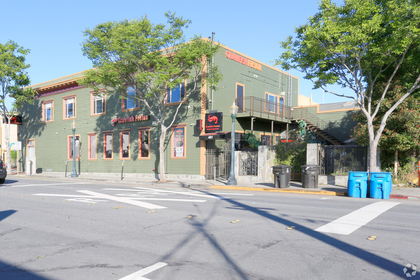
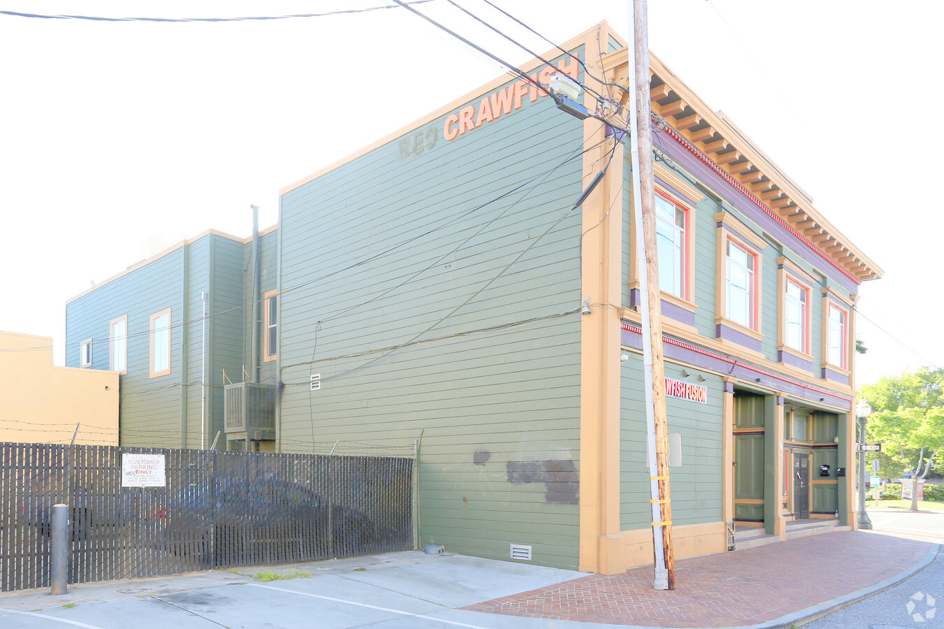
Property Record
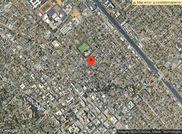
401 E 3Rd Ave, San Mateo, CA 94401

NEARBY LISTINGS FOR SALE OR LEASE
Property Detail
401 E 3Rd Ave
San Francisco-Redwood City-South San Francisco, CA
Town Of San Mateo
034-181-050
LOT 12 BLOCK 17 TOWN OF SAN MATEO VOL 2 MISC PG 95
Officebuilding
San Mateo
X
California
06081C0154G
12
2023
0.13 AC
2023
San Mateo
606201
San Francisco
10,988 SF
DEMOGRAPHICS near 401 E 3Rd Ave
1 Mile
3 Mile
5 Mile
2024 Total Population
37,097
133,015
232,598
2029 Population
35,423
127,381
222,105
Pop Growth 2024-2029
(4.51%)
(4.24%)
(4.51%)
Average Age
41
41
42
2024 Total Households
13,679
50,976
87,862
HH Growth 2024-2029
(4.72%)
(4.41%)
(4.72%)
Median Household Inc
$117,506
$142,016
$154,254
Avg Household Size
2.60
2.50
2.60
2024 Avg HH Vehicles
2.00
2.00
2.00
Median Home Value
$1,102,184
$1,119,249
$1,127,146
Median Year Built
1961
1965
1968
Nearby Places
- Restaurants
- Banks
- Shops
- Fitness
- Groceries
PUBLIC TRANSPORTATION
COMMUTER RAIL
San Mateo (Caltrain - Caltrain (Caltrain))
DRIVE
WALK
Distance
San Mateo (Caltrain - Caltrain (Caltrain))
1 min
8 min
0.4 mi
Burlingame (Caltrain - Caltrain (Caltrain))
DRIVE
WALK
Distance
Burlingame (Caltrain - Caltrain (Caltrain))
3 min
1.6 mi
AIRPORT
San Francisco International
DRIVE
WALK
Distance
San Francisco International
11 min
6.5 mi
Metro Oakland International
DRIVE
WALK
Distance
Metro Oakland International
34 min
26.1 mi
Norman Y Mineta San Jose International
DRIVE
WALK
Distance
Norman Y Mineta San Jose International
35 min
27.6 mi
Freight Ports
Port of Redwood City
DRIVE
WALK
Distance
Port of Redwood City
16 min
10.4 mi
Nearby Properties
Address
Land Use
TOTAL SIZE
Lot Size
Zoning
Address
Land Use
TOTAL SIZE
Lot Size
Zoning
1,068,445 SF
39.91 AC
Address
Land Use
TOTAL SIZE
Lot Size
Zoning
8.65 AC
Address
Land Use
TOTAL SIZE
Lot Size
Zoning
239,107 SF
2.37 AC
Address
Land Use
TOTAL SIZE
Lot Size
Zoning
354,800 SF
6 AC
Address
Land Use
TOTAL SIZE
Lot Size
Zoning
5.73 AC
Address
Land Use
TOTAL SIZE
Lot Size
Zoning
277,784 SF
10.95 AC
Address
Land Use
TOTAL SIZE
Lot Size
Zoning
397,793 SF
10.48 AC
CL00C1
Address
Land Use
TOTAL SIZE
Lot Size
Zoning
215,318 SF
3.42 AC
Address
Land Use
TOTAL SIZE
Lot Size
Zoning
568,423 SF
16.07 AC
Address
Land Use
TOTAL SIZE
Lot Size
Zoning
311,952 SF
3.68 AC
Address
Land Use
TOTAL SIZE
Lot Size
Zoning
399,422 SF
5.99 AC
Address
Land Use
TOTAL SIZE
Lot Size
Zoning
634,000 SF
8.14 AC
M10000
Address
Land Use
TOTAL SIZE
Lot Size
Zoning
260,547 SF
2.26 AC
Address
Land Use
TOTAL SIZE
Lot Size
Zoning
295,000 SF
4.02 AC
Address
Land Use
TOTAL SIZE
Lot Size
Zoning
547,306 SF
3.92 AC
Address
Land Use
TOTAL SIZE
Lot Size
Zoning
400,000 SF
4.38 AC
C10000
Address
Land Use
TOTAL SIZE
Lot Size
Zoning
219,318 SF
4.77 AC
Address
Land Use
TOTAL SIZE
Lot Size
Zoning
326,432 SF
10.27 AC
CL0C21
Address
Land Use
TOTAL SIZE
Lot Size
Zoning
337,459 SF
17.09 AC
EA0000
Address
Land Use
TOTAL SIZE
Lot Size
Zoning
245,260 SF
9.06 AC
Address
Land Use
TOTAL SIZE
Lot Size
Zoning
218,249 SF
2.15 AC
Address
Land Use
TOTAL SIZE
Lot Size
Zoning
150,806 SF
5.86 AC
Address
Land Use
TOTAL SIZE
Lot Size
Zoning
395,010 SF
15.12 AC
R003S3
Address
Land Use
TOTAL SIZE
Lot Size
Zoning
192,054 SF
4.54 AC
Address
Land Use
TOTAL SIZE
Lot Size
Zoning
196,504 SF
1.98 AC
Address
Land Use
TOTAL SIZE
Lot Size
Zoning
589,128 SF
11.22 AC
Address
Land Use
TOTAL SIZE
Lot Size
Zoning
233,788 SF
3.35 AC
Address
Land Use
TOTAL SIZE
Lot Size
Zoning
204,729 SF
2.70 AC
Address
Land Use
TOTAL SIZE
Lot Size
Zoning
5.47 AC
CBD000
Address
Land Use
TOTAL SIZE
Lot Size
Zoning
319,696 SF
3.12 AC
The World's #1 Commercial Real Estate Marketplace
Connect with us
© 2025 CoStar Group
The information above has been obtained from sources believed reliable. While we do not doubt its accuracy we have not verified it and make no guarantee, warranty or representation about it. It is your responsibility to independently confirm its accuracy and completeness. Any projections, opinions, assumptions, or estimates used are for example only and do not represent the current or future performance of the property. The value of this transaction to you depends on tax and other factors which should be evaluated by your tax, financial, and legal advisors. You and your advisors should conduct a careful, independent investigation of the property to determine to your satisfaction the suitability of the property for your needs.