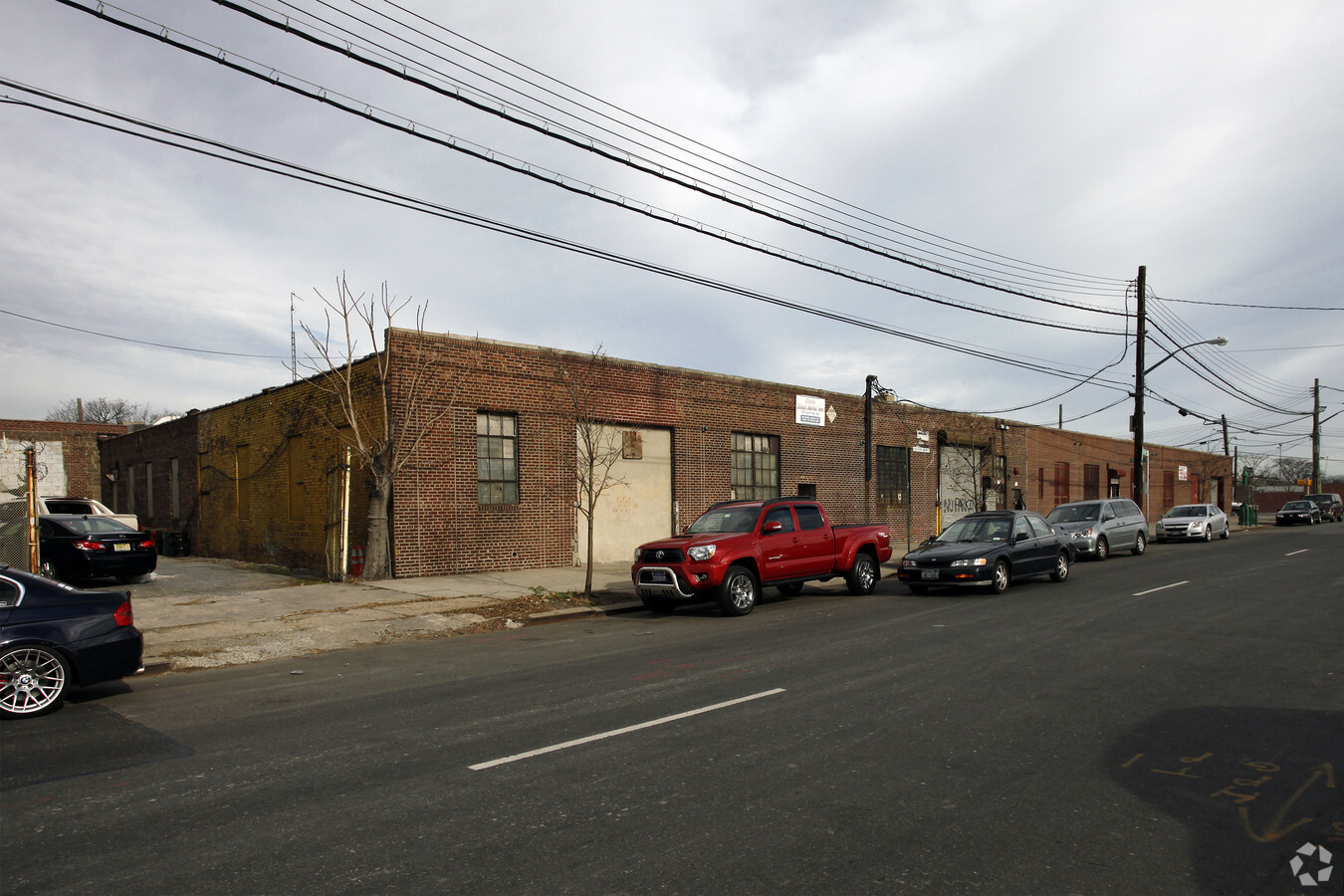
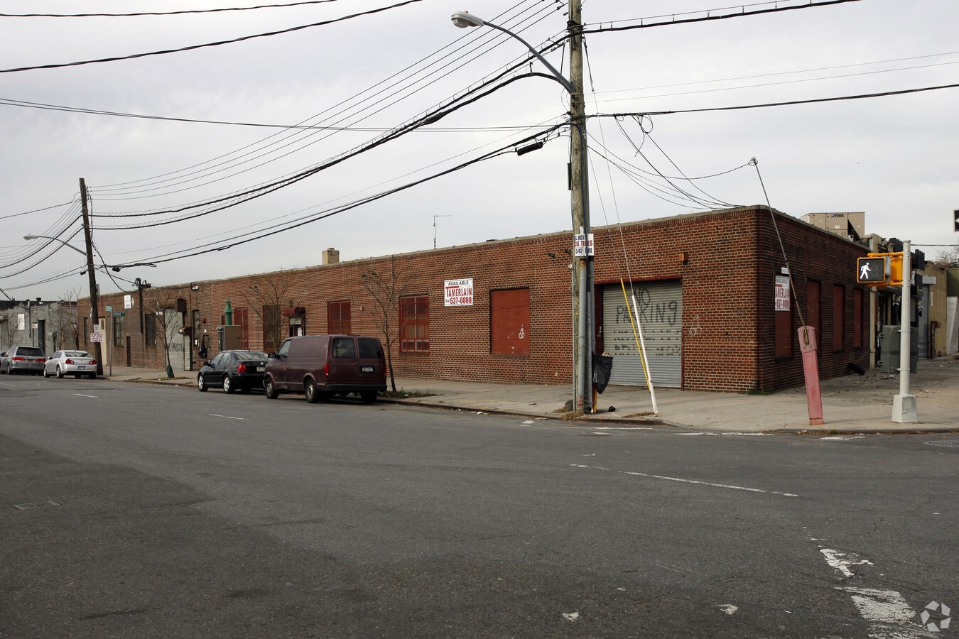
Property Record
401 Hunts Point Ave, Bronx, NY 10474
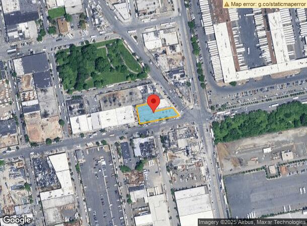
NEARBY LISTINGS FOR SALE OR LEASE
Property Detail
401 Hunts Point Ave
02772-0219
Bronx
Industrialgeneral
New York
X
219
3604970092F
0.36 AC
2024
Bronx
2024
Westchester/So Connecticut
009302
New York-Jersey City-White Plains, NY-NJ
15,635 SF
DEMOGRAPHICS near 401 Hunts Point Ave
1 Mile
3 Mile
5 Mile
2024 Total Population
32,074
722,494
2,604,451
2029 Population
30,011
668,475
2,415,812
Pop Growth 2024-2029
(6.43%)
(7.48%)
(7.24%)
Average Age
38
37
39
2024 Total Households
11,381
252,356
981,436
HH Growth 2024-2029
(7.28%)
(8.16%)
(7.69%)
Median Household Inc
$37,874
$38,859
$53,425
Avg Household Size
2.60
2.70
2.50
2024 Avg HH Vehicles
.00
.00
.00
Median Home Value
$376,900
$586,586
$696,274
Median Year Built
1961
1957
1952
Nearby Places
- Restaurants
- Banks
- Shops
- Fitness
- Groceries
PUBLIC TRANSPORTATION
TRANSIT/SUBWAY
Hunts Point Avenue (6 - New York MTA Subway (The Subway))
DRIVE
WALK
Distance
Hunts Point Avenue (6 - New York MTA Subway (The Subway))
3 min
19 min
1.0 mi
COMMUTER RAIL
Melrose Station (Harlem Line - Metro-North Commuter Railroad Company (Metro-North))
DRIVE
WALK
Distance
Melrose Station (Harlem Line - Metro-North Commuter Railroad Company (Metro-North))
8 min
2.9 mi
Tremont Station (Harlem Line - Metro-North Commuter Railroad Company (Metro-North))
DRIVE
WALK
Distance
Tremont Station (Harlem Line - Metro-North Commuter Railroad Company (Metro-North))
9 min
4.1 mi
AIRPORT
Laguardia
DRIVE
WALK
Distance
Laguardia
16 min
7.7 mi
John F Kennedy International
DRIVE
WALK
Distance
John F Kennedy International
28 min
18.8 mi
Newark Liberty International
DRIVE
WALK
Distance
Newark Liberty International
33 min
25.8 mi
Freight Ports
NY - Red Hook Container Terminal
DRIVE
WALK
Distance
NY - Red Hook Container Terminal
28 min
15.8 mi
SALE & LEASE HISTORY
LISTING DATE
SALE/LEASE

Sep 25, 2016
For Lease
Nearby Properties
Address
Land Use
TOTAL SIZE
Lot Size
Zoning
Address
Land Use
TOTAL SIZE
Lot Size
Zoning
1,290,000 SF
14.56 AC
PARK
Address
Land Use
TOTAL SIZE
Lot Size
Zoning
5,519,372 SF
409.21 AC
C8-2
Address
Land Use
TOTAL SIZE
Lot Size
Zoning
1,593,305 SF
9.89 AC
C4-4
Address
Land Use
TOTAL SIZE
Lot Size
Zoning
207.09 AC
PARK
Address
Land Use
TOTAL SIZE
Lot Size
Zoning
507,265 SF
4.04 AC
C4-4
Address
Land Use
TOTAL SIZE
Lot Size
Zoning
1,012,000 SF
7.79 AC
R6
Address
Land Use
TOTAL SIZE
Lot Size
Zoning
390,750 SF
265 AC
PARK
Address
Land Use
TOTAL SIZE
Lot Size
Zoning
973,381 SF
2.93 AC
M13R8
Address
Land Use
TOTAL SIZE
Lot Size
Zoning
480,769 SF
1.21 AC
R8
Address
Land Use
TOTAL SIZE
Lot Size
Zoning
436,402 SF
9.12 AC
C8-3
Address
Land Use
TOTAL SIZE
Lot Size
Zoning
447,145 SF
8.05 AC
M3-1
Address
Land Use
TOTAL SIZE
Lot Size
Zoning
127,000 SF
16.53 AC
M3-1
Address
Land Use
TOTAL SIZE
Lot Size
Zoning
14,681 SF
97 AC
PARK
Address
Land Use
TOTAL SIZE
Lot Size
Zoning
291,885 SF
8.86 AC
R8
Address
Land Use
TOTAL SIZE
Lot Size
Zoning
566,233 SF
13.25 AC
M3-1
Address
Land Use
TOTAL SIZE
Lot Size
Zoning
526,259 SF
4.79 AC
C4-4
Address
Land Use
TOTAL SIZE
Lot Size
Zoning
986,360 SF
11.85 AC
M3-1
Address
Land Use
TOTAL SIZE
Lot Size
Zoning
238,500 SF
1.13 AC
C4-4
Address
Land Use
TOTAL SIZE
Lot Size
Zoning
340,364 SF
4.10 AC
C4-6
Address
Land Use
TOTAL SIZE
Lot Size
Zoning
510 SF
68.73 AC
PARK
Address
Land Use
TOTAL SIZE
Lot Size
Zoning
1,172,005 SF
128.83 AC
M1-1
Address
Land Use
TOTAL SIZE
Lot Size
Zoning
464,489 SF
5.66 AC
C4-4
Address
Land Use
TOTAL SIZE
Lot Size
Zoning
448,890 SF
1.54 AC
M13R8
Address
Land Use
TOTAL SIZE
Lot Size
Zoning
689,840 SF
1.62 AC
C4-6
Address
Land Use
TOTAL SIZE
Lot Size
Zoning
1,478,410 SF
8.84 AC
R6
Address
Land Use
TOTAL SIZE
Lot Size
Zoning
878,373 SF
4.78 AC
C4-4
Address
Land Use
TOTAL SIZE
Lot Size
Zoning
312,844 SF
0.44 AC
M14R7X
Address
Land Use
TOTAL SIZE
Lot Size
Zoning
140,000 SF
2.34 AC
M1-4
Address
Land Use
TOTAL SIZE
Lot Size
Zoning
2,795 SF
2.12 AC
C4-4
Address
Land Use
TOTAL SIZE
Lot Size
Zoning
16,300 SF
148.32 AC
PARK
The World's #1 Commercial Real Estate Marketplace
Connect with us
© 2025 CoStar Group
The information above has been obtained from sources believed reliable. While we do not doubt its accuracy we have not verified it and make no guarantee, warranty or representation about it. It is your responsibility to independently confirm its accuracy and completeness. Any projections, opinions, assumptions, or estimates used are for example only and do not represent the current or future performance of the property. The value of this transaction to you depends on tax and other factors which should be evaluated by your tax, financial, and legal advisors. You and your advisors should conduct a careful, independent investigation of the property to determine to your satisfaction the suitability of the property for your needs.