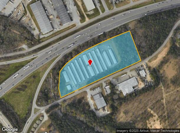
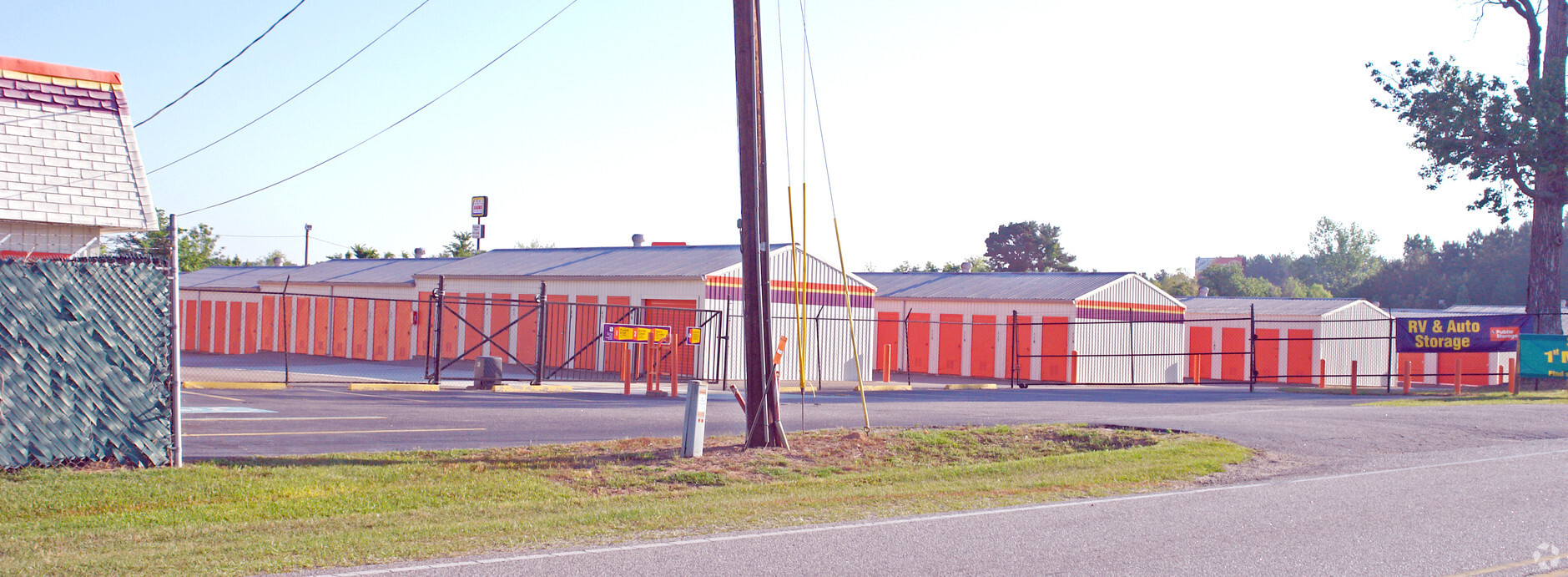
Property Record
401 Buckner Rd, Columbia, SC 29203

NEARBY LISTINGS FOR SALE OR LEASE
-
-
View all Columbia listings for sale on LoopNet.com
Property Detail
401 Buckner Rd
09312-02-01
#SU #PR X-88 Y-5383 Z-1620 #OM 0455-03-01
Commercialnec
Richland
AE
South Carolina
45079C0233L
7.03 AC
2024
North Columbia
2023
Columbia
010600
Columbia, SC
58,315 SF
DEMOGRAPHICS near 401 Buckner Rd
1 Mile
3 Mile
5 Mile
2024 Total Population
2,579
39,214
121,895
2029 Population
2,640
40,093
124,689
Pop Growth 2024-2029
+ 2.37%
+ 2.24%
+ 2.29%
Average Age
39
39
38
2024 Total Households
1,151
17,251
52,571
HH Growth 2024-2029
+ 2.43%
+ 2.28%
+ 2.46%
Median Household Inc
$29,387
$35,005
$40,679
Avg Household Size
2.20
2.20
2.10
2024 Avg HH Vehicles
1.00
1.00
1.00
Median Home Value
$81,784
$113,129
$160,403
Median Year Built
1965
1968
1971
Nearby Places
- Restaurants
- Banks
- Shops
- Fitness
- Groceries
PUBLIC TRANSPORTATION
COMMUTER RAIL
Columbia Amtrak Station (Silver Star - Amtrak)
DRIVE
WALK
Distance
Columbia Amtrak Station (Silver Star - Amtrak)
13 min
5.5 mi
AIRPORT
Columbia Metro
DRIVE
WALK
Distance
Columbia Metro
27 min
15.2 mi
Freight Ports
North Charleston Terminal
DRIVE
WALK
Distance
North Charleston Terminal
127 min
111.5 mi
Nearby Properties
Address
Land Use
TOTAL SIZE
Lot Size
Zoning
Address
Land Use
TOTAL SIZE
Lot Size
Zoning
20,434 SF
17.20 AC
C-1
Address
Land Use
TOTAL SIZE
Lot Size
Zoning
100 SF
393.13 AC
INS-GEN
Address
Land Use
TOTAL SIZE
Lot Size
Zoning
207,112 SF
16.86 AC
RM-HD
Address
Land Use
TOTAL SIZE
Lot Size
Zoning
278,912 SF
23.24 AC
RM-HD
Address
Land Use
TOTAL SIZE
Lot Size
Zoning
208,688 SF
13.02 AC
RM-HD
Address
Land Use
TOTAL SIZE
Lot Size
Zoning
237,885 SF
20.76 AC
RM-2
Address
Land Use
TOTAL SIZE
Lot Size
Zoning
96,189 SF
2.22 AC
C-1
Address
Land Use
TOTAL SIZE
Lot Size
Zoning
34,393 SF
2.96 AC
M-1
Address
Land Use
TOTAL SIZE
Lot Size
Zoning
127,063 SF
14.70 AC
RM-HD
Address
Land Use
TOTAL SIZE
Lot Size
Zoning
100 SF
7.45 AC
RM-1
Address
Land Use
TOTAL SIZE
Lot Size
Zoning
67,200 SF
1.72 AC
C-1
Address
Land Use
TOTAL SIZE
Lot Size
Zoning
100 SF
44.73 AC
C-1
Address
Land Use
TOTAL SIZE
Lot Size
Zoning
90,430 SF
0.42 AC
C-1
Address
Land Use
TOTAL SIZE
Lot Size
Zoning
129,017 SF
14.70 AC
PDD
Address
Land Use
TOTAL SIZE
Lot Size
Zoning
103,405 SF
0.38 AC
C-3
Address
Land Use
TOTAL SIZE
Lot Size
Zoning
42,735 SF
2.12 AC
C-1
Address
Land Use
TOTAL SIZE
Lot Size
Zoning
134,400 SF
5.85 AC
RG-2
Address
Land Use
TOTAL SIZE
Lot Size
Zoning
199,962 SF
40.13 AC
RG-1
Address
Land Use
TOTAL SIZE
Lot Size
Zoning
96,248 SF
5.97 AC
RM-2
Address
Land Use
TOTAL SIZE
Lot Size
Zoning
100 SF
63.15 AC
C-1
Address
Land Use
TOTAL SIZE
Lot Size
Zoning
82,692 SF
5.87 AC
C-3
Address
Land Use
TOTAL SIZE
Lot Size
Zoning
71,832 SF
4.54 AC
RG-2
Address
Land Use
TOTAL SIZE
Lot Size
Zoning
58,094 SF
4.43 AC
M-1
Address
Land Use
TOTAL SIZE
Lot Size
Zoning
67,800 SF
1.54 AC
C-1
Address
Land Use
TOTAL SIZE
Lot Size
Zoning
2,456 SF
5 AC
C-1
Address
Land Use
TOTAL SIZE
Lot Size
Zoning
4,986 SF
5.74 AC
PUD-C
Address
Land Use
TOTAL SIZE
Lot Size
Zoning
15,440 SF
3.04 AC
M-1
Address
Land Use
TOTAL SIZE
Lot Size
Zoning
75,981 SF
1.33 AC
C-1
Address
Land Use
TOTAL SIZE
Lot Size
Zoning
153,272 SF
9.63 AC
RM-HD
Address
Land Use
TOTAL SIZE
Lot Size
Zoning
6.26 AC
C-3
The World's #1 Commercial Real Estate Marketplace
Connect with us
© 2025 CoStar Group
The information above has been obtained from sources believed reliable. While we do not doubt its accuracy we have not verified it and make no guarantee, warranty or representation about it. It is your responsibility to independently confirm its accuracy and completeness. Any projections, opinions, assumptions, or estimates used are for example only and do not represent the current or future performance of the property. The value of this transaction to you depends on tax and other factors which should be evaluated by your tax, financial, and legal advisors. You and your advisors should conduct a careful, independent investigation of the property to determine to your satisfaction the suitability of the property for your needs.