Property Record
401 E Pagosa St, Pagosa Springs, CO 81147

NEARBY LISTINGS FOR SALE OR LEASE
-
-
View all Pagosa Springs listings for sale on LoopNet.com
Property Detail
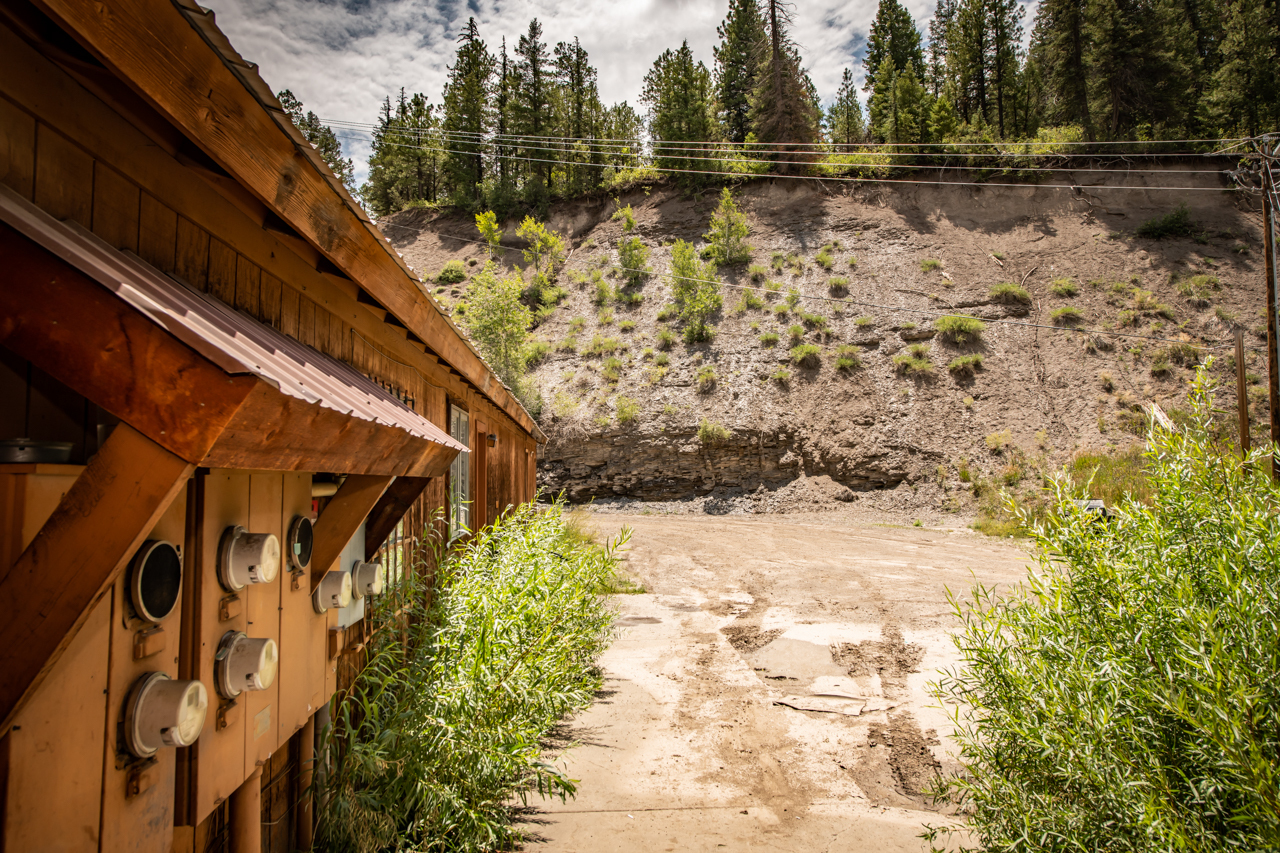
401 E Pagosa St
570118304026
Ps Junction Sub
Restaurantbuilding
SUBDIVISION: PS JUNCTION SUB COMM LOT: 2 PS JCT SEC: 18 TWN: 35 RNG: 1W
X
Archuleta
08007C0288D
Colorado
2023
2
2023
0.77 AC
974300
Colorado Southwest Area
5,390 SF
Other Market Areas
DEMOGRAPHICS near 401 E Pagosa St
1 Mile
3 Mile
5 Mile
2024 Total Population
261
1,757
5,341
2029 Population
290
1,952
6,088
Pop Growth 2024-2029
+ 11.11%
+ 11.10%
+ 13.99%
Average Age
46
46
47
2024 Total Households
113
730
2,363
HH Growth 2024-2029
+ 11.50%
+ 11.23%
+ 14.35%
Median Household Inc
$48,571
$44,541
$53,509
Avg Household Size
2.30
2.40
2.20
2024 Avg HH Vehicles
2.00
2.00
2.00
Median Home Value
$513,158
$553,333
$464,641
Median Year Built
1985
1991
1992
Nearby Places
- Restaurants
- Banks
- Shops
- Fitness
- Groceries
SALE & LEASE HISTORY
LISTING DATE
SALE/LEASE

May 10, 2024
For Sale
Apr 22, 2022
For Sale
Nearby Properties
Address
Land Use
TOTAL SIZE
Lot Size
Zoning
Address
Land Use
TOTAL SIZE
Lot Size
Zoning
8155
3 AC
MIXED-USE
Address
Land Use
TOTAL SIZE
Lot Size
Zoning
2690
4.98 AC
MIXED-USE
Address
Land Use
TOTAL SIZE
Lot Size
Zoning
15857
0.63 AC
MIXED-USE
Address
Land Use
TOTAL SIZE
Lot Size
Zoning
3316
1.21 AC
MIXED-USE
Address
Land Use
TOTAL SIZE
Lot Size
Zoning
26.50 AC
OPEN SPACE
Address
Land Use
TOTAL SIZE
Lot Size
Zoning
6748
1.66 AC
MIXED-USE
Address
Land Use
TOTAL SIZE
Lot Size
Zoning
6344
0.77 AC
MIXED-USE
Address
Land Use
TOTAL SIZE
Lot Size
Zoning
3480
15.53 AC
OPEN SPACE
Address
Land Use
TOTAL SIZE
Lot Size
Zoning
65245
15.02 AC
PUBLIC/QUA
Address
Land Use
TOTAL SIZE
Lot Size
Zoning
24000
0.86 AC
MIXED-USE
Address
Land Use
TOTAL SIZE
Lot Size
Zoning
22125
3.57 AC
MIXED-USE
Address
Land Use
TOTAL SIZE
Lot Size
Zoning
552.73 AC
AGRICULTUR
Address
Land Use
TOTAL SIZE
Lot Size
Zoning
14801
0.38 AC
Address
Land Use
TOTAL SIZE
Lot Size
Zoning
6912
14.84 AC
COMMERCIAL
Address
Land Use
TOTAL SIZE
Lot Size
Zoning
420
2.07 AC
OPEN SPACE
Address
Land Use
TOTAL SIZE
Lot Size
Zoning
110 AC
OPEN SPACE
Address
Land Use
TOTAL SIZE
Lot Size
Zoning
20922
1.04 AC
MIXED-USE
Address
Land Use
TOTAL SIZE
Lot Size
Zoning
12509
2.08 AC
PUBLIC/QUA
Address
Land Use
TOTAL SIZE
Lot Size
Zoning
16000
6 AC
MIXED-USE
Address
Land Use
TOTAL SIZE
Lot Size
Zoning
11860
0.38 AC
MIXED-USE
Address
Land Use
TOTAL SIZE
Lot Size
Zoning
9780
1.01 AC
MIXED-USE
Address
Land Use
TOTAL SIZE
Lot Size
Zoning
10990
8.32 AC
AGRICULTUR
Address
Land Use
TOTAL SIZE
Lot Size
Zoning
4140
0.50 AC
MIXED-USE
Address
Land Use
TOTAL SIZE
Lot Size
Zoning
6840
3.99 AC
PUBLIC/QUA
Address
Land Use
TOTAL SIZE
Lot Size
Zoning
3360
0.52 AC
PUBLIC/QUA
Address
Land Use
TOTAL SIZE
Lot Size
Zoning
5468
1.03 AC
MIXED-USE
Address
Land Use
TOTAL SIZE
Lot Size
Zoning
1970
0.04 AC
MIXED-USE
Address
Land Use
TOTAL SIZE
Lot Size
Zoning
5472
1.34 AC
MIXED-USE
Address
Land Use
TOTAL SIZE
Lot Size
Zoning
2 AC
PUBLIC/QUA
Address
Land Use
TOTAL SIZE
Lot Size
Zoning
16126
1.06 AC
MIXED-USE
Start a new search to find other properties for sale or lease
Connect with us
© 2024 CoStar Group
The information above has been obtained from sources believed reliable. While we do not doubt its accuracy we have not verified it and make no guarantee, warranty or representation about it. It is your responsibility to independently confirm its accuracy and completeness. Any projections, opinions, assumptions, or estimates used are for example only and do not represent the current or future performance of the property. The value of this transaction to you depends on tax and other factors which should be evaluated by your tax, financial, and legal advisors. You and your advisors should conduct a careful, independent investigation of the property to determine to your satisfaction the suitability of the property for your needs.