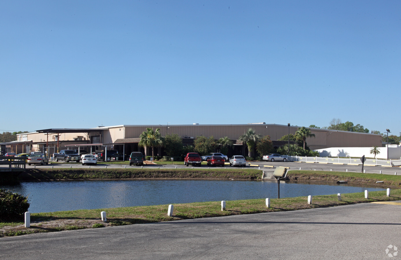
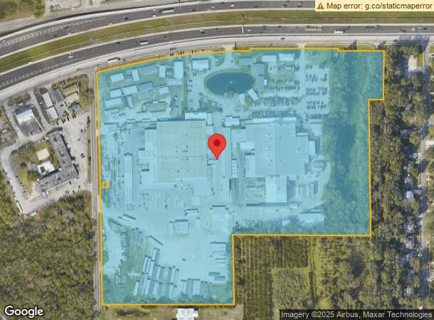
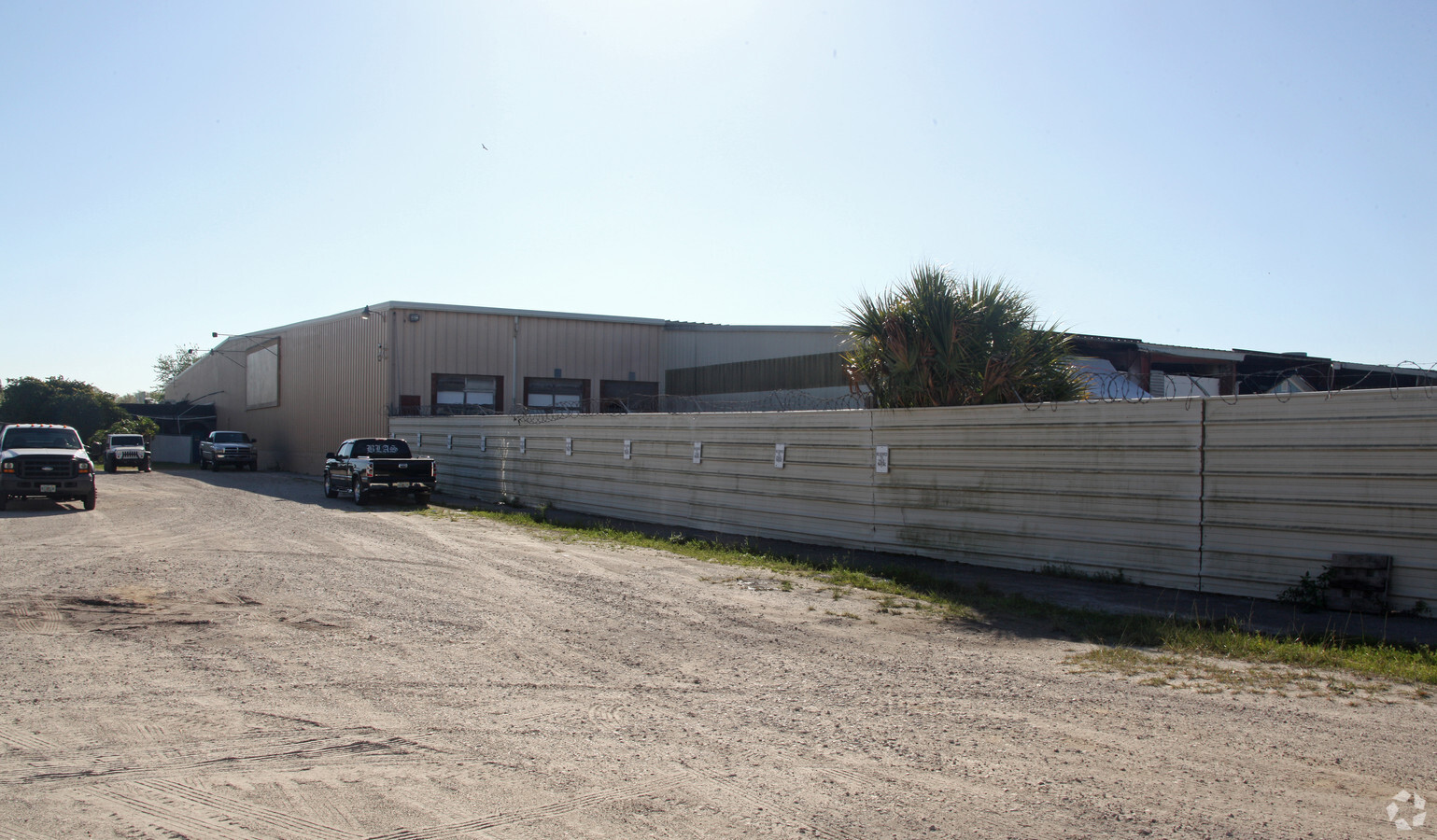
Property Record
401 S Frontage Rd, Plant City, FL 33563
NEARBY LISTINGS FOR SALE OR LEASE
Property Detail
401 S Frontage Rd
Tampa-St. Petersburg-Clearwater, FL
Unplatted
P-21-28-22-ZZZ-000006-01250.0
SW 1/4 OF NW 1/4 LESS HWY AND LESS N 25 FT OF S 548.7 FT OF E 25 FT OF W 55 FT OF NW 1/4 AND LESS S 1/2 OF SE 1/4 OF SW 1/4 OF NW 1/4 AND TOGETHER WITH LOT 22 OF BRACEWELL HEIGHTS
Lightindustrial
Hillsborough
AE
Florida
12057C0286H
1250
2023
31.39 AC
2023
E Hillsborough/Plant
012702
Tampa/St Petersburg
286,266 SF
DEMOGRAPHICS near 401 S Frontage Rd
1 Mile
3 Mile
5 Mile
2024 Total Population
5,814
34,992
61,720
2029 Population
6,345
38,375
67,558
Pop Growth 2024-2029
+ 9.13%
+ 9.67%
+ 9.46%
Average Age
40
40
39
2024 Total Households
2,051
12,835
21,913
HH Growth 2024-2029
+ 9.41%
+ 9.97%
+ 9.75%
Median Household Inc
$61,755
$50,742
$57,166
Avg Household Size
2.70
2.60
2.70
2024 Avg HH Vehicles
2.00
2.00
2.00
Median Home Value
$209,049
$184,573
$238,492
Median Year Built
1977
1983
1986
Nearby Places
- Restaurants
- Banks
- Shops
- Fitness
- Groceries
PUBLIC TRANSPORTATION
AIRPORT
Tampa International
DRIVE
WALK
Distance
Tampa International
42 min
30.5 mi
Freight Ports
Port of Tampa Bay
DRIVE
WALK
Distance
Port of Tampa Bay
34 min
23.9 mi
Nearby Properties
Address
Land Use
TOTAL SIZE
Lot Size
Zoning
Address
Land Use
TOTAL SIZE
Lot Size
Zoning
1,055,503 SF
112.72 AC
PD
Address
Land Use
TOTAL SIZE
Lot Size
Zoning
723,962 SF
47.49 AC
PD
Address
Land Use
TOTAL SIZE
Lot Size
Zoning
519,942 SF
130.10 AC
PD
Address
Land Use
TOTAL SIZE
Lot Size
Zoning
286,824 SF
43.03 AC
PD
Address
Land Use
TOTAL SIZE
Lot Size
Zoning
505,506 SF
50.60 AC
PD
Address
Land Use
TOTAL SIZE
Lot Size
Zoning
235,102 SF
7.73 AC
C-1B
Address
Land Use
TOTAL SIZE
Lot Size
Zoning
415,389 SF
62.31 AC
PD
Address
Land Use
TOTAL SIZE
Lot Size
Zoning
333,718 SF
28.99 AC
M-1
Address
Land Use
TOTAL SIZE
Lot Size
Zoning
243,294 SF
19.80 AC
R-20
Address
Land Use
TOTAL SIZE
Lot Size
Zoning
297,907 SF
21.43 AC
I
Address
Land Use
TOTAL SIZE
Lot Size
Zoning
492,180 SF
32.58 AC
PD
Address
Land Use
TOTAL SIZE
Lot Size
Zoning
297,907 SF
22.41 AC
M-1A
Address
Land Use
TOTAL SIZE
Lot Size
Zoning
496,217 SF
35.02 AC
M-AP
Address
Land Use
TOTAL SIZE
Lot Size
Zoning
93,924 SF
3.96 AC
C-1
Address
Land Use
TOTAL SIZE
Lot Size
Zoning
132,285 SF
30.77 AC
PD
Address
Land Use
TOTAL SIZE
Lot Size
Zoning
145,222 SF
36.47 AC
PD
Address
Land Use
TOTAL SIZE
Lot Size
Zoning
192,911 SF
16.36 AC
PD
Address
Land Use
TOTAL SIZE
Lot Size
Zoning
35,426 SF
39.92 AC
R-1A
Address
Land Use
TOTAL SIZE
Lot Size
Zoning
213,188 SF
16.10 AC
PD
Address
Land Use
TOTAL SIZE
Lot Size
Zoning
187,247 SF
10.19 AC
PD
Address
Land Use
TOTAL SIZE
Lot Size
Zoning
152,518 SF
43.50 AC
C-1A
Address
Land Use
TOTAL SIZE
Lot Size
Zoning
139,392 SF
73.31 AC
CC
Address
Land Use
TOTAL SIZE
Lot Size
Zoning
159,805 SF
77.66 AC
PD
Address
Land Use
TOTAL SIZE
Lot Size
Zoning
252,166 SF
22.88 AC
M-1
Address
Land Use
TOTAL SIZE
Lot Size
Zoning
122,814 SF
17.18 AC
M-1A
Address
Land Use
TOTAL SIZE
Lot Size
Zoning
247,608 SF
25.84 AC
PD
Address
Land Use
TOTAL SIZE
Lot Size
Zoning
242,449 SF
19.97 AC
PD
Address
Land Use
TOTAL SIZE
Lot Size
Zoning
144,648 SF
8.84 AC
PD
Address
Land Use
TOTAL SIZE
Lot Size
Zoning
73,613 SF
57.94 AC
R-1A
Address
Land Use
TOTAL SIZE
Lot Size
Zoning
139,062 SF
9.17 AC
PD
The World's #1 Commercial Real Estate Marketplace
Connect with us
© 2025 CoStar Group
The information above has been obtained from sources believed reliable. While we do not doubt its accuracy we have not verified it and make no guarantee, warranty or representation about it. It is your responsibility to independently confirm its accuracy and completeness. Any projections, opinions, assumptions, or estimates used are for example only and do not represent the current or future performance of the property. The value of this transaction to you depends on tax and other factors which should be evaluated by your tax, financial, and legal advisors. You and your advisors should conduct a careful, independent investigation of the property to determine to your satisfaction the suitability of the property for your needs.