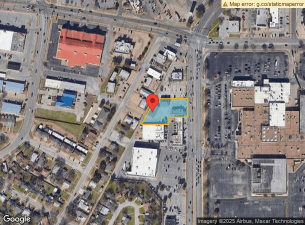
Property Record
4020 Kemp Blvd, Wichita Falls, TX 76308


NEARBY LISTINGS FOR SALE OR LEASE
Property Detail
4020 Kemp Blvd
Wichita Falls, TX
Abst. 619 - D. L.
109177
LOT 1 BLK 1 DENNIS ABST 619 DAY LAND & CATTLE CO #1
Stripcommercialcenter
Wichita
X
Texas
48009C0085C
1
2024
0.84 AC
2024
Southwest Wichita Falls
012100
Other Market Areas
9,807 SF
DEMOGRAPHICS near 4020 Kemp Blvd
1 Mile
3 Mile
5 Mile
2024 Total Population
9,142
61,341
85,503
2029 Population
9,280
62,459
87,570
Pop Growth 2024-2029
+ 1.51%
+ 1.82%
+ 2.42%
Average Age
36
39
38
2024 Total Households
3,399
25,431
34,608
HH Growth 2024-2029
+ 1.62%
+ 1.86%
+ 2.47%
Median Household Inc
$50,362
$56,754
$52,640
Avg Household Size
2.30
2.30
2.30
2024 Avg HH Vehicles
2.00
2.00
2.00
Median Home Value
$132,892
$148,062
$137,330
Median Year Built
1971
1971
1970
Nearby Places
- Restaurants
- Banks
- Shops
- Fitness
- Groceries
Nearby Properties
Address
Land Use
TOTAL SIZE
Lot Size
Zoning
Address
Land Use
TOTAL SIZE
Lot Size
Zoning
1,172,641 SF
100 AC
Address
Land Use
TOTAL SIZE
Lot Size
Zoning
45,719 SF
35.31 AC
Address
Land Use
TOTAL SIZE
Lot Size
Zoning
358,158 SF
150.40 AC
Address
Land Use
TOTAL SIZE
Lot Size
Zoning
588,693 SF
271.40 AC
Address
Land Use
TOTAL SIZE
Lot Size
Zoning
245,000 SF
37 AC
SF2
Address
Land Use
TOTAL SIZE
Lot Size
Zoning
247,406 SF
10 AC
Address
Land Use
TOTAL SIZE
Lot Size
Zoning
275,676 SF
22.58 AC
Address
Land Use
TOTAL SIZE
Lot Size
Zoning
129,655 SF
Address
Land Use
TOTAL SIZE
Lot Size
Zoning
157,968 SF
7.40 AC
GC
Address
Land Use
TOTAL SIZE
Lot Size
Zoning
266,509 SF
14.25 AC
SF2
Address
Land Use
TOTAL SIZE
Lot Size
Zoning
130,756 SF
14.82 AC
Address
Land Use
TOTAL SIZE
Lot Size
Zoning
784,240 SF
58.86 AC
GC
Address
Land Use
TOTAL SIZE
Lot Size
Zoning
9.60 AC
LI
Address
Land Use
TOTAL SIZE
Lot Size
Zoning
151,854 SF
5.11 AC
Address
Land Use
TOTAL SIZE
Lot Size
Zoning
138,336 SF
18.97 AC
GC
Address
Land Use
TOTAL SIZE
Lot Size
Zoning
62,791 SF
63.60 AC
Address
Land Use
TOTAL SIZE
Lot Size
Zoning
158,687 SF
14.68 AC
GC
Address
Land Use
TOTAL SIZE
Lot Size
Zoning
67,381 SF
4.25 AC
GC
Address
Land Use
TOTAL SIZE
Lot Size
Zoning
226,866 SF
12.10 AC
MFR
Address
Land Use
TOTAL SIZE
Lot Size
Zoning
69,483 SF
30 AC
Address
Land Use
TOTAL SIZE
Lot Size
Zoning
189,192 SF
9.24 AC
GC
Address
Land Use
TOTAL SIZE
Lot Size
Zoning
78,105 SF
6.66 AC
Address
Land Use
TOTAL SIZE
Lot Size
Zoning
82,217 SF
10.57 AC
SF2
Address
Land Use
TOTAL SIZE
Lot Size
Zoning
62,292 SF
14.60 AC
Address
Land Use
TOTAL SIZE
Lot Size
Zoning
224,276 SF
23 AC
Address
Land Use
TOTAL SIZE
Lot Size
Zoning
67,331 SF
15 AC
Address
Land Use
TOTAL SIZE
Lot Size
Zoning
188,646 SF
19.90 AC
GC
Address
Land Use
TOTAL SIZE
Lot Size
Zoning
179,865 SF
11.46 AC
Address
Land Use
TOTAL SIZE
Lot Size
Zoning
70,217 SF
9.63 AC
Address
Land Use
TOTAL SIZE
Lot Size
Zoning
82,761 SF
2.01 AC
GC
The World's #1 Commercial Real Estate Marketplace
Connect with us
© 2025 CoStar Group
The information above has been obtained from sources believed reliable. While we do not doubt its accuracy we have not verified it and make no guarantee, warranty or representation about it. It is your responsibility to independently confirm its accuracy and completeness. Any projections, opinions, assumptions, or estimates used are for example only and do not represent the current or future performance of the property. The value of this transaction to you depends on tax and other factors which should be evaluated by your tax, financial, and legal advisors. You and your advisors should conduct a careful, independent investigation of the property to determine to your satisfaction the suitability of the property for your needs.