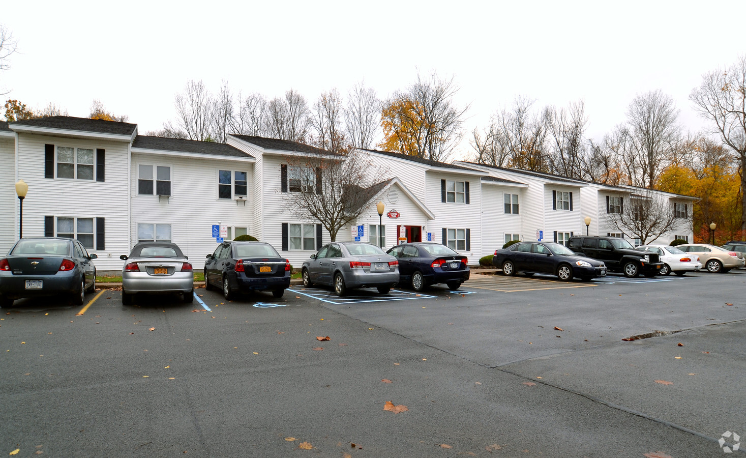
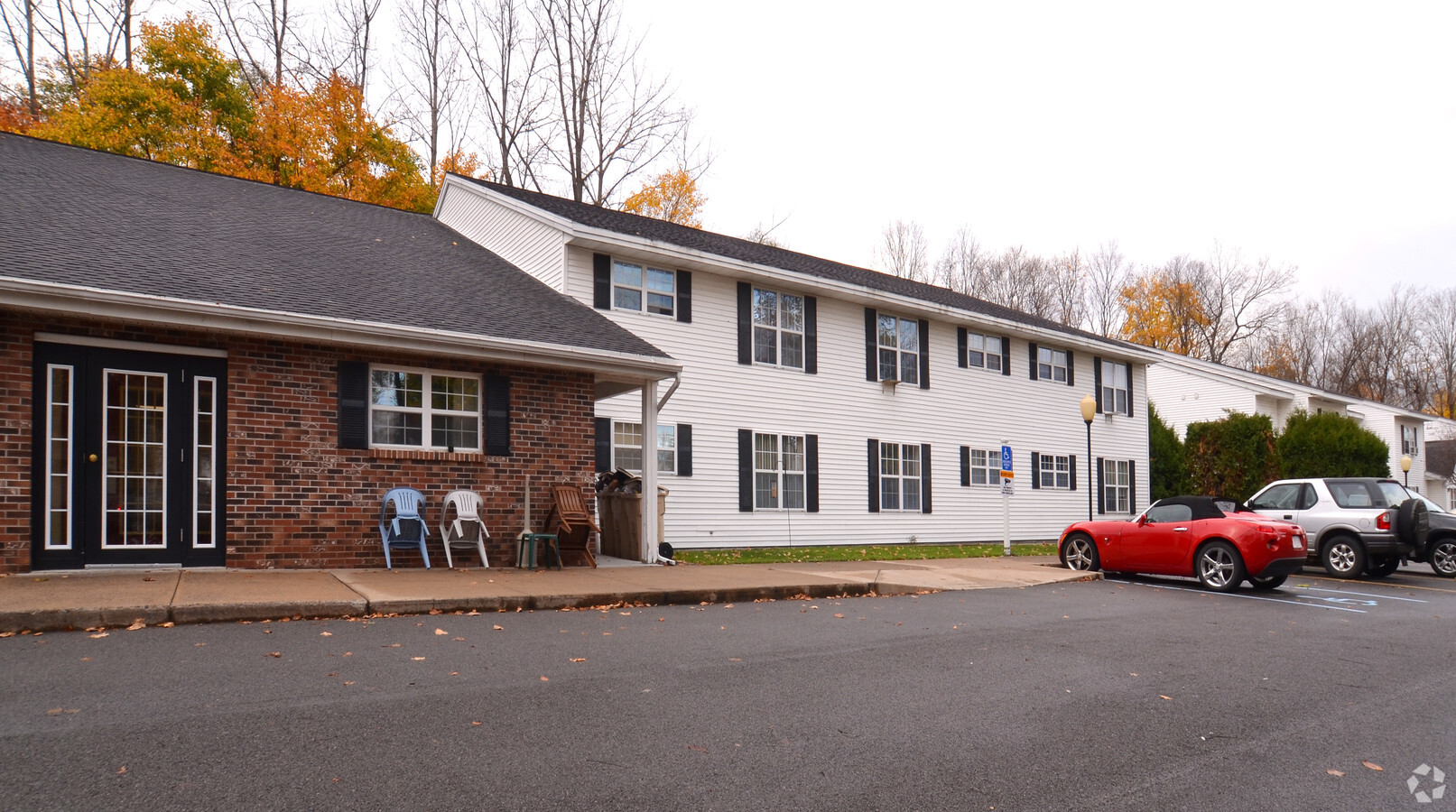
Property Record
404 S Litchfield St, Frankfort, NY 13340
NEARBY LISTINGS FOR SALE OR LEASE
-
-
View all Frankfort listings for sale on LoopNet.com
Property Detail
404 S Litchfield St
Utica-Rome, NY
W GOVT SUB LOW INCOME LITCHFIELD MANOR
212601-112-073-0001-020-100-0000
Herkimer
Apartment
New York
2024
20.200
2023
1.40 AC
010201
South Herkimer County
20,744 SF
Utica/Rome
DEMOGRAPHICS near 404 S Litchfield St
1 Mile
3 Mile
5 Mile
2024 Total Population
3,087
13,231
25,807
2029 Population
3,015
13,062
25,552
Pop Growth 2024-2029
(2.33%)
(1.28%)
(0.99%)
Average Age
43
42
42
2024 Total Households
1,358
5,644
10,880
HH Growth 2024-2029
(2.50%)
(1.35%)
(0.98%)
Median Household Inc
$54,839
$58,662
$60,134
Avg Household Size
2.20
2.20
2.20
2024 Avg HH Vehicles
1.00
2.00
2.00
Median Home Value
$108,732
$94,760
$104,145
Median Year Built
1947
1948
1948
Nearby Places
- Restaurants
- Banks
- Shops
- Fitness
- Groceries
PUBLIC TRANSPORTATION
COMMUTER RAIL
Utica Amtrak Station (Empire Service - Amtrak, Lake Shore Limited - Amtrak, Maple Leaf - Amtrak)
DRIVE
WALK
Distance
Utica Amtrak Station (Empire Service - Amtrak, Lake Shore Limited - Amtrak, Maple Leaf - Amtrak)
16 min
9.8 mi
Utica (Toronto - New York - VIA Rail)
DRIVE
WALK
Distance
Utica (Toronto - New York - VIA Rail)
16 min
9.9 mi
Freight Ports
Albany, NY Port
DRIVE
WALK
Distance
Albany, NY Port
107 min
85.8 mi
Nearby Properties
Address
Land Use
TOTAL SIZE
Lot Size
Zoning
Address
Land Use
TOTAL SIZE
Lot Size
Zoning
931,161 SF
141.90 AC
Address
Land Use
TOTAL SIZE
Lot Size
Zoning
272,335 SF
32.50 AC
RA
Address
Land Use
TOTAL SIZE
Lot Size
Zoning
80,065 SF
19.86 AC
R1
Address
Land Use
TOTAL SIZE
Lot Size
Zoning
267,566 SF
21.57 AC
M1
Address
Land Use
TOTAL SIZE
Lot Size
Zoning
77,493 SF
9.70 AC
R3
Address
Land Use
TOTAL SIZE
Lot Size
Zoning
77,280 SF
1.80 AC
PS
Address
Land Use
TOTAL SIZE
Lot Size
Zoning
24,960 SF
3.10 AC
PS
Address
Land Use
TOTAL SIZE
Lot Size
Zoning
80,832 SF
1.91 AC
B1
Address
Land Use
TOTAL SIZE
Lot Size
Zoning
1,152 SF
40.70 AC
RA
Address
Land Use
TOTAL SIZE
Lot Size
Zoning
131.40 AC
Address
Land Use
TOTAL SIZE
Lot Size
Zoning
66,560 SF
1.90 AC
PS
Address
Land Use
TOTAL SIZE
Lot Size
Zoning
22,424 SF
11.10 AC
R
Address
Land Use
TOTAL SIZE
Lot Size
Zoning
48,385 SF
24.50 AC
R
Address
Land Use
TOTAL SIZE
Lot Size
Zoning
8,526 SF
15.12 AC
PS
Address
Land Use
TOTAL SIZE
Lot Size
Zoning
38,750 SF
3.90 AC
Address
Land Use
TOTAL SIZE
Lot Size
Zoning
80,000 SF
8 AC
A
Address
Land Use
TOTAL SIZE
Lot Size
Zoning
16,400 SF
3.60 AC
R
Address
Land Use
TOTAL SIZE
Lot Size
Zoning
1,620 SF
15.80 AC
R
Address
Land Use
TOTAL SIZE
Lot Size
Zoning
22,152 SF
3.10 AC
B2
Address
Land Use
TOTAL SIZE
Lot Size
Zoning
0.01 AC
01 - NOT Z
Address
Land Use
TOTAL SIZE
Lot Size
Zoning
28,800 SF
6.70 AC
Address
Land Use
TOTAL SIZE
Lot Size
Zoning
13,813 SF
0.77 AC
PS
Address
Land Use
TOTAL SIZE
Lot Size
Zoning
1,568 SF
11 AC
CH
Address
Land Use
TOTAL SIZE
Lot Size
Zoning
131.40 AC
Address
Land Use
TOTAL SIZE
Lot Size
Zoning
37,608 SF
1.45 AC
PS
Address
Land Use
TOTAL SIZE
Lot Size
Zoning
780 SF
9.60 AC
CH
Address
Land Use
TOTAL SIZE
Lot Size
Zoning
4,912 SF
6.60 AC
PS
Address
Land Use
TOTAL SIZE
Lot Size
Zoning
7,072 SF
1.50 AC
OP
Address
Land Use
TOTAL SIZE
Lot Size
Zoning
13,455 SF
1.30 AC
Address
Land Use
TOTAL SIZE
Lot Size
Zoning
13,308 SF
3.60 AC
The World's #1 Commercial Real Estate Marketplace
Connect with us
© 2025 CoStar Group
The information above has been obtained from sources believed reliable. While we do not doubt its accuracy we have not verified it and make no guarantee, warranty or representation about it. It is your responsibility to independently confirm its accuracy and completeness. Any projections, opinions, assumptions, or estimates used are for example only and do not represent the current or future performance of the property. The value of this transaction to you depends on tax and other factors which should be evaluated by your tax, financial, and legal advisors. You and your advisors should conduct a careful, independent investigation of the property to determine to your satisfaction the suitability of the property for your needs.