Property Record
4020 Dayton Springfield Rd, Springfield, OH 45502
NEARBY LISTINGS FOR SALE OR LEASE
-
-
View all Springfield listings for lease on LoopNet.com
Property Detail
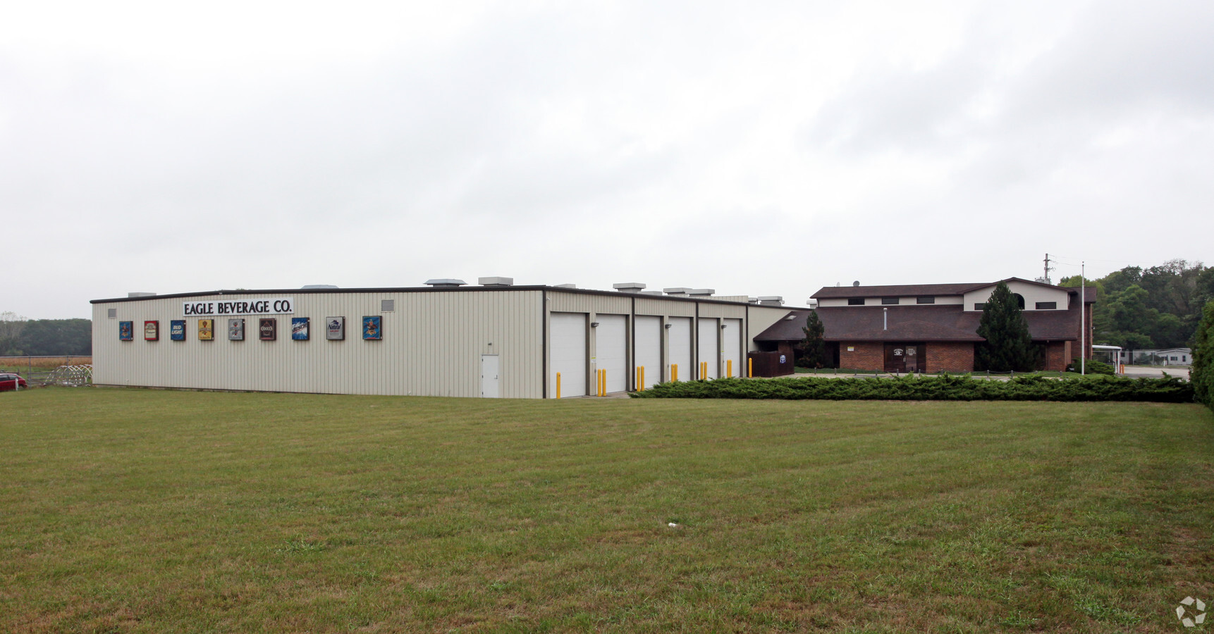
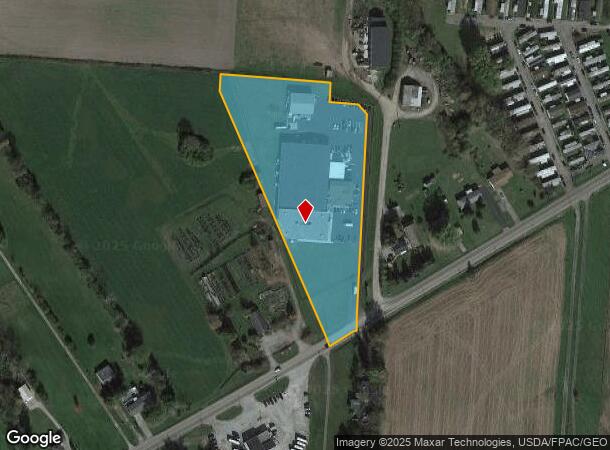
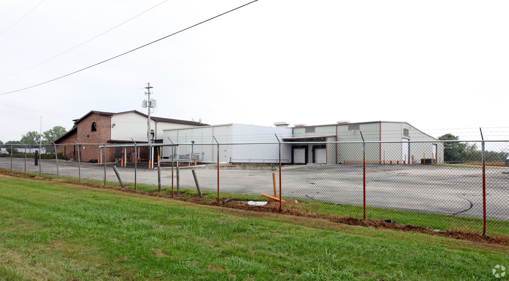
4020 Dayton Springfield Rd
Springfield, OH
Mrs
18-00600-02100-0044
S PT S W QR
Foodprocessing
Clark
X
Ohio
39023C0170E
44
2023
20.32 AC
2024
Northeast Dayton
003002
Cincinnati/Dayton
51,313 SF
DEMOGRAPHICS near 4020 Dayton Springfield Rd
1 Mile
3 Mile
5 Mile
2024 Total Population
912
10,873
50,350
2029 Population
940
10,807
50,439
Pop Growth 2024-2029
+ 3.07%
(0.61%)
+ 0.18%
Average Age
42
44
40
2024 Total Households
367
4,289
19,947
HH Growth 2024-2029
+ 3.27%
(0.49%)
+ 0.15%
Median Household Inc
$66,039
$72,925
$54,685
Avg Household Size
2.40
2.50
2.40
2024 Avg HH Vehicles
3.00
2.00
2.00
Median Home Value
$175,714
$179,975
$149,832
Median Year Built
1959
1962
1958
Nearby Places
- Restaurants
- Banks
- Shops
- Fitness
- Groceries
PUBLIC TRANSPORTATION
AIRPORT
James M Cox Dayton International
DRIVE
WALK
Distance
James M Cox Dayton International
34 min
22.8 mi
Freight Ports
Port of Toledo
DRIVE
WALK
Distance
Port of Toledo
191 min
133.8 mi
SALE & LEASE HISTORY
LISTING DATE
SALE/LEASE

Sep 25, 2016
For Lease
Sep 24, 2016
For Sale
Nearby Properties
Address
Land Use
TOTAL SIZE
Lot Size
Zoning
Address
Land Use
TOTAL SIZE
Lot Size
Zoning
17,280 SF
14.32 AC
Address
Land Use
TOTAL SIZE
Lot Size
Zoning
234,478 SF
59.28 AC
Address
Land Use
TOTAL SIZE
Lot Size
Zoning
6,495 SF
38.20 AC
Address
Land Use
TOTAL SIZE
Lot Size
Zoning
144,644 SF
38.20 AC
I-1
Address
Land Use
TOTAL SIZE
Lot Size
Zoning
103,589 SF
59.28 AC
Address
Land Use
TOTAL SIZE
Lot Size
Zoning
Address
Land Use
TOTAL SIZE
Lot Size
Zoning
20,982 SF
19.65 AC
Address
Land Use
TOTAL SIZE
Lot Size
Zoning
84,432 SF
13.39 AC
I-1
Address
Land Use
TOTAL SIZE
Lot Size
Zoning
41,989 SF
2.59 AC
O-2
Address
Land Use
TOTAL SIZE
Lot Size
Zoning
5,886 SF
12.93 AC
Address
Land Use
TOTAL SIZE
Lot Size
Zoning
137,053 SF
9.90 AC
Address
Land Use
TOTAL SIZE
Lot Size
Zoning
40,000 SF
10.41 AC
I-1
Address
Land Use
TOTAL SIZE
Lot Size
Zoning
52,710 SF
1.87 AC
Address
Land Use
TOTAL SIZE
Lot Size
Zoning
43.31 AC
Address
Land Use
TOTAL SIZE
Lot Size
Zoning
95,450 SF
5.28 AC
Address
Land Use
TOTAL SIZE
Lot Size
Zoning
265.13 AC
A-1
Address
Land Use
TOTAL SIZE
Lot Size
Zoning
24,440 SF
169.99 AC
A-1
Address
Land Use
TOTAL SIZE
Lot Size
Zoning
4,760 SF
199.77 AC
A-1
Address
Land Use
TOTAL SIZE
Lot Size
Zoning
102,224 SF
12.10 AC
Address
Land Use
TOTAL SIZE
Lot Size
Zoning
21,406 SF
8.31 AC
Address
Land Use
TOTAL SIZE
Lot Size
Zoning
4,356 SF
201.93 AC
A1
Address
Land Use
TOTAL SIZE
Lot Size
Zoning
Address
Land Use
TOTAL SIZE
Lot Size
Zoning
18,485 SF
215.29 AC
Address
Land Use
TOTAL SIZE
Lot Size
Zoning
7,304 SF
142.87 AC
A-1
Address
Land Use
TOTAL SIZE
Lot Size
Zoning
4,868 SF
129.27 AC
A-1
Address
Land Use
TOTAL SIZE
Lot Size
Zoning
22,970 SF
20.28 AC
A
Address
Land Use
TOTAL SIZE
Lot Size
Zoning
19,106 SF
0.94 AC
Address
Land Use
TOTAL SIZE
Lot Size
Zoning
1,750 SF
146.40 AC
A-1
Address
Land Use
TOTAL SIZE
Lot Size
Zoning
7,766 SF
89.49 AC
A-1
The World's #1 Commercial Real Estate Marketplace
Connect with us
© 2025 CoStar Group
The information above has been obtained from sources believed reliable. While we do not doubt its accuracy we have not verified it and make no guarantee, warranty or representation about it. It is your responsibility to independently confirm its accuracy and completeness. Any projections, opinions, assumptions, or estimates used are for example only and do not represent the current or future performance of the property. The value of this transaction to you depends on tax and other factors which should be evaluated by your tax, financial, and legal advisors. You and your advisors should conduct a careful, independent investigation of the property to determine to your satisfaction the suitability of the property for your needs.