Property Record
4020 Gannett Ave, Des Moines, IA 50321
NEARBY LISTINGS FOR SALE OR LEASE
-
-
View all Des Moines listings for sale on LoopNet.com
Property Detail
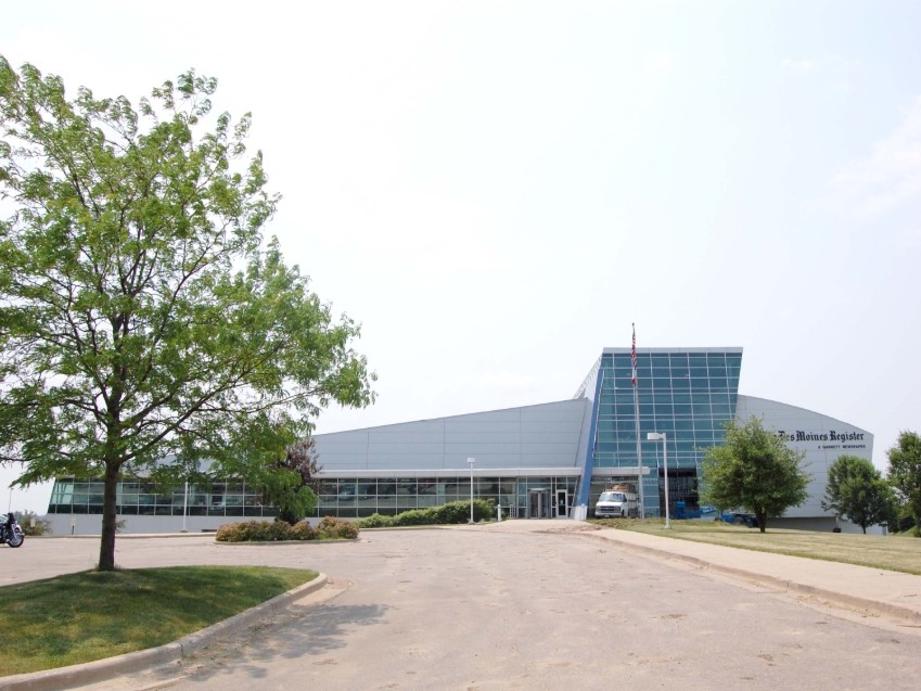
4020 Gannett Ave
Des Moines-West Des Moines, IA
Airport Business Park Plat 1
120-00004005005
Polk
Lightindustrial
Iowa
X
9.41 AC
19153C0345F
South
161,788 SF
Des Moines
DEMOGRAPHICS near 4020 Gannett Ave
1 Mile
3 Mile
5 Mile
2024 Total Population
333
30,518
93,013
2029 Population
366
32,620
98,173
Pop Growth 2024-2029
+ 9.91%
+ 6.89%
+ 5.55%
Average Age
36
38
38
2024 Total Households
119
12,113
38,737
HH Growth 2024-2029
+ 10.08%
+ 6.92%
+ 5.64%
Median Household Inc
$89,499
$74,586
$66,298
Avg Household Size
2.80
2.40
2.30
2024 Avg HH Vehicles
2.00
2.00
2.00
Median Home Value
$199,999
$199,067
$188,580
Median Year Built
1987
1978
1973
Nearby Places
- Restaurants
- Banks
- Shops
- Fitness
- Groceries
PUBLIC TRANSPORTATION
AIRPORT
Des Moines International
DRIVE
WALK
Distance
Des Moines International
10 min
4.3 mi
Freight Ports
Port Milwaukee
DRIVE
WALK
Distance
Port Milwaukee
429 min
381.3 mi
Nearby Properties
Address
Land Use
TOTAL SIZE
Lot Size
Zoning
Address
Land Use
TOTAL SIZE
Lot Size
Zoning
351,427 SF
57.41 AC
Address
Land Use
TOTAL SIZE
Lot Size
Zoning
283,760 SF
27.19 AC
Address
Land Use
TOTAL SIZE
Lot Size
Zoning
283,760 SF
14.96 AC
Address
Land Use
TOTAL SIZE
Lot Size
Zoning
227,640 SF
19.48 AC
Address
Land Use
TOTAL SIZE
Lot Size
Zoning
397,938 SF
27.97 AC
PUD
Address
Land Use
TOTAL SIZE
Lot Size
Zoning
302,800 SF
20.85 AC
Address
Land Use
TOTAL SIZE
Lot Size
Zoning
203,710 SF
26.88 AC
Address
Land Use
TOTAL SIZE
Lot Size
Zoning
298,716 SF
18.90 AC
PUD
Address
Land Use
TOTAL SIZE
Lot Size
Zoning
100,044 SF
7.30 AC
Address
Land Use
TOTAL SIZE
Lot Size
Zoning
110,621 SF
23.31 AC
Address
Land Use
TOTAL SIZE
Lot Size
Zoning
260,420 SF
18.17 AC
R-3
Address
Land Use
TOTAL SIZE
Lot Size
Zoning
2,216 SF
7.50 AC
Address
Land Use
TOTAL SIZE
Lot Size
Zoning
149,564 SF
22.28 AC
PUD
Address
Land Use
TOTAL SIZE
Lot Size
Zoning
26,946 SF
8.12 AC
Address
Land Use
TOTAL SIZE
Lot Size
Zoning
191,668 SF
8.26 AC
R-6
Address
Land Use
TOTAL SIZE
Lot Size
Zoning
80,589 SF
8.62 AC
Address
Land Use
TOTAL SIZE
Lot Size
Zoning
135,016 SF
25.08 AC
M-1
Address
Land Use
TOTAL SIZE
Lot Size
Zoning
61,320 SF
8.13 AC
Address
Land Use
TOTAL SIZE
Lot Size
Zoning
82,044 SF
2.91 AC
Address
Land Use
TOTAL SIZE
Lot Size
Zoning
109,422 SF
16.09 AC
PBP
Address
Land Use
TOTAL SIZE
Lot Size
Zoning
38,950 SF
9.99 AC
RM
Address
Land Use
TOTAL SIZE
Lot Size
Zoning
184,596 SF
59.32 AC
Address
Land Use
TOTAL SIZE
Lot Size
Zoning
121,200 SF
10.32 AC
C-2
Address
Land Use
TOTAL SIZE
Lot Size
Zoning
144,828 SF
8.34 AC
R-3
Address
Land Use
TOTAL SIZE
Lot Size
Zoning
23,662 SF
15.89 AC
PBP
Address
Land Use
TOTAL SIZE
Lot Size
Zoning
4.34 AC
Address
Land Use
TOTAL SIZE
Lot Size
Zoning
178,721 SF
8.19 AC
C-2
Address
Land Use
TOTAL SIZE
Lot Size
Zoning
71,644 SF
15.23 AC
Address
Land Use
TOTAL SIZE
Lot Size
Zoning
4,320 SF
17.07 AC
Address
Land Use
TOTAL SIZE
Lot Size
Zoning
86,304 SF
3.56 AC
R-3
The World's #1 Commercial Real Estate Marketplace
Connect with us
© 2025 CoStar Group
The information above has been obtained from sources believed reliable. While we do not doubt its accuracy we have not verified it and make no guarantee, warranty or representation about it. It is your responsibility to independently confirm its accuracy and completeness. Any projections, opinions, assumptions, or estimates used are for example only and do not represent the current or future performance of the property. The value of this transaction to you depends on tax and other factors which should be evaluated by your tax, financial, and legal advisors. You and your advisors should conduct a careful, independent investigation of the property to determine to your satisfaction the suitability of the property for your needs.