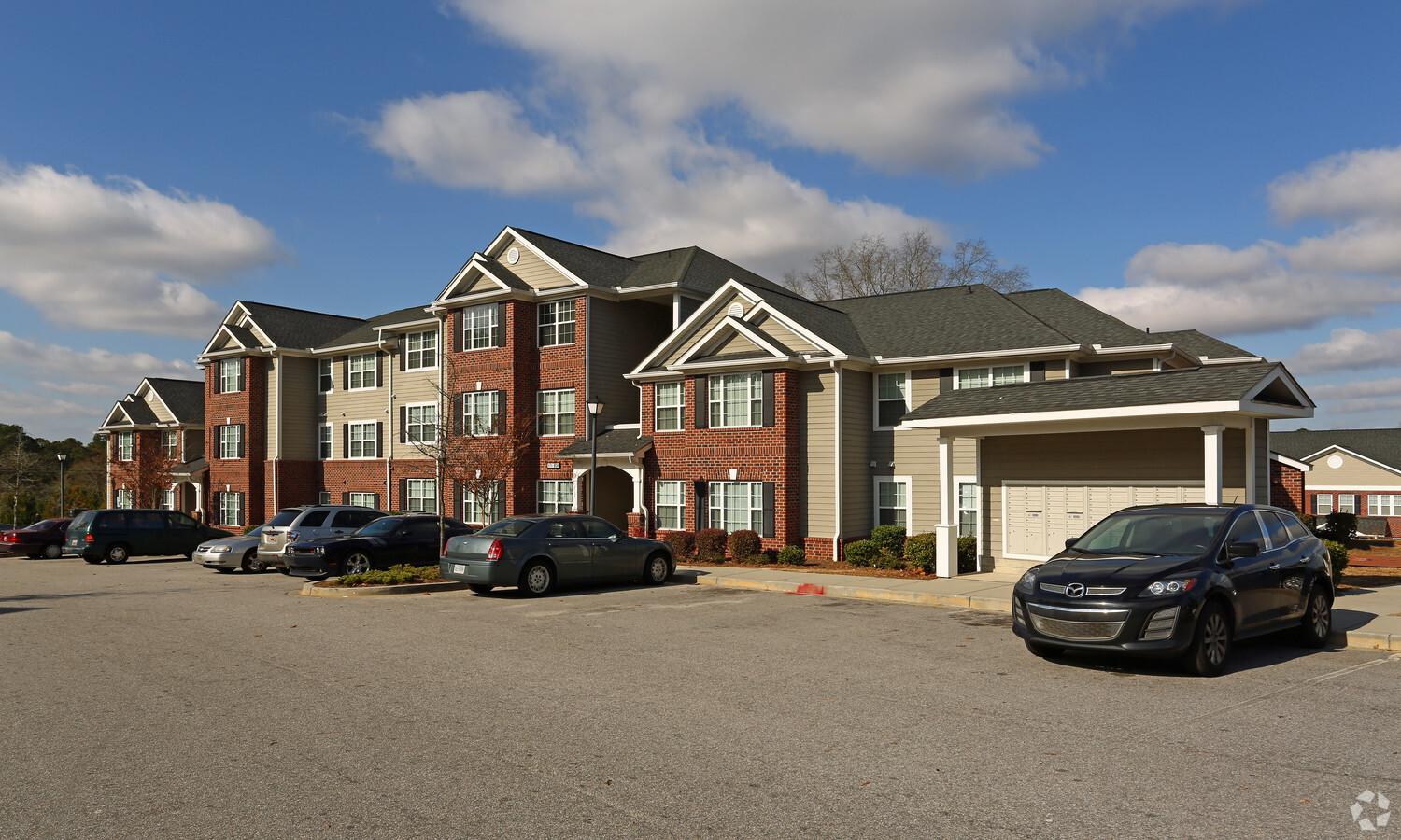
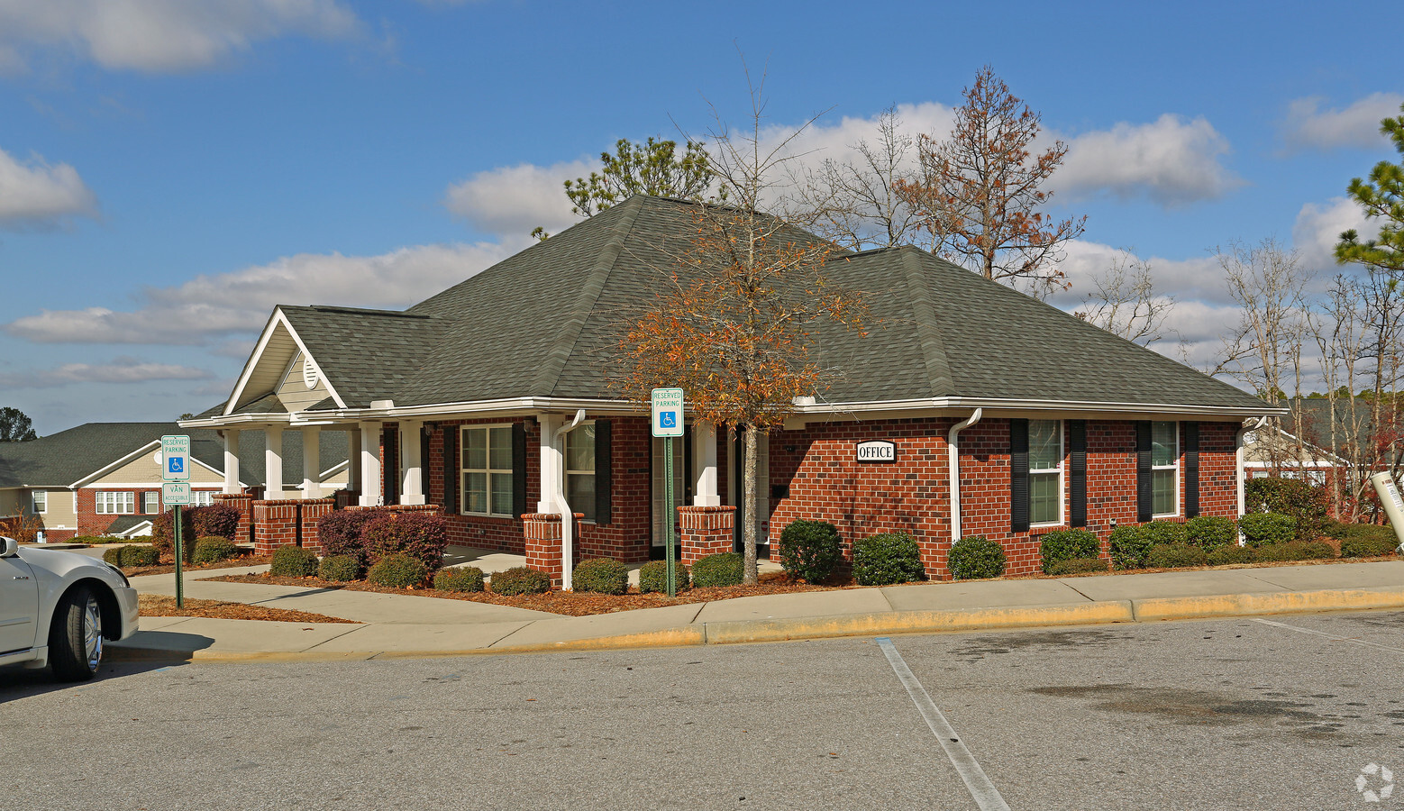
Property Record
4022 Ulmer Rd, Columbia, SC 29209
NEARBY LISTINGS FOR SALE OR LEASE
-
-
View all Columbia listings for sale on LoopNet.com
Property Detail
4022 Ulmer Rd
19216-06-04
Madison Station
Apartment
TRACT 1 132.8X983.4X307X416.5X367XETC #SU #PR RB1304-353
X
Richland
45079C0382L
South Carolina
2024
4.92 AC
2023
Hopkins Suburban
011606
Columbia
61,682 SF
Columbia, SC
DEMOGRAPHICS near 4022 Ulmer Rd
1 Mile
3 Mile
5 Mile
2024 Total Population
4,153
30,553
68,630
2029 Population
4,197
31,173
69,729
Pop Growth 2024-2029
+ 1.06%
+ 2.03%
+ 1.60%
Average Age
41
37
37
2024 Total Households
1,677
11,558
25,509
HH Growth 2024-2029
+ 1.13%
+ 1.89%
+ 1.68%
Median Household Inc
$62,269
$58,201
$59,526
Avg Household Size
2.50
2.50
2.30
2024 Avg HH Vehicles
2.00
2.00
2.00
Median Home Value
$161,111
$163,165
$197,472
Median Year Built
1982
1991
1983
Nearby Places
- Restaurants
- Banks
- Shops
- Fitness
- Groceries
PUBLIC TRANSPORTATION
COMMUTER RAIL
Columbia Amtrak Station (Silver Star - Amtrak)
DRIVE
WALK
Distance
Columbia Amtrak Station (Silver Star - Amtrak)
19 min
9.3 mi
AIRPORT
Columbia Metro
DRIVE
WALK
Distance
Columbia Metro
33 min
19.1 mi
Freight Ports
North Charleston Terminal
DRIVE
WALK
Distance
North Charleston Terminal
127 min
110.5 mi
Nearby Properties
Address
Land Use
TOTAL SIZE
Lot Size
Zoning
Address
Land Use
TOTAL SIZE
Lot Size
Zoning
241,878 SF
14.03 AC
C-3
Address
Land Use
TOTAL SIZE
Lot Size
Zoning
294,105 SF
19 AC
RG-2
Address
Land Use
TOTAL SIZE
Lot Size
Zoning
230,053 SF
18.35 AC
C-3
Address
Land Use
TOTAL SIZE
Lot Size
Zoning
212,787 SF
26.93 AC
C-3
Address
Land Use
TOTAL SIZE
Lot Size
Zoning
3,000 SF
52.49 AC
O-I
Address
Land Use
TOTAL SIZE
Lot Size
Zoning
281,304 SF
22.86 AC
RG-2
Address
Land Use
TOTAL SIZE
Lot Size
Zoning
247,744 SF
15.32 AC
RM-HD
Address
Land Use
TOTAL SIZE
Lot Size
Zoning
255,848 SF
19.98 AC
RM-HD
Address
Land Use
TOTAL SIZE
Lot Size
Zoning
199,263 SF
18.29 AC
C-3
Address
Land Use
TOTAL SIZE
Lot Size
Zoning
160,954 SF
24.03 AC
C-3
Address
Land Use
TOTAL SIZE
Lot Size
Zoning
1,676 SF
8.03 AC
RG-2
Address
Land Use
TOTAL SIZE
Lot Size
Zoning
72,128 SF
4.95 AC
C-3
Address
Land Use
TOTAL SIZE
Lot Size
Zoning
45,883 SF
5.11 AC
GC
Address
Land Use
TOTAL SIZE
Lot Size
Zoning
45,530 SF
4.72 AC
D-1
Address
Land Use
TOTAL SIZE
Lot Size
Zoning
402.10 AC
M-1
Address
Land Use
TOTAL SIZE
Lot Size
Zoning
114,660 SF
11.02 AC
RM-HD
Address
Land Use
TOTAL SIZE
Lot Size
Zoning
55,828 SF
2.68 AC
C-3
Address
Land Use
TOTAL SIZE
Lot Size
Zoning
75,034 SF
2.46 AC
GC
Address
Land Use
TOTAL SIZE
Lot Size
Zoning
102.68 AC
M-1
Address
Land Use
TOTAL SIZE
Lot Size
Zoning
60,772 SF
9.30 AC
GC
Address
Land Use
TOTAL SIZE
Lot Size
Zoning
163,792 SF
22.45 AC
RM-2
Address
Land Use
TOTAL SIZE
Lot Size
Zoning
92,918 SF
10.39 AC
M-1
Address
Land Use
TOTAL SIZE
Lot Size
Zoning
62,720 SF
1.93 AC
C-3
Address
Land Use
TOTAL SIZE
Lot Size
Zoning
77,012 SF
10.70 AC
C-3
Address
Land Use
TOTAL SIZE
Lot Size
Zoning
16,140 SF
1.84 AC
PD
Address
Land Use
TOTAL SIZE
Lot Size
Zoning
16,620 SF
1.77 AC
C-3
Address
Land Use
TOTAL SIZE
Lot Size
Zoning
55,574 SF
1.82 AC
C-3
Address
Land Use
TOTAL SIZE
Lot Size
Zoning
84,788 SF
5.83 AC
RM-HD
Address
Land Use
TOTAL SIZE
Lot Size
Zoning
27,823 SF
3.02 AC
RU
Address
Land Use
TOTAL SIZE
Lot Size
Zoning
84,212 SF
6.88 AC
RG-1A
The World's #1 Commercial Real Estate Marketplace
Connect with us
© 2025 CoStar Group
The information above has been obtained from sources believed reliable. While we do not doubt its accuracy we have not verified it and make no guarantee, warranty or representation about it. It is your responsibility to independently confirm its accuracy and completeness. Any projections, opinions, assumptions, or estimates used are for example only and do not represent the current or future performance of the property. The value of this transaction to you depends on tax and other factors which should be evaluated by your tax, financial, and legal advisors. You and your advisors should conduct a careful, independent investigation of the property to determine to your satisfaction the suitability of the property for your needs.