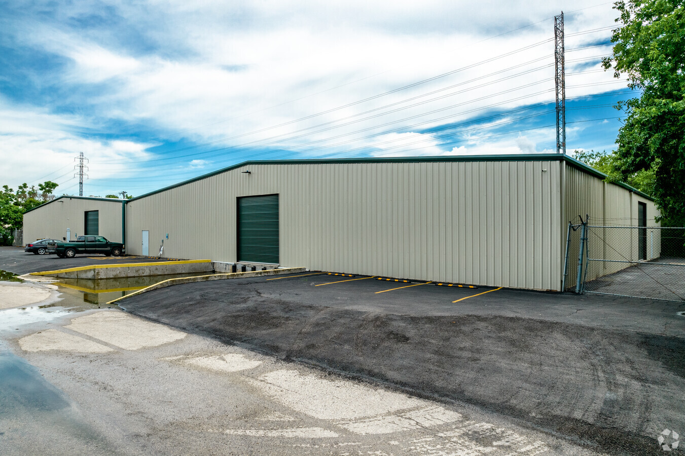
Property Record
403 Kraft St, San Antonio, TX 78220

Current Lease Availabilities
NEARBY LISTINGS FOR SALE OR LEASE
Property Detail
403 Kraft St
San Antonio-New Braunfels, TX
Elliott Indust Bl 10233
10233-000-0050
NCB 10233 (KRAFT SUBD), LOT 18 2024 NEW ACCT PER PLAT 20003/893
Warehouse
Bexar
X
Texas
48029C0415G
18
2023
1.59 AC
2024
Northeast
130800
San Antonio
31,080 SF
DEMOGRAPHICS near 403 Kraft St
1 Mile
3 Mile
5 Mile
2024 Total Population
12,827
99,910
280,970
2029 Population
13,872
107,859
301,810
Pop Growth 2024-2029
+ 8.15%
+ 7.96%
+ 7.42%
Average Age
35
37
38
2024 Total Households
4,276
37,476
104,713
HH Growth 2024-2029
+ 8.35%
+ 8.32%
+ 7.76%
Median Household Inc
$31,768
$40,519
$44,424
Avg Household Size
2.90
2.50
2.50
2024 Avg HH Vehicles
2.00
2.00
2.00
Median Home Value
$88,305
$150,826
$168,033
Median Year Built
1957
1963
1964
Nearby Places
- Restaurants
- Banks
- Shops
- Fitness
- Groceries
PUBLIC TRANSPORTATION
COMMUTER RAIL
San Antonio Amtrak Station (Sunset Limited - Amtrak, Texas Eagle - Amtrak)
DRIVE
WALK
Distance
San Antonio Amtrak Station (Sunset Limited - Amtrak, Texas Eagle - Amtrak)
4 min
2.4 mi
AIRPORT
San Antonio International
DRIVE
WALK
Distance
San Antonio International
14 min
10.3 mi
Freight Ports
Calhoun Port
DRIVE
WALK
Distance
Calhoun Port
176 min
144.3 mi
Nearby Properties
Address
Land Use
TOTAL SIZE
Lot Size
Zoning
Address
Land Use
TOTAL SIZE
Lot Size
Zoning
2,544.56 AC
Address
Land Use
TOTAL SIZE
Lot Size
Zoning
26.51 AC
Address
Land Use
TOTAL SIZE
Lot Size
Zoning
443,000 SF
4.16 AC
Address
Land Use
TOTAL SIZE
Lot Size
Zoning
738,650 SF
2.93 AC
Address
Land Use
TOTAL SIZE
Lot Size
Zoning
1,049,861 SF
1.50 AC
Address
Land Use
TOTAL SIZE
Lot Size
Zoning
339,590 SF
3.12 AC
Address
Land Use
TOTAL SIZE
Lot Size
Zoning
922,468 SF
10.78 AC
Address
Land Use
TOTAL SIZE
Lot Size
Zoning
481,589 SF
5.29 AC
Address
Land Use
TOTAL SIZE
Lot Size
Zoning
400,228 SF
0.78 AC
Address
Land Use
TOTAL SIZE
Lot Size
Zoning
290,794 SF
0.62 AC
Address
Land Use
TOTAL SIZE
Lot Size
Zoning
15,468 SF
4.18 AC
Address
Land Use
TOTAL SIZE
Lot Size
Zoning
387,443 SF
0.89 AC
Address
Land Use
TOTAL SIZE
Lot Size
Zoning
8.10 AC
Address
Land Use
TOTAL SIZE
Lot Size
Zoning
542,922 SF
1.83 AC
Address
Land Use
TOTAL SIZE
Lot Size
Zoning
221,865 SF
3.12 AC
Address
Land Use
TOTAL SIZE
Lot Size
Zoning
262,082 SF
1.60 AC
Address
Land Use
TOTAL SIZE
Lot Size
Zoning
495,840 SF
1.20 AC
Address
Land Use
TOTAL SIZE
Lot Size
Zoning
161,652 SF
1.79 AC
Address
Land Use
TOTAL SIZE
Lot Size
Zoning
254,908 SF
1.92 AC
Address
Land Use
TOTAL SIZE
Lot Size
Zoning
178,534 SF
1.32 AC
Address
Land Use
TOTAL SIZE
Lot Size
Zoning
103,425 SF
4.76 AC
Address
Land Use
TOTAL SIZE
Lot Size
Zoning
303,199 SF
9.88 AC
Address
Land Use
TOTAL SIZE
Lot Size
Zoning
4,075 SF
2.80 AC
Address
Land Use
TOTAL SIZE
Lot Size
Zoning
349,678 SF
0.83 AC
Address
Land Use
TOTAL SIZE
Lot Size
Zoning
9,390 SF
3.71 AC
Address
Land Use
TOTAL SIZE
Lot Size
Zoning
352,920 SF
2.48 AC
Address
Land Use
TOTAL SIZE
Lot Size
Zoning
240,394 SF
0.64 AC
Address
Land Use
TOTAL SIZE
Lot Size
Zoning
163,858 SF
0.62 AC
Address
Land Use
TOTAL SIZE
Lot Size
Zoning
219,419 SF
2.59 AC
Address
Land Use
TOTAL SIZE
Lot Size
Zoning
2,833 SF
2.25 AC
The World's #1 Commercial Real Estate Marketplace
Connect with us
© 2025 CoStar Group
The information above has been obtained from sources believed reliable. While we do not doubt its accuracy we have not verified it and make no guarantee, warranty or representation about it. It is your responsibility to independently confirm its accuracy and completeness. Any projections, opinions, assumptions, or estimates used are for example only and do not represent the current or future performance of the property. The value of this transaction to you depends on tax and other factors which should be evaluated by your tax, financial, and legal advisors. You and your advisors should conduct a careful, independent investigation of the property to determine to your satisfaction the suitability of the property for your needs.