Property Record
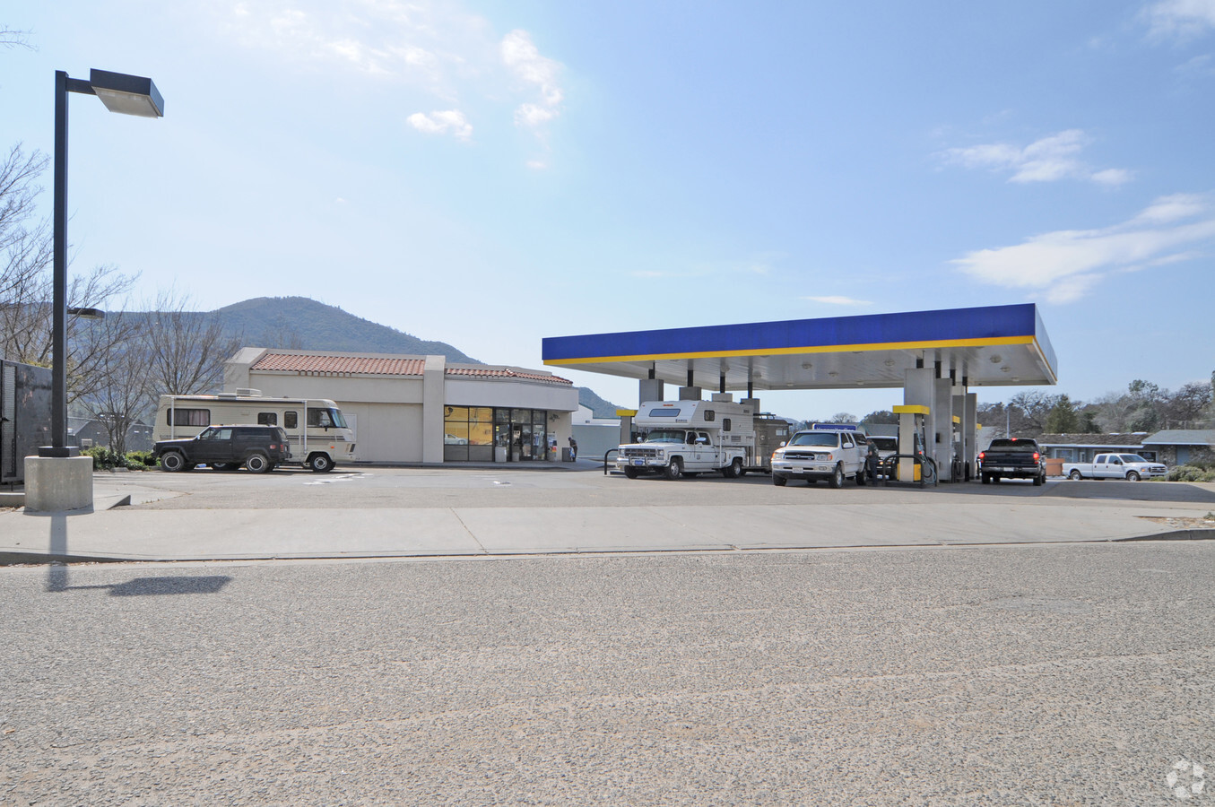
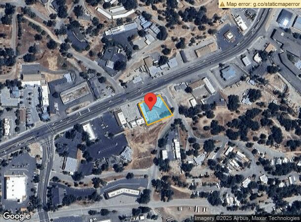
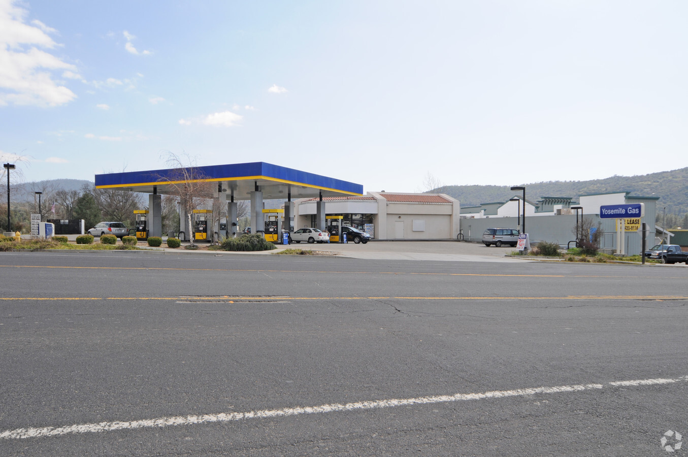
40387 Highway 41, Oakhurst, CA 93644

NEARBY LISTINGS FOR SALE OR LEASE
Property Detail
40387 Highway 41
065-080-024
SEC 11 7/21
Servicestation
Madera
X
California
06039C0484E
0.51 AC
2024
Outlying Madera County
2023
Fresno
000104
Madera, CA
DEMOGRAPHICS near 40387 Highway 41
1 Mile
3 Mile
5 Mile
2024 Total Population
2,363
6,431
11,184
2029 Population
2,559
6,978
12,102
Pop Growth 2024-2029
+ 8.29%
+ 8.51%
+ 8.21%
Average Age
45
47
48
2024 Total Households
994
2,705
4,684
HH Growth 2024-2029
+ 7.95%
+ 8.17%
+ 7.90%
Median Household Inc
$60,863
$62,760
$65,130
Avg Household Size
2.30
2.30
2.30
2024 Avg HH Vehicles
2.00
2.00
2.00
Median Home Value
$279,166
$355,848
$400,388
Median Year Built
1978
1978
1979
Nearby Places
- Restaurants
- Banks
- Shops
- Fitness
- Groceries
Nearby Properties
Address
Land Use
TOTAL SIZE
Lot Size
Zoning
Address
Land Use
TOTAL SIZE
Lot Size
Zoning
2.16 AC
Address
Land Use
TOTAL SIZE
Lot Size
Zoning
1.89 AC
Address
Land Use
TOTAL SIZE
Lot Size
Zoning
2.02 AC
Address
Land Use
TOTAL SIZE
Lot Size
Zoning
11,200 SF
36.59 AC
IH
Address
Land Use
TOTAL SIZE
Lot Size
Zoning
51,268 SF
1.79 AC
CUM
Address
Land Use
TOTAL SIZE
Lot Size
Zoning
42,500 SF
8.02 AC
CUM
Address
Land Use
TOTAL SIZE
Lot Size
Zoning
3.45 AC
Address
Land Use
TOTAL SIZE
Lot Size
Zoning
14.32 AC
IH
Address
Land Use
TOTAL SIZE
Lot Size
Zoning
12.77 AC
CUM
Address
Land Use
TOTAL SIZE
Lot Size
Zoning
35,254 SF
3.94 AC
PCD
Address
Land Use
TOTAL SIZE
Lot Size
Zoning
8,500 SF
2.79 AC
CUM
Address
Land Use
TOTAL SIZE
Lot Size
Zoning
2.44 AC
RM
Address
Land Use
TOTAL SIZE
Lot Size
Zoning
16,988 SF
1.93 AC
CRM
Address
Land Use
TOTAL SIZE
Lot Size
Zoning
3.84 AC
CRG
Address
Land Use
TOTAL SIZE
Lot Size
Zoning
2,448 SF
5.59 AC
RUM
Address
Land Use
TOTAL SIZE
Lot Size
Zoning
31,785 SF
4.61 AC
CRG
Address
Land Use
TOTAL SIZE
Lot Size
Zoning
7,320 SF
1.04 AC
CUM
Address
Land Use
TOTAL SIZE
Lot Size
Zoning
16,750 SF
2.92 AC
CUM
Address
Land Use
TOTAL SIZE
Lot Size
Zoning
46,607 SF
9.04 AC
RUS
Address
Land Use
TOTAL SIZE
Lot Size
Zoning
0.39 AC
CUM
Address
Land Use
TOTAL SIZE
Lot Size
Zoning
28,176 SF
2.35 AC
RUM
Address
Land Use
TOTAL SIZE
Lot Size
Zoning
0.84 AC
PSC
Address
Land Use
TOTAL SIZE
Lot Size
Zoning
6,289 SF
13.68 AC
CRM
Address
Land Use
TOTAL SIZE
Lot Size
Zoning
6.05 AC
CUM
Address
Land Use
TOTAL SIZE
Lot Size
Zoning
21,000 SF
1.80 AC
RUM
Address
Land Use
TOTAL SIZE
Lot Size
Zoning
4.31 AC
RRM
Address
Land Use
TOTAL SIZE
Lot Size
Zoning
1.23 AC
CUM
Address
Land Use
TOTAL SIZE
Lot Size
Zoning
917 SF
4.81 AC
PCD
The World's #1 Commercial Real Estate Marketplace
Connect with us
© 2025 CoStar Group
The information above has been obtained from sources believed reliable. While we do not doubt its accuracy we have not verified it and make no guarantee, warranty or representation about it. It is your responsibility to independently confirm its accuracy and completeness. Any projections, opinions, assumptions, or estimates used are for example only and do not represent the current or future performance of the property. The value of this transaction to you depends on tax and other factors which should be evaluated by your tax, financial, and legal advisors. You and your advisors should conduct a careful, independent investigation of the property to determine to your satisfaction the suitability of the property for your needs.