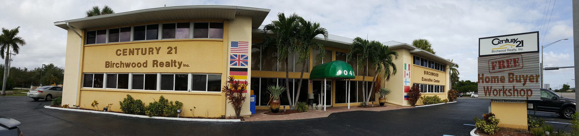
Property Record
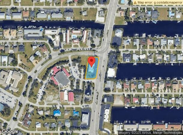
4040 Del Prado Blvd S, Cape Coral, FL 33904
Current Lease Availabilities
NEARBY LISTINGS FOR SALE OR LEASE
Property Detail
4040 Del Prado Blvd S
Cape Coral-Fort Myers, FL
Cape Coral
07-45-24-C2-00342.0060
CAPE CORAL UNIT 7 BLK.342 PB 12 PG 123 LOTS 6 THRU 11
Officebuilding
Lee
AE
Florida
12071C0404G
6-11
2023
0.73 AC
2024
Cape Coral
010602
Southwest Florida
9,536 SF
DEMOGRAPHICS near 4040 Del Prado Blvd S
1 Mile
3 Mile
5 Mile
2024 Total Population
9,525
62,858
190,661
2029 Population
11,387
74,446
225,693
Pop Growth 2024-2029
+ 19.55%
+ 18.44%
+ 18.37%
Average Age
53
49
47
2024 Total Households
4,711
28,515
83,870
HH Growth 2024-2029
+ 19.23%
+ 18.13%
+ 18.06%
Median Household Inc
$59,820
$62,561
$62,637
Avg Household Size
2.00
2.10
2.20
2024 Avg HH Vehicles
2.00
2.00
2.00
Median Home Value
$303,960
$309,743
$287,387
Median Year Built
1982
1984
1988
Nearby Places
- Restaurants
- Banks
- Shops
- Fitness
- Groceries
PUBLIC TRANSPORTATION
AIRPORT
Southwest Florida International
DRIVE
WALK
Distance
Southwest Florida International
27 min
14.4 mi
Punta Gorda
DRIVE
WALK
Distance
Punta Gorda
45 min
28.4 mi
Freight Ports
Port Manatee
DRIVE
WALK
Distance
Port Manatee
125 min
100.1 mi
Nearby Properties
Address
Land Use
TOTAL SIZE
Lot Size
Zoning
Address
Land Use
TOTAL SIZE
Lot Size
Zoning
381,135 SF
15.07 AC
MPD
Address
Land Use
TOTAL SIZE
Lot Size
Zoning
278,679 SF
29.21 AC
C1-D
Address
Land Use
TOTAL SIZE
Lot Size
Zoning
211,588 SF
14.89 AC
MPD
Address
Land Use
TOTAL SIZE
Lot Size
Zoning
54,248 SF
15.42 AC
C1-W
Address
Land Use
TOTAL SIZE
Lot Size
Zoning
142,773 SF
10.82 AC
C-1
Address
Land Use
TOTAL SIZE
Lot Size
Zoning
144,607 SF
20 AC
INS
Address
Land Use
TOTAL SIZE
Lot Size
Zoning
99,749 SF
11.49 AC
WSHP
Address
Land Use
TOTAL SIZE
Lot Size
Zoning
26,337 SF
11.54 AC
C-1
Address
Land Use
TOTAL SIZE
Lot Size
Zoning
47,660 SF
3.52 AC
C1-D
Address
Land Use
TOTAL SIZE
Lot Size
Zoning
113,239 SF
12.62 AC
R1-D
Address
Land Use
TOTAL SIZE
Lot Size
Zoning
95,942 SF
5.22 AC
C1-D
Address
Land Use
TOTAL SIZE
Lot Size
Zoning
121,182 SF
9.91 AC
C-1A
Address
Land Use
TOTAL SIZE
Lot Size
Zoning
84,145 SF
8.10 AC
C-1
Address
Land Use
TOTAL SIZE
Lot Size
Zoning
52,003 SF
6.66 AC
WSHP
Address
Land Use
TOTAL SIZE
Lot Size
Zoning
69,261 SF
8.44 AC
WSHP
Address
Land Use
TOTAL SIZE
Lot Size
Zoning
87,627 SF
8.75 AC
C-1A
Address
Land Use
TOTAL SIZE
Lot Size
Zoning
81,988 SF
7.97 AC
C-1A
Address
Land Use
TOTAL SIZE
Lot Size
Zoning
74,368 SF
2.32 AC
SC
Address
Land Use
TOTAL SIZE
Lot Size
Zoning
65,875 SF
7.67 AC
MPD
Address
Land Use
TOTAL SIZE
Lot Size
Zoning
86,497 SF
6.20 AC
SC
Address
Land Use
TOTAL SIZE
Lot Size
Zoning
139,446 SF
9.94 AC
C1-D
Address
Land Use
TOTAL SIZE
Lot Size
Zoning
45,809 SF
1.75 AC
SC
Address
Land Use
TOTAL SIZE
Lot Size
Zoning
51,688 SF
3.60 AC
C-1
Address
Land Use
TOTAL SIZE
Lot Size
Zoning
46,386 SF
3.43 AC
C-1
Address
Land Use
TOTAL SIZE
Lot Size
Zoning
39,441 SF
3.05 AC
C-1
Address
Land Use
TOTAL SIZE
Lot Size
Zoning
67,396 SF
2.02 AC
SC
Address
Land Use
TOTAL SIZE
Lot Size
Zoning
23,799 SF
2.27 AC
RS-1
Address
Land Use
TOTAL SIZE
Lot Size
Zoning
76,025 SF
2.25 AC
MPD
Address
Land Use
TOTAL SIZE
Lot Size
Zoning
97,049 SF
1.04 AC
C-1
Address
Land Use
TOTAL SIZE
Lot Size
Zoning
54,928 SF
16.13 AC
C1-D
The World's #1 Commercial Real Estate Marketplace
Connect with us
© 2025 CoStar Group
The information above has been obtained from sources believed reliable. While we do not doubt its accuracy we have not verified it and make no guarantee, warranty or representation about it. It is your responsibility to independently confirm its accuracy and completeness. Any projections, opinions, assumptions, or estimates used are for example only and do not represent the current or future performance of the property. The value of this transaction to you depends on tax and other factors which should be evaluated by your tax, financial, and legal advisors. You and your advisors should conduct a careful, independent investigation of the property to determine to your satisfaction the suitability of the property for your needs.