Property Record
4040 Jordonia Station Rd, Nashville, TN 37218


NEARBY LISTINGS FOR SALE OR LEASE
Property Detail
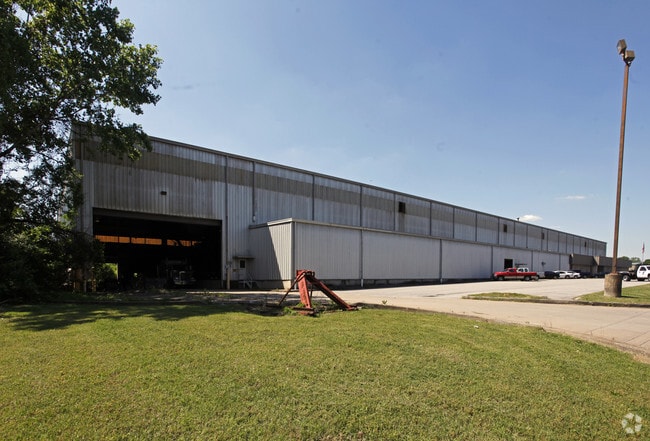
4040 Jordonia Station Rd
069-00-0-117
LOT 1 HYDES FERRY IND.PARK, RESUB PARCELS A&B
Publicstorage
Davidson
X
Tennessee
47037C0228H
1
2025
15.47 AC
2025
West
012802
Nashville
106,540 SF
Nashville-Davidson--Murfreesboro--Franklin, TN
DEMOGRAPHICS near 4040 Jordonia Station Rd
1 Mile
3 Mile
5 Mile
2024 Total Population
1,312
17,106
94,421
2029 Population
1,296
16,965
95,907
Pop Growth 2024-2029
(1.22%)
(0.82%)
+ 1.57%
Average Age
45
41
37
2024 Total Households
469
6,534
41,352
HH Growth 2024-2029
(1.49%)
(1.06%)
+ 1.81%
Median Household Inc
$73,728
$55,075
$57,375
Avg Household Size
2.40
2.30
2.10
2024 Avg HH Vehicles
2.00
2.00
2.00
Median Home Value
$325,000
$306,455
$380,067
Median Year Built
1975
1976
1996
Nearby Places
Map Layers
Map Styles
 Street
 Aerial
- Restaurants
- Banks
- Shops
- Fitness
- Groceries
PUBLIC TRANSPORTATION
COMMUTER RAIL
Riverfront (East Corridor Line - Tennessee Regional Transportation Authority Music City Star (Music City Star))
DRIVE
WALK
Distance
Riverfront (East Corridor Line - Tennessee Regional Transportation Authority Music City Star (Music City Star))
13 min
7.7 mi
AIRPORT
Nashville International
DRIVE
WALK
Distance
Nashville International
25 min
16.6 mi
Freight Ports
Port of Mobile
DRIVE
WALK
Distance
Port of Mobile
495 min
452.5 mi
Nearby Properties
Address
Land Use
TOTAL SIZE
Lot Size
Zoning
Address
Land Use
TOTAL SIZE
Lot Size
Zoning
301.19 AC
MULTI-ZONE
Address
Land Use
TOTAL SIZE
Lot Size
Zoning
55,073 SF
11.42 AC
IWD
Address
Land Use
TOTAL SIZE
Lot Size
Zoning
213,556 SF
123.31 AC
IR
Address
Land Use
TOTAL SIZE
Lot Size
Zoning
89,821 SF
3.90 AC
IR
Address
Land Use
TOTAL SIZE
Lot Size
Zoning
146.13 AC
IR
Address
Land Use
TOTAL SIZE
Lot Size
Zoning
99,216 SF
6.92 AC
IWD
Address
Land Use
TOTAL SIZE
Lot Size
Zoning
9,632 SF
6.79 AC
IWD
Address
Land Use
TOTAL SIZE
Lot Size
Zoning
112,240 SF
19.21 AC
IWD
Address
Land Use
TOTAL SIZE
Lot Size
Zoning
146,453 SF
3.42 AC
IR
Address
Land Use
TOTAL SIZE
Lot Size
Zoning
76,395 SF
5.10 AC
MULA
Address
Land Use
TOTAL SIZE
Lot Size
Zoning
58,613 SF
494.44 AC
MULTI-ZONE
Address
Land Use
TOTAL SIZE
Lot Size
Zoning
77,460 SF
6.59 AC
R8
Address
Land Use
TOTAL SIZE
Lot Size
Zoning
66,720 SF
0.46 AC
SP
Address
Land Use
TOTAL SIZE
Lot Size
Zoning
30,456 SF
118.53 AC
IR
Address
Land Use
TOTAL SIZE
Lot Size
Zoning
28,660 SF
46.90 AC
IR
Address
Land Use
TOTAL SIZE
Lot Size
Zoning
64,014 SF
54.79 AC
RS15
Address
Land Use
TOTAL SIZE
Lot Size
Zoning
314,058 SF
4.17 AC
SP
Address
Land Use
TOTAL SIZE
Lot Size
Zoning
299,400 SF
11.99 AC
IR
Address
Land Use
TOTAL SIZE
Lot Size
Zoning
432,858 SF
21.73 AC
IR
Address
Land Use
TOTAL SIZE
Lot Size
Zoning
73,683 SF
3.76 AC
MULA
Address
Land Use
TOTAL SIZE
Lot Size
Zoning
49,221 SF
0.46 AC
SP
Address
Land Use
TOTAL SIZE
Lot Size
Zoning
6,992 SF
32.83 AC
R8
Address
Land Use
TOTAL SIZE
Lot Size
Zoning
21,255 SF
54.38 AC
IR
Address
Land Use
TOTAL SIZE
Lot Size
Zoning
2,400 SF
65.90 AC
IWD
Address
Land Use
TOTAL SIZE
Lot Size
Zoning
10,156 SF
6.77 AC
MULTI-ZONE
Address
Land Use
TOTAL SIZE
Lot Size
Zoning
47,199 SF
0.38 AC
SP
Address
Land Use
TOTAL SIZE
Lot Size
Zoning
109,144 SF
9.10 AC
IR
Address
Land Use
TOTAL SIZE
Lot Size
Zoning
6,000 SF
22.06 AC
IWD
Address
Land Use
TOTAL SIZE
Lot Size
Zoning
22,900 SF
14.42 AC
MULTI-ZONE
Address
Land Use
TOTAL SIZE
Lot Size
Zoning
52,917 SF
7.18 AC
IWD
The World's #1 Commercial Real Estate Marketplace
Connect with us
© 2026 CoStar Group
The information above has been obtained from sources believed reliable. While we do not doubt its accuracy we have not verified it and make no guarantee, warranty or representation about it. It is your responsibility to independently confirm its accuracy and completeness. Any projections, opinions, assumptions, or estimates used are for example only and do not represent the current or future performance of the property. The value of this transaction to you depends on tax and other factors which should be evaluated by your tax, financial, and legal advisors. You and your advisors should conduct a careful, independent investigation of the property to determine to your satisfaction the suitability of the property for your needs.