Property Record
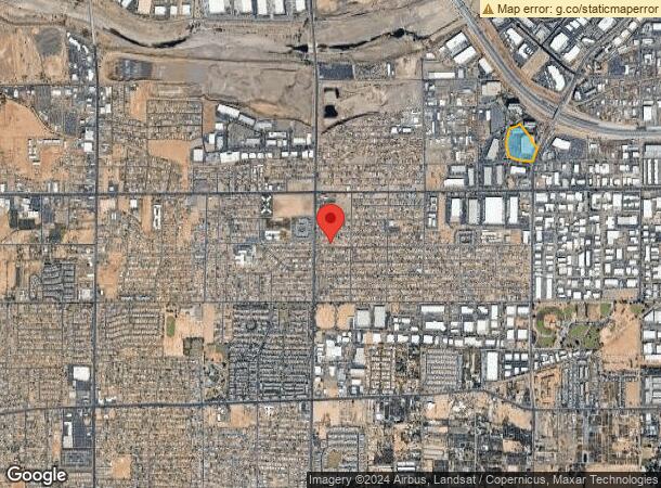
4055 S Riverpoint Pkwy, Phoenix, AZ 85040


Current Lease Availabilities
NEARBY LISTINGS FOR SALE OR LEASE
Property Detail
4055 S Riverpoint Pkwy
Phoenix-Mesa-Scottsdale, AZ
Riverpoint
122-16-067D
THAT POR LT 5 RIVERPOINT MCR 566-04 DAF BEG MOST ELY COR SD LT 5 TH S 23D 35M W 168.06F TH S 21D 30M W 64.52F TH W 49.18F TH S 125.42F TH S 28D 13M W 168.61F TH N 62D 21M W 89.81F TH N 38D 10M W 163.26F TH N 51D 48M E 39.84F TH N 38D 10M W 468.50F TH
Officebuilding
Maricopa
X
Arizona
04013C2220M
5
2024
5.74 AC
2025
Airport Area
116100
Phoenix
172,272 SF
DEMOGRAPHICS near 4055 S Riverpoint Pkwy
1 Mile
3 Mile
5 Mile
2024 Total Population
5,015
65,796
298,856
2029 Population
5,452
71,055
324,546
Pop Growth 2024-2029
+ 8.71%
+ 7.99%
+ 8.60%
Average Age
31
35
35
2024 Total Households
1,475
21,920
111,161
HH Growth 2024-2029
+ 8.88%
+ 8.03%
+ 9.03%
Median Household Inc
$43,382
$58,819
$56,255
Avg Household Size
3.30
2.90
2.50
2024 Avg HH Vehicles
2.00
2.00
2.00
Median Home Value
$275,949
$276,387
$319,785
Median Year Built
1990
1985
1982
Nearby Places
- Restaurants
- Banks
- Shops
- Fitness
- Groceries
PUBLIC TRANSPORTATION
AIRPORT
Phoenix Sky Harbor International
Drive
Walk
Distance
Phoenix Sky Harbor International
11 min
4.8 mi
Phoenix-Mesa Gateway
Drive
Walk
Distance
Phoenix-Mesa Gateway
39 min
28.1 mi
Freight Ports
Port of San Diego
Drive
Walk
Distance
Port of San Diego
404 min
361.5 mi
Nearby Properties
Address
Land Use
TOTAL SIZE
Lot Size
Zoning
Address
Land Use
TOTAL SIZE
Lot Size
Zoning
2901193
20.73 AC
A-1
Address
Land Use
TOTAL SIZE
Lot Size
Zoning
1949842
40 AC
I-1
Address
Land Use
TOTAL SIZE
Lot Size
Zoning
2705875
133.42 AC
I-1
Address
Land Use
TOTAL SIZE
Lot Size
Zoning
522676
264.16 AC
I-1
Address
Land Use
TOTAL SIZE
Lot Size
Zoning
709191
52.85 AC
I-1
Address
Land Use
TOTAL SIZE
Lot Size
Zoning
635169
92.76 AC
I-1
Address
Land Use
TOTAL SIZE
Lot Size
Zoning
9344
134.45 AC
R3
Address
Land Use
TOTAL SIZE
Lot Size
Zoning
1524499
159.88 AC
I-1
Address
Land Use
TOTAL SIZE
Lot Size
Zoning
469025
199.14 AC
A-1
Address
Land Use
TOTAL SIZE
Lot Size
Zoning
277910
53.82 AC
A-1
Address
Land Use
TOTAL SIZE
Lot Size
Zoning
359401
96.70 AC
R-6
Address
Land Use
TOTAL SIZE
Lot Size
Zoning
369723
19.41 AC
R3
Address
Land Use
TOTAL SIZE
Lot Size
Zoning
180690
11.20 AC
I-P
Address
Land Use
TOTAL SIZE
Lot Size
Zoning
351199
22.04 AC
I-1
Address
Land Use
TOTAL SIZE
Lot Size
Zoning
494504
18.83 AC
I-1
Address
Land Use
TOTAL SIZE
Lot Size
Zoning
40 AC
I-1
Address
Land Use
TOTAL SIZE
Lot Size
Zoning
309.82 AC
R-35
Address
Land Use
TOTAL SIZE
Lot Size
Zoning
301102
27.44 AC
Address
Land Use
TOTAL SIZE
Lot Size
Zoning
138984
9.75 AC
I-1
Address
Land Use
TOTAL SIZE
Lot Size
Zoning
734975
10.53 AC
Address
Land Use
TOTAL SIZE
Lot Size
Zoning
269181
78.11 AC
I-1
Address
Land Use
TOTAL SIZE
Lot Size
Zoning
558712
30.72 AC
A2
Address
Land Use
TOTAL SIZE
Lot Size
Zoning
320708
16.24 AC
A1
Address
Land Use
TOTAL SIZE
Lot Size
Zoning
353363
21.29 AC
A-1
Address
Land Use
TOTAL SIZE
Lot Size
Zoning
391630
23 AC
A-1
Address
Land Use
TOTAL SIZE
Lot Size
Zoning
112968
10.55 AC
R-43AG
Address
Land Use
TOTAL SIZE
Lot Size
Zoning
283648
6.83 AC
Address
Land Use
TOTAL SIZE
Lot Size
Zoning
227269
40.19 AC
I-1
Address
Land Use
TOTAL SIZE
Lot Size
Zoning
214325
12.09 AC
A1
Address
Land Use
TOTAL SIZE
Lot Size
Zoning
321010
15.01 AC
I-1
Start a new search to find other properties for sale or lease
Connect with us
© 2024 CoStar Group
The information above has been obtained from sources believed reliable. While we do not doubt its accuracy we have not verified it and make no guarantee, warranty or representation about it. It is your responsibility to independently confirm its accuracy and completeness. Any projections, opinions, assumptions, or estimates used are for example only and do not represent the current or future performance of the property. The value of this transaction to you depends on tax and other factors which should be evaluated by your tax, financial, and legal advisors. You and your advisors should conduct a careful, independent investigation of the property to determine to your satisfaction the suitability of the property for your needs.