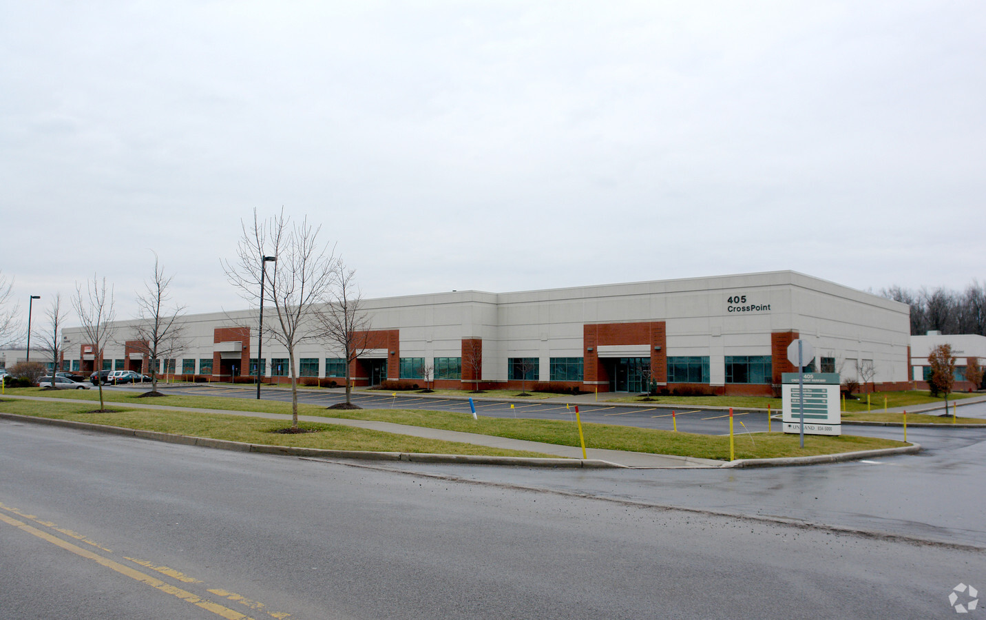
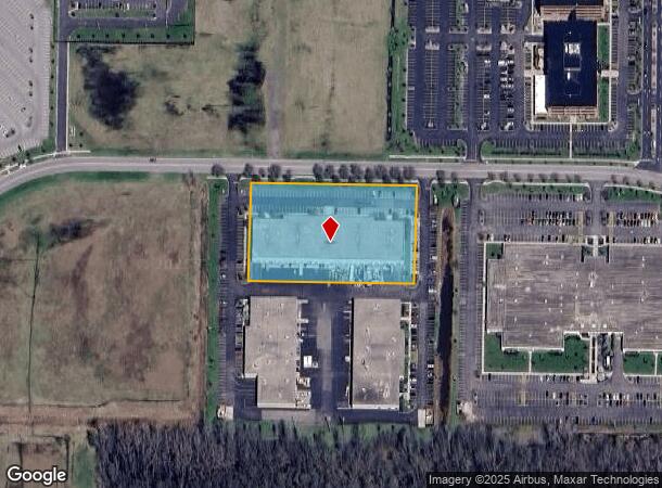
Property Record
405 Crosspoint Pkwy, Getzville, NY 14068

NEARBY LISTINGS FOR SALE OR LEASE
-
-
View all Getzville listings for sale on LoopNet.com
Property Detail
405 Crosspoint Pkwy
142289 28.00-1-67.2
Holland Land Companys Survey
Warehouse
Erie
AE
New York
36029C0086H
67.200
2024
2.62 AC
2023
North
009009
Buffalo/Niagara Falls
43,739 SF
Buffalo-Cheektowaga-Niagara Falls, NY
DEMOGRAPHICS near 405 Crosspoint Pkwy
1 Mile
3 Mile
5 Mile
2024 Total Population
3,900
39,700
119,544
2029 Population
3,825
39,586
119,405
Pop Growth 2024-2029
(1.92%)
(0.29%)
(0.12%)
Average Age
42
43
42
2024 Total Households
1,560
15,662
46,204
HH Growth 2024-2029
(2.05%)
(0.24%)
(0.05%)
Median Household Inc
$131,689
$106,679
$86,669
Avg Household Size
2.50
2.40
2.40
2024 Avg HH Vehicles
2.00
2.00
2.00
Median Home Value
$351,388
$316,703
$281,405
Median Year Built
1988
1984
1979
Nearby Places
- Restaurants
- Banks
- Shops
- Fitness
- Groceries
PUBLIC TRANSPORTATION
AIRPORT
Buffalo Niagara International
DRIVE
WALK
Distance
Buffalo Niagara International
20 min
7.8 mi
Niagara Falls International
DRIVE
WALK
Distance
Niagara Falls International
24 min
13.2 mi
Freight Ports
Albany, NY Port
DRIVE
WALK
Distance
Albany, NY Port
341 min
287.6 mi
Nearby Properties
Address
Land Use
TOTAL SIZE
Lot Size
Zoning
Address
Land Use
TOTAL SIZE
Lot Size
Zoning
283,706 SF
68.90 AC
Address
Land Use
TOTAL SIZE
Lot Size
Zoning
41,104 SF
27.52 AC
Address
Land Use
TOTAL SIZE
Lot Size
Zoning
5,364 SF
56.45 AC
Address
Land Use
TOTAL SIZE
Lot Size
Zoning
173,881 SF
13.12 AC
GC
Address
Land Use
TOTAL SIZE
Lot Size
Zoning
113,096 SF
9 AC
Address
Land Use
TOTAL SIZE
Lot Size
Zoning
4,436 SF
18.51 AC
Address
Land Use
TOTAL SIZE
Lot Size
Zoning
403,248 SF
53.50 AC
Address
Land Use
TOTAL SIZE
Lot Size
Zoning
213,943 SF
5.50 AC
Address
Land Use
TOTAL SIZE
Lot Size
Zoning
134,136 SF
30.20 AC
NCD
Address
Land Use
TOTAL SIZE
Lot Size
Zoning
154,296 SF
7.90 AC
RD
Address
Land Use
TOTAL SIZE
Lot Size
Zoning
110,243 SF
19.06 AC
Address
Land Use
TOTAL SIZE
Lot Size
Zoning
7,080 SF
21.40 AC
MFR-5
Address
Land Use
TOTAL SIZE
Lot Size
Zoning
14,140 SF
12.30 AC
Address
Land Use
TOTAL SIZE
Lot Size
Zoning
131,128 SF
15.48 AC
RD
Address
Land Use
TOTAL SIZE
Lot Size
Zoning
67,475 SF
5 AC
Address
Land Use
TOTAL SIZE
Lot Size
Zoning
197,074 SF
29.46 AC
Address
Land Use
TOTAL SIZE
Lot Size
Zoning
253,920 SF
22.83 AC
RD
Address
Land Use
TOTAL SIZE
Lot Size
Zoning
106,676 SF
8.90 AC
RD
Address
Land Use
TOTAL SIZE
Lot Size
Zoning
131,200 SF
16.90 AC
Address
Land Use
TOTAL SIZE
Lot Size
Zoning
83,256 SF
8.01 AC
NCD
Address
Land Use
TOTAL SIZE
Lot Size
Zoning
87,718 SF
1.26 AC
RD
Address
Land Use
TOTAL SIZE
Lot Size
Zoning
86,640 SF
10.30 AC
RD
Address
Land Use
TOTAL SIZE
Lot Size
Zoning
128,867 SF
9.42 AC
RD
Address
Land Use
TOTAL SIZE
Lot Size
Zoning
75,448 SF
8.82 AC
Address
Land Use
TOTAL SIZE
Lot Size
Zoning
92,368 SF
0.75 AC
RD
Address
Land Use
TOTAL SIZE
Lot Size
Zoning
9,338 SF
6.20 AC
Address
Land Use
TOTAL SIZE
Lot Size
Zoning
49,478 SF
4 AC
NCD
Address
Land Use
TOTAL SIZE
Lot Size
Zoning
73,959 SF
7.85 AC
Address
Land Use
TOTAL SIZE
Lot Size
Zoning
81,920 SF
3.82 AC
Address
Land Use
TOTAL SIZE
Lot Size
Zoning
63,464 SF
2.44 AC
The World's #1 Commercial Real Estate Marketplace
Connect with us
© 2025 CoStar Group
The information above has been obtained from sources believed reliable. While we do not doubt its accuracy we have not verified it and make no guarantee, warranty or representation about it. It is your responsibility to independently confirm its accuracy and completeness. Any projections, opinions, assumptions, or estimates used are for example only and do not represent the current or future performance of the property. The value of this transaction to you depends on tax and other factors which should be evaluated by your tax, financial, and legal advisors. You and your advisors should conduct a careful, independent investigation of the property to determine to your satisfaction the suitability of the property for your needs.