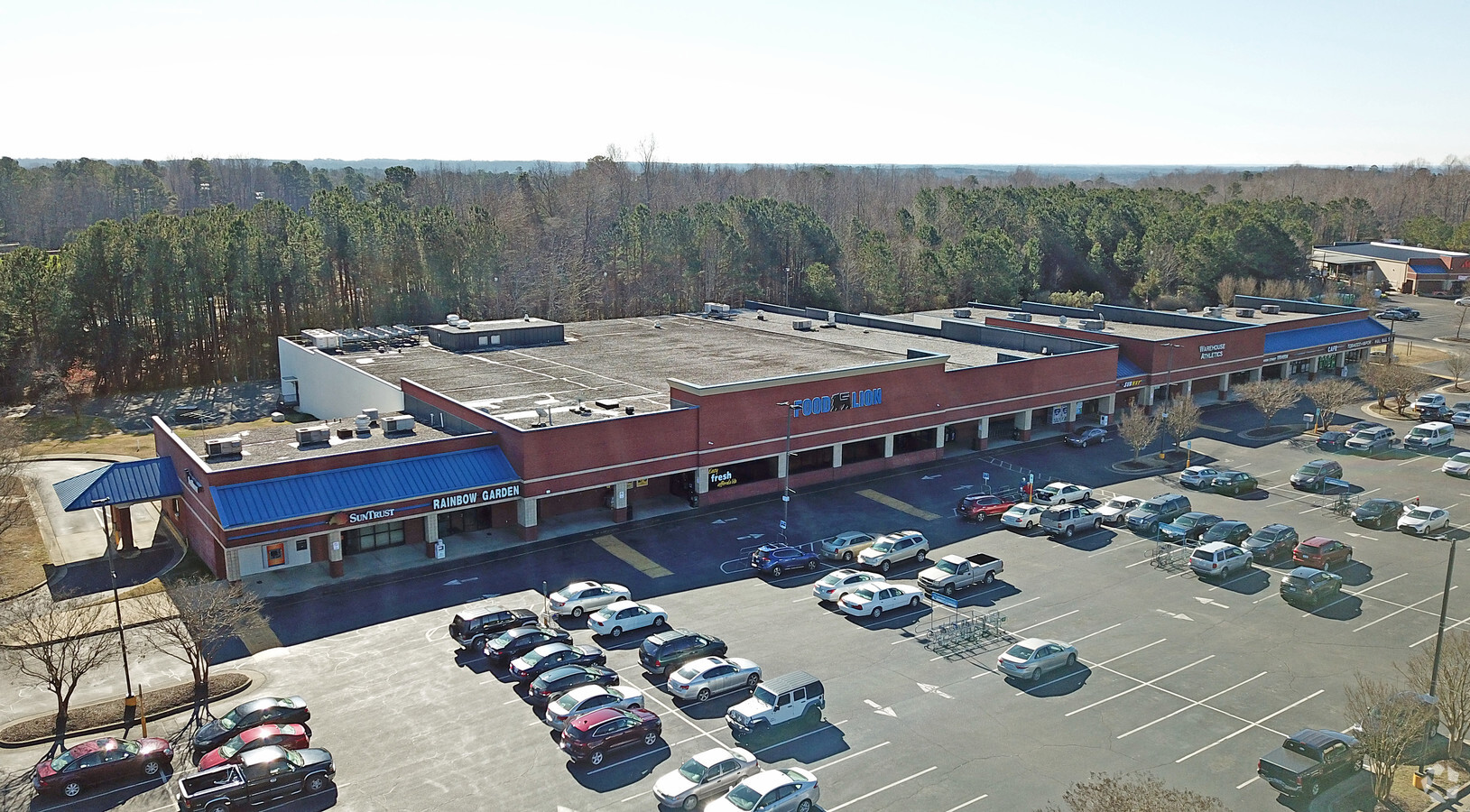
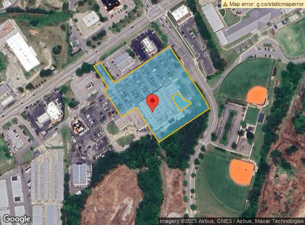
Property Record
405 S Main St, Rolesville, NC 27571
NEARBY LISTINGS FOR SALE OR LEASE
Property Detail
405 S Main St
Raleigh, NC
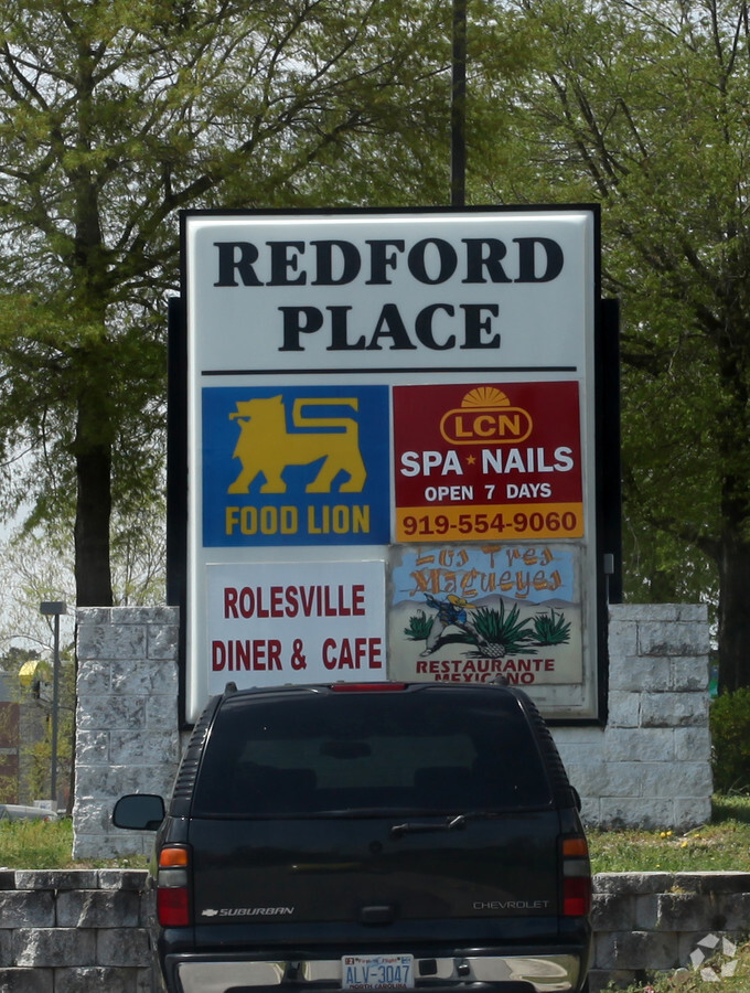
Rcmb Survey Redford Cntr
1758.08-89-5219-000
LOE RCMB SURVEY REDFORD CNTR BM1993-1381
Regionalshoppingcenterormallwithanchorstore
Wake
X
North Carolina
3720175800K
e
2024
4.74 AC
2024
Northeast Wake County
054215
Raleigh/Durham
38,211 SF
DEMOGRAPHICS near 405 S Main St
1 Mile
3 Mile
5 Mile
2024 Total Population
5,025
28,894
81,684
2029 Population
5,466
31,639
89,244
Pop Growth 2024-2029
+ 8.78%
+ 9.50%
+ 9.26%
Average Age
38
38
39
2024 Total Households
1,653
9,461
28,679
HH Growth 2024-2029
+ 8.83%
+ 9.48%
+ 9.25%
Median Household Inc
$110,273
$122,545
$106,294
Avg Household Size
3.00
3.00
2.80
2024 Avg HH Vehicles
2.00
2.00
2.00
Median Home Value
$407,420
$399,955
$355,974
Median Year Built
2010
2009
2007
Nearby Places
- Restaurants
- Banks
- Shops
- Fitness
- Groceries
PUBLIC TRANSPORTATION
AIRPORT
Raleigh-Durham International
DRIVE
WALK
Distance
Raleigh-Durham International
33 min
23.5 mi
Freight Ports
Virginia Port Authority - Richmond
DRIVE
WALK
Distance
Virginia Port Authority - Richmond
171 min
138.7 mi
SALE & LEASE HISTORY
LISTING DATE
SALE/LEASE

Oct 11, 2017
For Sale
Nearby Properties
Address
Land Use
TOTAL SIZE
Lot Size
Zoning
Address
Land Use
TOTAL SIZE
Lot Size
Zoning
340,702 SF
121.26 AC
RM-CZ
Address
Land Use
TOTAL SIZE
Lot Size
Zoning
283,870 SF
11.39 AC
RMX
Address
Land Use
TOTAL SIZE
Lot Size
Zoning
196,091 SF
37.21 AC
RL
Address
Land Use
TOTAL SIZE
Lot Size
Zoning
100,625 SF
16.39 AC
RL
Address
Land Use
TOTAL SIZE
Lot Size
Zoning
227,653 SF
10.86 AC
TC
Address
Land Use
TOTAL SIZE
Lot Size
Zoning
115,872 SF
17.25 AC
CX-3
Address
Land Use
TOTAL SIZE
Lot Size
Zoning
77,559 SF
8.78 AC
RX-3
Address
Land Use
TOTAL SIZE
Lot Size
Zoning
74,000 SF
20 AC
R-30
Address
Land Use
TOTAL SIZE
Lot Size
Zoning
53,707 SF
17.07 AC
RL
Address
Land Use
TOTAL SIZE
Lot Size
Zoning
47,984 SF
4.44 AC
NB
Address
Land Use
TOTAL SIZE
Lot Size
Zoning
68,489 SF
7.26 AC
NB
Address
Land Use
TOTAL SIZE
Lot Size
Zoning
45,723 SF
8.96 AC
GC
Address
Land Use
TOTAL SIZE
Lot Size
Zoning
66,801 SF
11.01 AC
RL
Address
Land Use
TOTAL SIZE
Lot Size
Zoning
36,295 SF
5.71 AC
GC
Address
Land Use
TOTAL SIZE
Lot Size
Zoning
46,203 SF
4.68 AC
GC-CZ
Address
Land Use
TOTAL SIZE
Lot Size
Zoning
15,196 SF
2.77 AC
NB
Address
Land Use
TOTAL SIZE
Lot Size
Zoning
18,962 SF
52.06 AC
RL
Address
Land Use
TOTAL SIZE
Lot Size
Zoning
14,652 SF
1.74 AC
GC
Address
Land Use
TOTAL SIZE
Lot Size
Zoning
65,078 SF
5.74 AC
R&PUD
Address
Land Use
TOTAL SIZE
Lot Size
Zoning
28,670 SF
8.28 AC
GC-CZ
Address
Land Use
TOTAL SIZE
Lot Size
Zoning
20,220 SF
1.62 AC
GC
Address
Land Use
TOTAL SIZE
Lot Size
Zoning
32.96 AC
TC
Address
Land Use
TOTAL SIZE
Lot Size
Zoning
21,000 SF
3.21 AC
CO-SUD
Address
Land Use
TOTAL SIZE
Lot Size
Zoning
21,245 SF
0.45 AC
RL
Address
Land Use
TOTAL SIZE
Lot Size
Zoning
13,255 SF
2.88 AC
CX-3
Address
Land Use
TOTAL SIZE
Lot Size
Zoning
24.27 AC
GC-CZ
Address
Land Use
TOTAL SIZE
Lot Size
Zoning
81,031 SF
6.13 AC
R&PUD
Address
Land Use
TOTAL SIZE
Lot Size
Zoning
21.03 AC
GC-CZ
Address
Land Use
TOTAL SIZE
Lot Size
Zoning
7,748 SF
4.54 AC
GC-CZ
Address
Land Use
TOTAL SIZE
Lot Size
Zoning
13,247 SF
2.03 AC
NB
The World's #1 Commercial Real Estate Marketplace
Connect with us
© 2025 CoStar Group
The information above has been obtained from sources believed reliable. While we do not doubt its accuracy we have not verified it and make no guarantee, warranty or representation about it. It is your responsibility to independently confirm its accuracy and completeness. Any projections, opinions, assumptions, or estimates used are for example only and do not represent the current or future performance of the property. The value of this transaction to you depends on tax and other factors which should be evaluated by your tax, financial, and legal advisors. You and your advisors should conduct a careful, independent investigation of the property to determine to your satisfaction the suitability of the property for your needs.