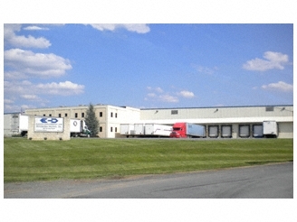
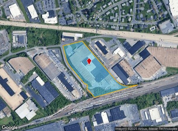
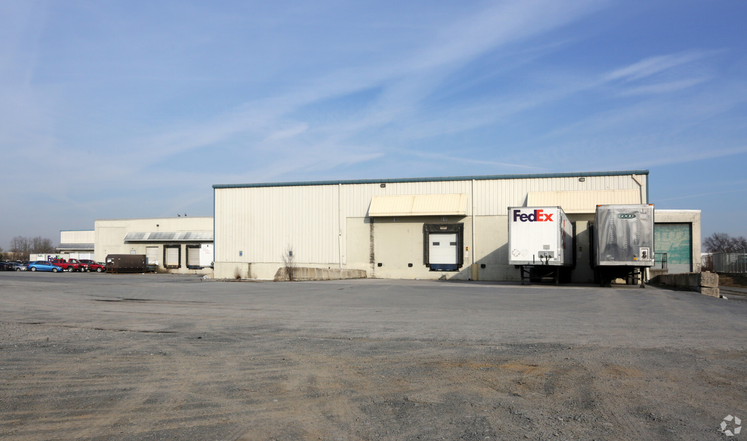
Property Record
405 Sterling St, Camp Hill, PA 17011
NEARBY LISTINGS FOR SALE OR LEASE
Property Detail
405 Sterling St
10-22-0531-014
LAND APPROX 16 ACRES
Commercialbuilding
Cumberland
A
Pennsylvania
42041C0277F
15.88 AC
2024
Harrisburg Area West
2024
Philadelphia
011304
Harrisburg-Carlisle, PA
DEMOGRAPHICS near 405 Sterling St
1 Mile
3 Mile
5 Mile
2024 Total Population
7,365
70,192
186,184
2029 Population
7,892
74,875
197,729
Pop Growth 2024-2029
+ 7.16%
+ 6.67%
+ 6.20%
Average Age
41
41
40
2024 Total Households
3,259
28,403
76,859
HH Growth 2024-2029
+ 7.33%
+ 7.41%
+ 6.54%
Median Household Inc
$82,608
$88,255
$77,245
Avg Household Size
2.20
2.30
2.30
2024 Avg HH Vehicles
2.00
2.00
2.00
Median Home Value
$222,175
$245,462
$234,601
Median Year Built
1959
1971
1970
Nearby Places
- Restaurants
- Banks
- Shops
- Fitness
- Groceries
PUBLIC TRANSPORTATION
COMMUTER RAIL
Harrisburg (Keystone Service - Amtrak, Pennsylvanian - Amtrak)
DRIVE
WALK
Distance
Harrisburg (Keystone Service - Amtrak, Pennsylvanian - Amtrak)
14 min
6.5 mi
AIRPORT
Harrisburg International
DRIVE
WALK
Distance
Harrisburg International
26 min
15.6 mi
Freight Ports
Port of Baltimore
DRIVE
WALK
Distance
Port of Baltimore
114 min
82.2 mi
Nearby Properties
Address
Land Use
TOTAL SIZE
Lot Size
Zoning
Address
Land Use
TOTAL SIZE
Lot Size
Zoning
Address
Land Use
TOTAL SIZE
Lot Size
Zoning
Address
Land Use
TOTAL SIZE
Lot Size
Zoning
Address
Land Use
TOTAL SIZE
Lot Size
Zoning
Address
Land Use
TOTAL SIZE
Lot Size
Zoning
Address
Land Use
TOTAL SIZE
Lot Size
Zoning
Address
Land Use
TOTAL SIZE
Lot Size
Zoning
804.01 AC
Address
Land Use
TOTAL SIZE
Lot Size
Zoning
22.15 AC
Address
Land Use
TOTAL SIZE
Lot Size
Zoning
Address
Land Use
TOTAL SIZE
Lot Size
Zoning
72.78 AC
Address
Land Use
TOTAL SIZE
Lot Size
Zoning
40.97 AC
Address
Land Use
TOTAL SIZE
Lot Size
Zoning
21.42 AC
Address
Land Use
TOTAL SIZE
Lot Size
Zoning
29.68 AC
Address
Land Use
TOTAL SIZE
Lot Size
Zoning
Address
Land Use
TOTAL SIZE
Lot Size
Zoning
Address
Land Use
TOTAL SIZE
Lot Size
Zoning
38.26 AC
Address
Land Use
TOTAL SIZE
Lot Size
Zoning
56.15 AC
Address
Land Use
TOTAL SIZE
Lot Size
Zoning
Address
Land Use
TOTAL SIZE
Lot Size
Zoning
Address
Land Use
TOTAL SIZE
Lot Size
Zoning
34.45 AC
Address
Land Use
TOTAL SIZE
Lot Size
Zoning
Address
Land Use
TOTAL SIZE
Lot Size
Zoning
725 SF
19.33 AC
Address
Land Use
TOTAL SIZE
Lot Size
Zoning
9.37 AC
Address
Land Use
TOTAL SIZE
Lot Size
Zoning
26.55 AC
Address
Land Use
TOTAL SIZE
Lot Size
Zoning
14.24 AC
Address
Land Use
TOTAL SIZE
Lot Size
Zoning
28.37 AC
Address
Land Use
TOTAL SIZE
Lot Size
Zoning
26.43 AC
Address
Land Use
TOTAL SIZE
Lot Size
Zoning
Address
Land Use
TOTAL SIZE
Lot Size
Zoning
27.95 AC
Address
Land Use
TOTAL SIZE
Lot Size
Zoning
628.50 AC
The World's #1 Commercial Real Estate Marketplace
Connect with us
© 2025 CoStar Group
The information above has been obtained from sources believed reliable. While we do not doubt its accuracy we have not verified it and make no guarantee, warranty or representation about it. It is your responsibility to independently confirm its accuracy and completeness. Any projections, opinions, assumptions, or estimates used are for example only and do not represent the current or future performance of the property. The value of this transaction to you depends on tax and other factors which should be evaluated by your tax, financial, and legal advisors. You and your advisors should conduct a careful, independent investigation of the property to determine to your satisfaction the suitability of the property for your needs.