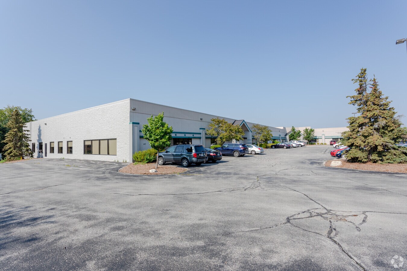
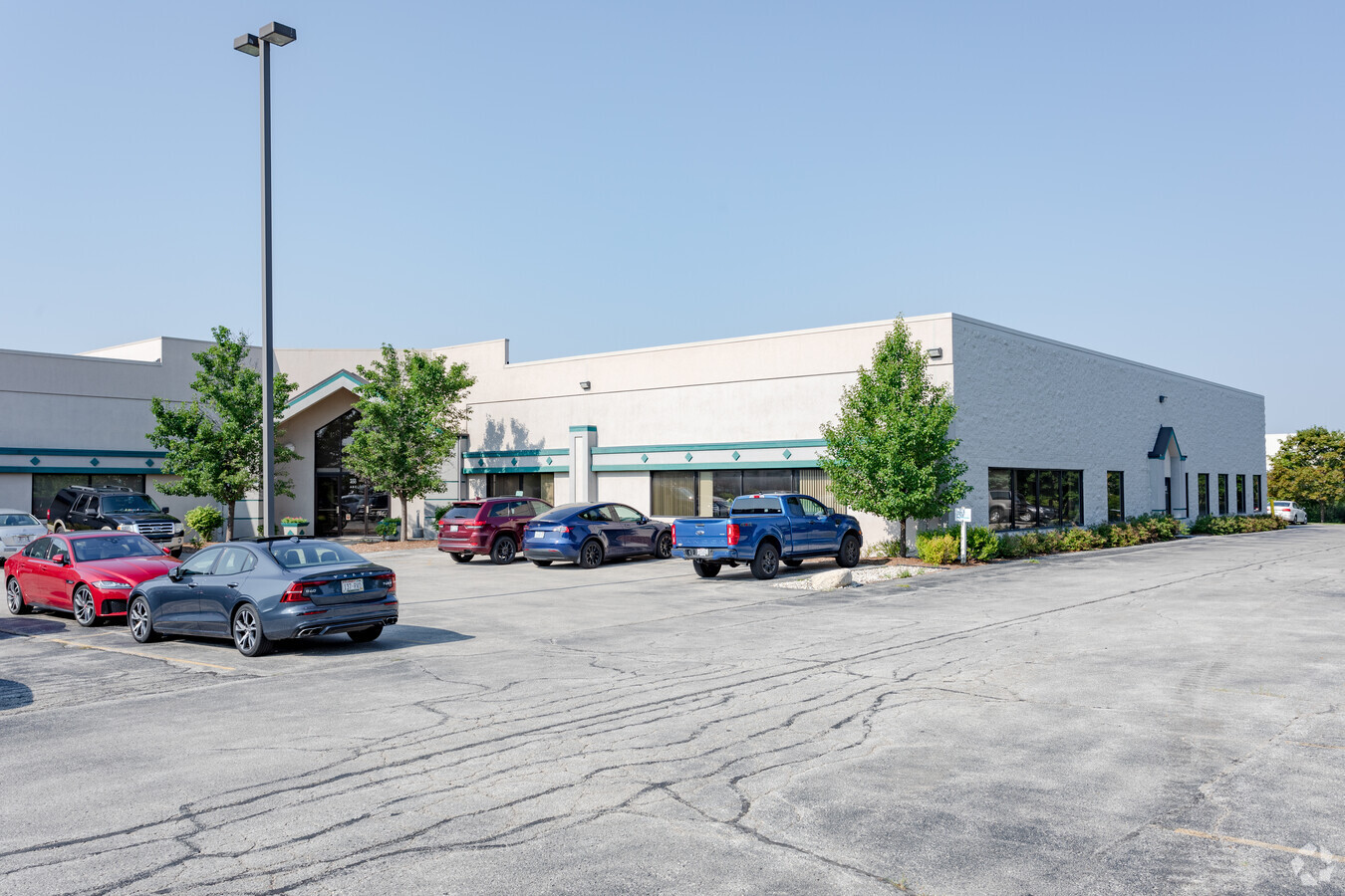
Property Record
407 Pilot Ct, Waukesha, WI 53188
Current Lease Availabilities
NEARBY LISTINGS FOR SALE OR LEASE
Property Detail
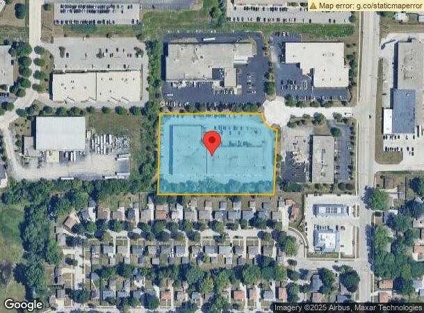
407 Pilot Ct
Milwaukee-Waukesha-West Allis, WI
Peters Sub
WAKC-0997-079
LOT 2 CSM NO 5809 (V47 CSM P182) PT NE1/4 SEC 34 T7N R19E 3.6 AC DOC NO 4040352
Commercialnec
Waukesha
X
Wisconsin
55133C0213H
2
2023
3.60 AC
2023
Central Waukesha
203000
Milwaukee/Madison
51,227 SF
DEMOGRAPHICS near 407 Pilot Ct
1 Mile
3 Mile
5 Mile
2024 Total Population
8,405
67,312
120,363
2029 Population
8,735
69,897
124,432
Pop Growth 2024-2029
+ 3.93%
+ 3.84%
+ 3.38%
Average Age
41
41
41
2024 Total Households
3,773
29,585
51,172
HH Growth 2024-2029
+ 4.16%
+ 3.92%
+ 3.48%
Median Household Inc
$57,912
$70,328
$80,485
Avg Household Size
2.10
2.20
2.30
2024 Avg HH Vehicles
2.00
2.00
2.00
Median Home Value
$220,048
$251,250
$291,885
Median Year Built
1969
1978
1981
Nearby Places
- Restaurants
- Banks
- Shops
- Fitness
- Groceries
PUBLIC TRANSPORTATION
AIRPORT
General Mitchell International
DRIVE
WALK
Distance
General Mitchell International
37 min
23.8 mi
Freight Ports
Port Milwaukee
DRIVE
WALK
Distance
Port Milwaukee
29 min
20.3 mi
Nearby Properties
Address
Land Use
TOTAL SIZE
Lot Size
Zoning
Address
Land Use
TOTAL SIZE
Lot Size
Zoning
25.92 AC
Address
Land Use
TOTAL SIZE
Lot Size
Zoning
201,304 SF
29.43 AC
RM-2(PUD)
Address
Land Use
TOTAL SIZE
Lot Size
Zoning
172.13 AC
M-2
Address
Land Use
TOTAL SIZE
Lot Size
Zoning
Address
Land Use
TOTAL SIZE
Lot Size
Zoning
56.81 AC
Address
Land Use
TOTAL SIZE
Lot Size
Zoning
21.73 AC
M-1
Address
Land Use
TOTAL SIZE
Lot Size
Zoning
68,591 SF
2.97 AC
RM-3(PUD)
Address
Land Use
TOTAL SIZE
Lot Size
Zoning
Address
Land Use
TOTAL SIZE
Lot Size
Zoning
6.56 AC
I-1
Address
Land Use
TOTAL SIZE
Lot Size
Zoning
63,482 SF
39.53 AC
I-1
Address
Land Use
TOTAL SIZE
Lot Size
Zoning
237,267 SF
16.14 AC
B-5
Address
Land Use
TOTAL SIZE
Lot Size
Zoning
167,693 SF
13.83 AC
B-5
Address
Land Use
TOTAL SIZE
Lot Size
Zoning
51,676 SF
7.41 AC
RM-3(PUD)
Address
Land Use
TOTAL SIZE
Lot Size
Zoning
19.01 AC
RM-2
Address
Land Use
TOTAL SIZE
Lot Size
Zoning
51,676 SF
6.96 AC
RM-3(PUD)
Address
Land Use
TOTAL SIZE
Lot Size
Zoning
129,059 SF
19.19 AC
RM-2(PUD)
Address
Land Use
TOTAL SIZE
Lot Size
Zoning
Address
Land Use
TOTAL SIZE
Lot Size
Zoning
91,322 SF
8.48 AC
B-4
Address
Land Use
TOTAL SIZE
Lot Size
Zoning
Address
Land Use
TOTAL SIZE
Lot Size
Zoning
140,144 SF
13.85 AC
RM-2(PUD)
Address
Land Use
TOTAL SIZE
Lot Size
Zoning
110,992 SF
12.15 AC
RM-1(PUD)
Address
Land Use
TOTAL SIZE
Lot Size
Zoning
10.58 AC
Address
Land Use
TOTAL SIZE
Lot Size
Zoning
61,299 SF
6.59 AC
RM-2(PUD)
Address
Land Use
TOTAL SIZE
Lot Size
Zoning
28,942 SF
2.31 AC
B-3(22.52)
Address
Land Use
TOTAL SIZE
Lot Size
Zoning
79,529 SF
23.86 AC
I-1
Address
Land Use
TOTAL SIZE
Lot Size
Zoning
29.41 AC
B-5(PUD)
Address
Land Use
TOTAL SIZE
Lot Size
Zoning
13.99 AC
Address
Land Use
TOTAL SIZE
Lot Size
Zoning
203,208 SF
41.18 AC
B-5,C-1
Address
Land Use
TOTAL SIZE
Lot Size
Zoning
24,981 SF
1.79 AC
B-3(22.52)
Address
Land Use
TOTAL SIZE
Lot Size
Zoning
20.66 AC
The World's #1 Commercial Real Estate Marketplace
Connect with us
© 2025 CoStar Group
The information above has been obtained from sources believed reliable. While we do not doubt its accuracy we have not verified it and make no guarantee, warranty or representation about it. It is your responsibility to independently confirm its accuracy and completeness. Any projections, opinions, assumptions, or estimates used are for example only and do not represent the current or future performance of the property. The value of this transaction to you depends on tax and other factors which should be evaluated by your tax, financial, and legal advisors. You and your advisors should conduct a careful, independent investigation of the property to determine to your satisfaction the suitability of the property for your needs.