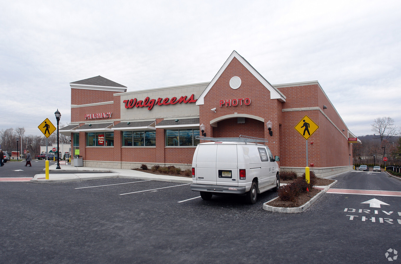
Property Record
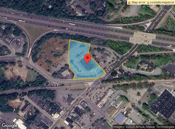
409 Ramapo Valley Rd, Oakland, NJ 07436

NEARBY LISTINGS FOR SALE OR LEASE
Property Detail
409 Ramapo Valley Rd
New York-Jersey City-White Plains, NY-NJ
2.20 AC
42-01706-0000-00003-01
Bergen
Commercialnec
New Jersey
X
3.1
34003C0063H
2.20 AC
2023
Western Bergen
2024
Northern New Jersey
039100
DEMOGRAPHICS near 409 Ramapo Valley Rd
1 Mile
3 Mile
5 Mile
2024 Total Population
7,228
40,898
117,805
2029 Population
7,209
40,856
117,403
Pop Growth 2024-2029
(0.26%)
(0.10%)
(0.34%)
Average Age
42
43
43
2024 Total Households
2,508
14,334
41,812
HH Growth 2024-2029
(0.32%)
(0.19%)
(0.50%)
Median Household Inc
$132,789
$134,649
$130,067
Avg Household Size
2.80
2.70
2.70
2024 Avg HH Vehicles
2.00
2.00
2.00
Median Home Value
$486,363
$497,116
$534,153
Median Year Built
1958
1968
1968
Nearby Places
- Restaurants
- Banks
- Shops
- Fitness
- Groceries
PUBLIC TRANSPORTATION
COMMUTER RAIL
Allendale (Bergen County/Port Jervis Line - NJ Transit Commuter Rail (NJ Transit), Main/Port Jervis Line - NJ Transit Commuter Rail (NJ Transit))
DRIVE
WALK
Distance
Allendale (Bergen County/Port Jervis Line - NJ Transit Commuter Rail (NJ Transit), Main/Port Jervis Line - NJ Transit Commuter Rail (NJ Transit))
14 min
8.1 mi
Ramsey (Bergen County/Port Jervis Line - NJ Transit Commuter Rail (NJ Transit), Main/Port Jervis Line - NJ Transit Commuter Rail (NJ Transit))
DRIVE
WALK
Distance
Ramsey (Bergen County/Port Jervis Line - NJ Transit Commuter Rail (NJ Transit), Main/Port Jervis Line - NJ Transit Commuter Rail (NJ Transit))
14 min
8.7 mi
AIRPORT
Laguardia
DRIVE
WALK
Distance
Laguardia
45 min
31.4 mi
Newark Liberty International
DRIVE
WALK
Distance
Newark Liberty International
39 min
31.7 mi
Westchester County
DRIVE
WALK
Distance
Westchester County
54 min
40.3 mi
Freight Ports
Port Newark Container Terminal
DRIVE
WALK
Distance
Port Newark Container Terminal
44 min
30.7 mi
Nearby Properties
Address
Land Use
TOTAL SIZE
Lot Size
Zoning
Address
Land Use
TOTAL SIZE
Lot Size
Zoning
128.12 AC
HOBR
Address
Land Use
TOTAL SIZE
Lot Size
Zoning
88.72 AC
ORL
Address
Land Use
TOTAL SIZE
Lot Size
Zoning
50.16 AC
CO
Address
Land Use
TOTAL SIZE
Lot Size
Zoning
10.55 AC
IP
Address
Land Use
TOTAL SIZE
Lot Size
Zoning
5.01 AC
IP
Address
Land Use
TOTAL SIZE
Lot Size
Zoning
231.26 AC
PRC
Address
Land Use
TOTAL SIZE
Lot Size
Zoning
14.04 AC
B2
Address
Land Use
TOTAL SIZE
Lot Size
Zoning
8.07 AC
IP
Address
Land Use
TOTAL SIZE
Lot Size
Zoning
79,562 SF
10.32 AC
RB
Address
Land Use
TOTAL SIZE
Lot Size
Zoning
10.42 AC
B2
Address
Land Use
TOTAL SIZE
Lot Size
Zoning
12.45 AC
A225
Address
Land Use
TOTAL SIZE
Lot Size
Zoning
12.49 AC
RB
Address
Land Use
TOTAL SIZE
Lot Size
Zoning
98.41 AC
A130
Address
Land Use
TOTAL SIZE
Lot Size
Zoning
13.39 AC
MFAH
Address
Land Use
TOTAL SIZE
Lot Size
Zoning
8.07 AC
SR
Address
Land Use
TOTAL SIZE
Lot Size
Zoning
2,005 SF
4.62 AC
A225
Address
Land Use
TOTAL SIZE
Lot Size
Zoning
2,738 SF
1.77 AC
RB
Address
Land Use
TOTAL SIZE
Lot Size
Zoning
7.58 AC
R-4
Address
Land Use
TOTAL SIZE
Lot Size
Zoning
40.30 AC
RA-2
Address
Land Use
TOTAL SIZE
Lot Size
Zoning
6.98 AC
IP
Address
Land Use
TOTAL SIZE
Lot Size
Zoning
6 AC
IP
Address
Land Use
TOTAL SIZE
Lot Size
Zoning
8.87 AC
RA1
Address
Land Use
TOTAL SIZE
Lot Size
Zoning
2,372 SF
5 AC
IP
Address
Land Use
TOTAL SIZE
Lot Size
Zoning
4.96 AC
I3
Address
Land Use
TOTAL SIZE
Lot Size
Zoning
2.50 AC
B2
Address
Land Use
TOTAL SIZE
Lot Size
Zoning
22 AC
A40
Address
Land Use
TOTAL SIZE
Lot Size
Zoning
3.06 AC
IP
Address
Land Use
TOTAL SIZE
Lot Size
Zoning
14 AC
RA3
Address
Land Use
TOTAL SIZE
Lot Size
Zoning
2.98 AC
RB
Address
Land Use
TOTAL SIZE
Lot Size
Zoning
3.58 AC
A225
The World's #1 Commercial Real Estate Marketplace
Connect with us
© 2025 CoStar Group
The information above has been obtained from sources believed reliable. While we do not doubt its accuracy we have not verified it and make no guarantee, warranty or representation about it. It is your responsibility to independently confirm its accuracy and completeness. Any projections, opinions, assumptions, or estimates used are for example only and do not represent the current or future performance of the property. The value of this transaction to you depends on tax and other factors which should be evaluated by your tax, financial, and legal advisors. You and your advisors should conduct a careful, independent investigation of the property to determine to your satisfaction the suitability of the property for your needs.