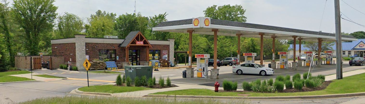
Property Record
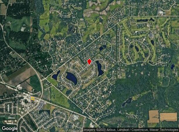
40W299 State Route 64, Campton Hills, IL 60175
NEARBY LISTINGS FOR SALE OR LEASE
Property Detail
40W299 State Route 64
08-23-205-004
Arlington Estates
Commercialnec
Kane
X
Illinois
17089C0234H
4
2023
0.82 AC
2023
Western East/West Corr
852404
Chicago
2,400 SF
Chicago-Naperville-Elgin, IL-IN-WI
DEMOGRAPHICS near 40W299 State Route 64
1 Mile
3 Mile
5 Mile
2024 Total Population
3,948
14,447
61,948
2029 Population
3,891
14,155
60,521
Pop Growth 2024-2029
(1.44%)
(2.02%)
(2.30%)
Average Age
41
41
41
2024 Total Households
1,249
4,722
21,975
HH Growth 2024-2029
(1.52%)
(2.08%)
(2.30%)
Median Household Inc
$195,261
$172,894
$138,898
Avg Household Size
3.10
3.00
2.70
2024 Avg HH Vehicles
3.00
3.00
2.00
Median Home Value
$462,756
$429,435
$393,894
Median Year Built
1991
1991
1993
Nearby Places
- Restaurants
- Banks
- Shops
- Fitness
- Groceries
PUBLIC TRANSPORTATION
COMMUTER RAIL
La Fox Station (Union Pacific West Line - Northeast Illinois Regional Commuter Railroad (Metra))
DRIVE
WALK
Distance
La Fox Station (Union Pacific West Line - Northeast Illinois Regional Commuter Railroad (Metra))
13 min
5.9 mi
Elburn Station (Union Pacific West Line - Northeast Illinois Regional Commuter Railroad (Metra))
DRIVE
WALK
Distance
Elburn Station (Union Pacific West Line - Northeast Illinois Regional Commuter Railroad (Metra))
15 min
8.1 mi
AIRPORT
Chicago O'Hare International
DRIVE
WALK
Distance
Chicago O'Hare International
54 min
38.0 mi
Freight Ports
Port Milwaukee
DRIVE
WALK
Distance
Port Milwaukee
132 min
94.4 mi
Nearby Properties
Address
Land Use
TOTAL SIZE
Lot Size
Zoning
Address
Land Use
TOTAL SIZE
Lot Size
Zoning
Address
Land Use
TOTAL SIZE
Lot Size
Zoning
5,596 SF
15.30 AC
Address
Land Use
TOTAL SIZE
Lot Size
Zoning
Address
Land Use
TOTAL SIZE
Lot Size
Zoning
175,152 SF
14.30 AC
Address
Land Use
TOTAL SIZE
Lot Size
Zoning
0.77 AC
Address
Land Use
TOTAL SIZE
Lot Size
Zoning
16,674 SF
2.90 AC
Address
Land Use
TOTAL SIZE
Lot Size
Zoning
7,632 SF
94.93 AC
Address
Land Use
TOTAL SIZE
Lot Size
Zoning
Address
Land Use
TOTAL SIZE
Lot Size
Zoning
31,944 SF
2.91 AC
Address
Land Use
TOTAL SIZE
Lot Size
Zoning
31,670 SF
5.22 AC
Address
Land Use
TOTAL SIZE
Lot Size
Zoning
25,984 SF
2.43 AC
Address
Land Use
TOTAL SIZE
Lot Size
Zoning
Address
Land Use
TOTAL SIZE
Lot Size
Zoning
8,575 SF
3.42 AC
Address
Land Use
TOTAL SIZE
Lot Size
Zoning
8,857 SF
2.07 AC
Address
Land Use
TOTAL SIZE
Lot Size
Zoning
43,409 SF
4.14 AC
Address
Land Use
TOTAL SIZE
Lot Size
Zoning
24,000 SF
1.87 AC
Address
Land Use
TOTAL SIZE
Lot Size
Zoning
15,674 SF
3.46 AC
Address
Land Use
TOTAL SIZE
Lot Size
Zoning
11,704 SF
5.69 AC
Address
Land Use
TOTAL SIZE
Lot Size
Zoning
22,045 SF
4.11 AC
Address
Land Use
TOTAL SIZE
Lot Size
Zoning
14,411 SF
1.91 AC
Address
Land Use
TOTAL SIZE
Lot Size
Zoning
Address
Land Use
TOTAL SIZE
Lot Size
Zoning
16,468 SF
1.20 AC
Address
Land Use
TOTAL SIZE
Lot Size
Zoning
Address
Land Use
TOTAL SIZE
Lot Size
Zoning
61.01 AC
Address
Land Use
TOTAL SIZE
Lot Size
Zoning
Address
Land Use
TOTAL SIZE
Lot Size
Zoning
22,975 SF
2.28 AC
Address
Land Use
TOTAL SIZE
Lot Size
Zoning
Address
Land Use
TOTAL SIZE
Lot Size
Zoning
11,480 SF
Address
Land Use
TOTAL SIZE
Lot Size
Zoning
17,500 SF
1.64 AC
Address
Land Use
TOTAL SIZE
Lot Size
Zoning
4,833 SF
1.22 AC
The World's #1 Commercial Real Estate Marketplace
Connect with us
© 2025 CoStar Group
The information above has been obtained from sources believed reliable. While we do not doubt its accuracy we have not verified it and make no guarantee, warranty or representation about it. It is your responsibility to independently confirm its accuracy and completeness. Any projections, opinions, assumptions, or estimates used are for example only and do not represent the current or future performance of the property. The value of this transaction to you depends on tax and other factors which should be evaluated by your tax, financial, and legal advisors. You and your advisors should conduct a careful, independent investigation of the property to determine to your satisfaction the suitability of the property for your needs.