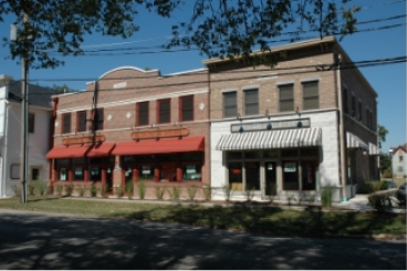
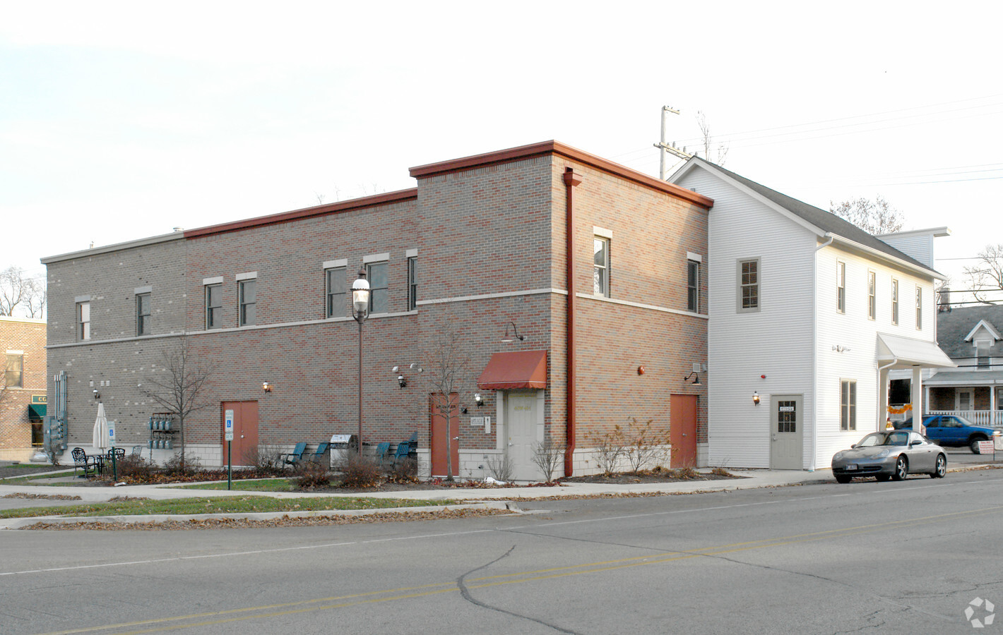
Property Record
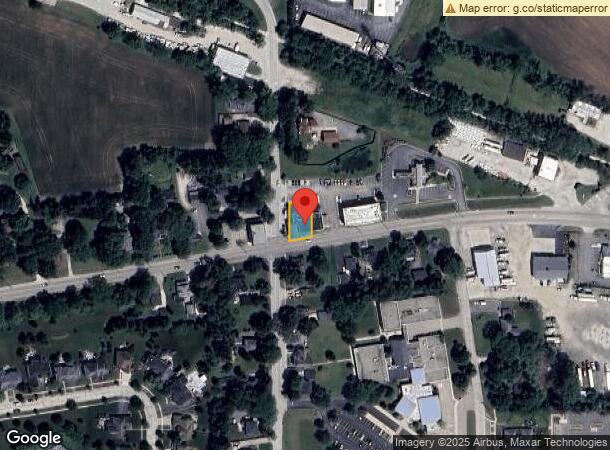
40W484 Rte 64, Wasco, IL 60183
NEARBY LISTINGS FOR SALE OR LEASE
-
-
View all Wasco listings for sale on LoopNet.com
Property Detail
40W484 Rte 64
08-23-202-003
Kane
Commercialnec
Illinois
X
3
17089C0234H
0.36 AC
2023
Western East/West Corr
2023
Chicago
852404
Chicago-Naperville-Elgin, IL-IN-WI
9,600 SF
DEMOGRAPHICS near 40W484 Rte 64
1 Mile
3 Mile
5 Mile
2024 Total Population
3,705
13,318
58,726
2029 Population
3,654
13,056
57,351
Pop Growth 2024-2029
(1.38%)
(1.97%)
(2.34%)
Average Age
41
41
41
2024 Total Households
1,179
4,351
20,626
HH Growth 2024-2029
(1.36%)
(2.00%)
(2.34%)
Median Household Inc
$194,617
$175,379
$141,422
Avg Household Size
3.10
3.00
2.80
2024 Avg HH Vehicles
3.00
3.00
2.00
Median Home Value
$458,390
$432,529
$397,193
Median Year Built
1991
1990
1994
Nearby Places
- Restaurants
- Banks
- Shops
- Fitness
- Groceries
PUBLIC TRANSPORTATION
COMMUTER RAIL
La Fox Station (Union Pacific West Line - Northeast Illinois Regional Commuter Railroad (Metra))
DRIVE
WALK
Distance
La Fox Station (Union Pacific West Line - Northeast Illinois Regional Commuter Railroad (Metra))
10 min
5.0 mi
Elburn Station (Union Pacific West Line - Northeast Illinois Regional Commuter Railroad (Metra))
DRIVE
WALK
Distance
Elburn Station (Union Pacific West Line - Northeast Illinois Regional Commuter Railroad (Metra))
12 min
7.3 mi
AIRPORT
Chicago O'Hare International
DRIVE
WALK
Distance
Chicago O'Hare International
53 min
38.6 mi
Freight Ports
Port Milwaukee
DRIVE
WALK
Distance
Port Milwaukee
132 min
94.9 mi
Nearby Properties
Address
Land Use
TOTAL SIZE
Lot Size
Zoning
Address
Land Use
TOTAL SIZE
Lot Size
Zoning
Address
Land Use
TOTAL SIZE
Lot Size
Zoning
7,632 SF
94.93 AC
Address
Land Use
TOTAL SIZE
Lot Size
Zoning
25,984 SF
2.43 AC
Address
Land Use
TOTAL SIZE
Lot Size
Zoning
8,575 SF
3.42 AC
Address
Land Use
TOTAL SIZE
Lot Size
Zoning
24,000 SF
1.87 AC
Address
Land Use
TOTAL SIZE
Lot Size
Zoning
14,411 SF
1.91 AC
Address
Land Use
TOTAL SIZE
Lot Size
Zoning
Address
Land Use
TOTAL SIZE
Lot Size
Zoning
61.01 AC
Address
Land Use
TOTAL SIZE
Lot Size
Zoning
11,480 SF
Address
Land Use
TOTAL SIZE
Lot Size
Zoning
11,572 SF
1.33 AC
Address
Land Use
TOTAL SIZE
Lot Size
Zoning
11,000 SF
0.34 AC
Address
Land Use
TOTAL SIZE
Lot Size
Zoning
24,000 SF
5 AC
Address
Land Use
TOTAL SIZE
Lot Size
Zoning
2,400 SF
0.82 AC
Address
Land Use
TOTAL SIZE
Lot Size
Zoning
7,410 SF
2.60 AC
Address
Land Use
TOTAL SIZE
Lot Size
Zoning
6,000 SF
2.01 AC
Address
Land Use
TOTAL SIZE
Lot Size
Zoning
4,394 SF
1.25 AC
Address
Land Use
TOTAL SIZE
Lot Size
Zoning
5,800 SF
1.14 AC
Address
Land Use
TOTAL SIZE
Lot Size
Zoning
5,000 SF
0.29 AC
Address
Land Use
TOTAL SIZE
Lot Size
Zoning
3,281 SF
4.02 AC
Address
Land Use
TOTAL SIZE
Lot Size
Zoning
4,092 SF
1.33 AC
Address
Land Use
TOTAL SIZE
Lot Size
Zoning
6,558 SF
1.02 AC
Address
Land Use
TOTAL SIZE
Lot Size
Zoning
7,408 SF
Address
Land Use
TOTAL SIZE
Lot Size
Zoning
0.48 AC
Address
Land Use
TOTAL SIZE
Lot Size
Zoning
4,128 SF
4.67 AC
Address
Land Use
TOTAL SIZE
Lot Size
Zoning
12,292 SF
0.74 AC
Address
Land Use
TOTAL SIZE
Lot Size
Zoning
3,598 SF
7 AC
Address
Land Use
TOTAL SIZE
Lot Size
Zoning
30.93 AC
Address
Land Use
TOTAL SIZE
Lot Size
Zoning
6,095 SF
0.44 AC
Address
Land Use
TOTAL SIZE
Lot Size
Zoning
4,387 SF
1.70 AC
Address
Land Use
TOTAL SIZE
Lot Size
Zoning
5,862 SF
0.56 AC
The World's #1 Commercial Real Estate Marketplace
Connect with us
© 2025 CoStar Group
The information above has been obtained from sources believed reliable. While we do not doubt its accuracy we have not verified it and make no guarantee, warranty or representation about it. It is your responsibility to independently confirm its accuracy and completeness. Any projections, opinions, assumptions, or estimates used are for example only and do not represent the current or future performance of the property. The value of this transaction to you depends on tax and other factors which should be evaluated by your tax, financial, and legal advisors. You and your advisors should conduct a careful, independent investigation of the property to determine to your satisfaction the suitability of the property for your needs.