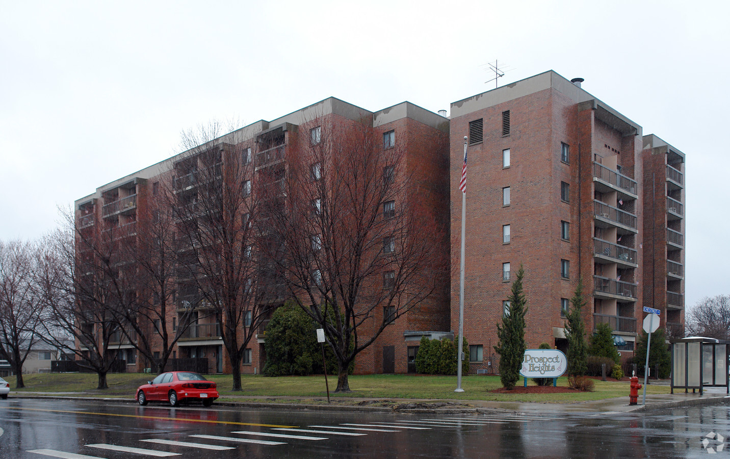
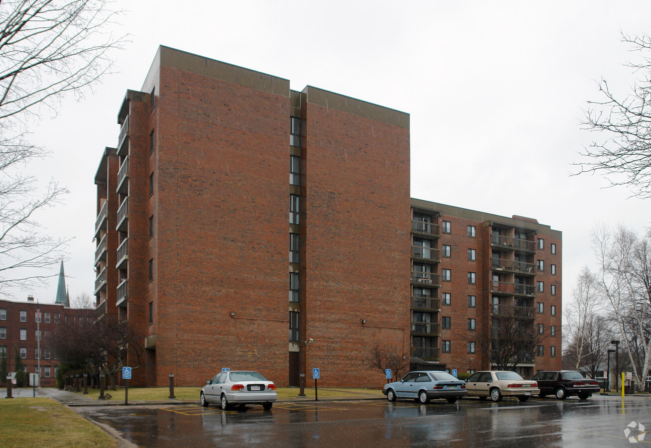
Property Record
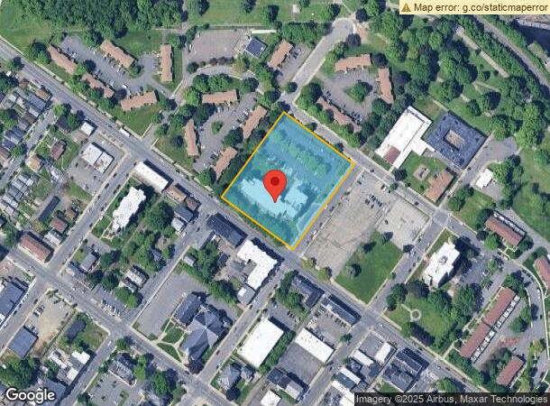
41 Chestnut St, Holyoke, MA 01040
NEARBY LISTINGS FOR SALE OR LEASE
-
-
View all Holyoke listings for sale on LoopNet.com
Property Detail
41 Chestnut St
HOLY-000007-000001-000009-000001
Hampden
Apartment
Massachusetts
X
9.1
25013C0203E
2.20 AC
2024
Downtown Holyoke
2024
Hartford
811700
Springfield, MA
81,022 SF
DEMOGRAPHICS near 41 Chestnut St
1 Mile
3 Mile
5 Mile
2024 Total Population
19,448
73,423
121,817
2029 Population
18,814
70,132
114,531
Pop Growth 2024-2029
(3.26%)
(4.48%)
(5.98%)
Average Age
38
41
41
2024 Total Households
7,991
31,031
51,276
HH Growth 2024-2029
(3.80%)
(4.83%)
(6.34%)
Median Household Inc
$33,839
$53,357
$57,781
Avg Household Size
2.30
2.30
2.20
2024 Avg HH Vehicles
1.00
1.00
2.00
Median Home Value
$207,242
$248,023
$255,672
Median Year Built
1948
1954
1956
Nearby Places
- Restaurants
- Banks
- Shops
- Fitness
- Groceries
PUBLIC TRANSPORTATION
COMMUTER RAIL
Holyoke Amtrak (Valley Flyer - Amtrak, Vermonter - Amtrak)
DRIVE
WALK
Distance
Holyoke Amtrak (Valley Flyer - Amtrak, Vermonter - Amtrak)
1 min
12 min
0.6 mi
Springfield (Amtrak Hartford Line - Hartford Line, Hartford Line - Hartford Line, Lake Shore Limited - Hartford Line, Northeast Regional - Hartford Line, Valley Flyer - Hartford Line, Vermonter - Hartford Line)
DRIVE
WALK
Distance
Springfield (Amtrak Hartford Line - Hartford Line, Hartford Line - Hartford Line, Lake Shore Limited - Hartford Line, Northeast Regional - Hartford Line, Valley Flyer - Hartford Line, Vermonter - Hartford Line)
13 min
8.5 mi
AIRPORT
Bradley International
DRIVE
WALK
Distance
Bradley International
42 min
21.2 mi
Freight Ports
Albany, NY Port
DRIVE
WALK
Distance
Albany, NY Port
104 min
83.8 mi
Nearby Properties
Address
Land Use
TOTAL SIZE
Lot Size
Zoning
Address
Land Use
TOTAL SIZE
Lot Size
Zoning
22.15 AC
R-1A
Address
Land Use
TOTAL SIZE
Lot Size
Zoning
21.80 AC
106
Address
Land Use
TOTAL SIZE
Lot Size
Zoning
171,241 SF
18.94 AC
106
Address
Land Use
TOTAL SIZE
Lot Size
Zoning
189,022 SF
10.62 AC
RA
Address
Land Use
TOTAL SIZE
Lot Size
Zoning
17.72 AC
R-2
Address
Land Use
TOTAL SIZE
Lot Size
Zoning
30.45 AC
106
Address
Land Use
TOTAL SIZE
Lot Size
Zoning
17.64 AC
105
Address
Land Use
TOTAL SIZE
Lot Size
Zoning
4.04 AC
107
Address
Land Use
TOTAL SIZE
Lot Size
Zoning
12.90 AC
IP
Address
Land Use
TOTAL SIZE
Lot Size
Zoning
8.16 AC
RM40
Address
Land Use
TOTAL SIZE
Lot Size
Zoning
2.41 AC
DR
Address
Land Use
TOTAL SIZE
Lot Size
Zoning
23,111 SF
1.43 AC
IA
Address
Land Use
TOTAL SIZE
Lot Size
Zoning
4.66 AC
105
Address
Land Use
TOTAL SIZE
Lot Size
Zoning
196,705 SF
21.45 AC
RM20
Address
Land Use
TOTAL SIZE
Lot Size
Zoning
135,552 SF
13.18 AC
RO
Address
Land Use
TOTAL SIZE
Lot Size
Zoning
26.98 AC
BG
Address
Land Use
TOTAL SIZE
Lot Size
Zoning
19.80 AC
105
Address
Land Use
TOTAL SIZE
Lot Size
Zoning
201,410 SF
13.16 AC
RM20
Address
Land Use
TOTAL SIZE
Lot Size
Zoning
72,239 SF
13.87 AC
R-1A
Address
Land Use
TOTAL SIZE
Lot Size
Zoning
14.47 AC
110
Address
Land Use
TOTAL SIZE
Lot Size
Zoning
194,875 SF
2.75 AC
IG
Address
Land Use
TOTAL SIZE
Lot Size
Zoning
116,625 SF
12.73 AC
111A
Address
Land Use
TOTAL SIZE
Lot Size
Zoning
64,638 SF
9.26 AC
RA2
Address
Land Use
TOTAL SIZE
Lot Size
Zoning
812,675 SF
19.64 AC
BH
Address
Land Use
TOTAL SIZE
Lot Size
Zoning
80,393 SF
1.71 AC
111
Address
Land Use
TOTAL SIZE
Lot Size
Zoning
6.28 AC
IG
Address
Land Use
TOTAL SIZE
Lot Size
Zoning
10.62 AC
111A
Address
Land Use
TOTAL SIZE
Lot Size
Zoning
152,380 SF
11.36 AC
110
Address
Land Use
TOTAL SIZE
Lot Size
Zoning
2.03 AC
111
Address
Land Use
TOTAL SIZE
Lot Size
Zoning
5.88 AC
IG
The World's #1 Commercial Real Estate Marketplace
Connect with us
© 2025 CoStar Group
The information above has been obtained from sources believed reliable. While we do not doubt its accuracy we have not verified it and make no guarantee, warranty or representation about it. It is your responsibility to independently confirm its accuracy and completeness. Any projections, opinions, assumptions, or estimates used are for example only and do not represent the current or future performance of the property. The value of this transaction to you depends on tax and other factors which should be evaluated by your tax, financial, and legal advisors. You and your advisors should conduct a careful, independent investigation of the property to determine to your satisfaction the suitability of the property for your needs.