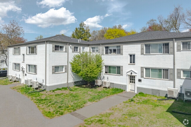
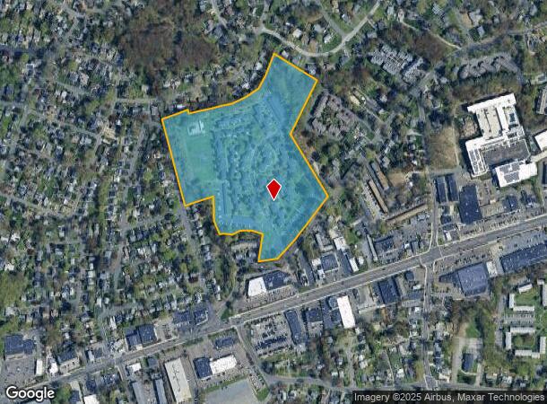
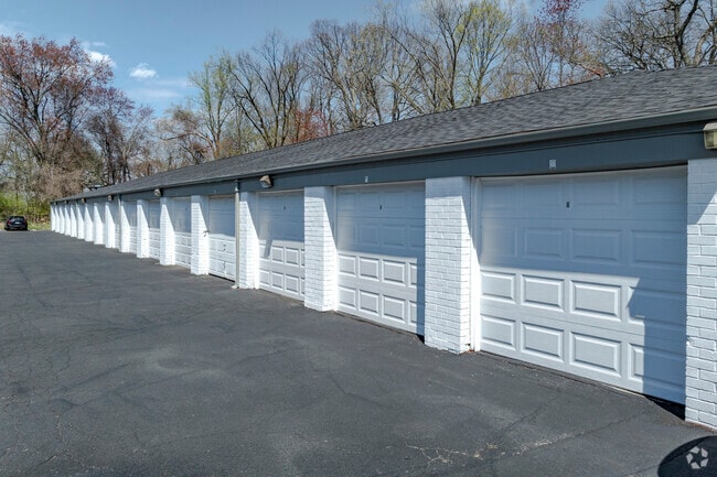
Property Record
41 Wolfpit Ave, Norwalk, CT 06851
NEARBY LISTINGS FOR SALE OR LEASE
Property Detail
41 Wolfpit Ave
NORW-000005-000016-000001A
Dreamy Hollow Coop
Apartmenthouse5plusunits
Fairfield
X
Connecticut
09001C0394F
1a
2025
18.78 AC
2025
Wolfpit
042600
Westchester/So Connecticut
165,384 SF
Bridgeport-Stamford-Norwalk, CT
DEMOGRAPHICS near 41 Wolfpit Ave
1 Mile
3 Mile
5 Mile
2024 Total Population
13,393
88,858
137,674
2029 Population
13,420
88,867
137,851
Pop Growth 2024-2029
+ 0.20%
+ 0.01%
+ 0.13%
Average Age
43
41
41
2024 Total Households
5,199
35,184
52,069
HH Growth 2024-2029
+ 0.19%
+ 0.03%
+ 0.11%
Median Household Inc
$101,993
$97,998
$117,141
Avg Household Size
2.50
2.40
2.60
2024 Avg HH Vehicles
2.00
2.00
2.00
Median Home Value
$492,843
$507,601
$695,462
Median Year Built
1964
1966
1966
Nearby Places
Map Layers
Map Styles
 Street
 Aerial
- Restaurants
- Banks
- Shops
- Fitness
- Groceries
PUBLIC TRANSPORTATION
COMMUTER RAIL
East Norwalk Station (New Haven Line - Metro-North Commuter Railroad Company (Metro-North))
DRIVE
WALK
Distance
East Norwalk Station (New Haven Line - Metro-North Commuter Railroad Company (Metro-North))
3 min
2.1 mi
Westport Station (New Haven Line - Metro-North Commuter Railroad Company (Metro-North))
DRIVE
WALK
Distance
Westport Station (New Haven Line - Metro-North Commuter Railroad Company (Metro-North))
6 min
3.0 mi
AIRPORT
Westchester County
DRIVE
WALK
Distance
Westchester County
36 min
23.3 mi
Tweed/New Haven
DRIVE
WALK
Distance
Tweed/New Haven
55 min
35.9 mi
Freight Ports
Port of New Haven
DRIVE
WALK
Distance
Port of New Haven
50 min
33.0 mi
SALE & LEASE HISTORY
LISTING DATE
SALE/LEASE

May 18, 2022
For Sale
Nearby Properties
Address
Land Use
TOTAL SIZE
Lot Size
Zoning
Address
Land Use
TOTAL SIZE
Lot Size
Zoning
4.49 AC
CBDB
Address
Land Use
TOTAL SIZE
Lot Size
Zoning
749,988 SF
4.52 AC
CBDB
Address
Land Use
TOTAL SIZE
Lot Size
Zoning
339,272 SF
4.07 AC
EO
Address
Land Use
TOTAL SIZE
Lot Size
Zoning
6.80 AC
B2
Address
Land Use
TOTAL SIZE
Lot Size
Zoning
226,920 SF
24.75 AC
B
Address
Land Use
TOTAL SIZE
Lot Size
Zoning
4.44 AC
CBDB
Address
Land Use
TOTAL SIZE
Lot Size
Zoning
248,486 SF
6.57 AC
EO
Address
Land Use
TOTAL SIZE
Lot Size
Zoning
292,852 SF
3.38 AC
EO
Address
Land Use
TOTAL SIZE
Lot Size
Zoning
254,126 SF
3.33 AC
EO
Address
Land Use
TOTAL SIZE
Lot Size
Zoning
269,100 SF
38.37 AC
RI
Address
Land Use
TOTAL SIZE
Lot Size
Zoning
320,588 SF
3.22 AC
EO
Address
Land Use
TOTAL SIZE
Lot Size
Zoning
254,126 SF
3.06 AC
EO
Address
Land Use
TOTAL SIZE
Lot Size
Zoning
252,316 SF
Address
Land Use
TOTAL SIZE
Lot Size
Zoning
271,344 SF
2.36 AC
EO
Address
Land Use
TOTAL SIZE
Lot Size
Zoning
1.44 AC
BCD/H
Address
Land Use
TOTAL SIZE
Lot Size
Zoning
101,688 SF
5 AC
RI
Address
Land Use
TOTAL SIZE
Lot Size
Zoning
21.34 AC
B2
Address
Land Use
TOTAL SIZE
Lot Size
Zoning
Address
Land Use
TOTAL SIZE
Lot Size
Zoning
128,459 SF
1.49 AC
I1
Address
Land Use
TOTAL SIZE
Lot Size
Zoning
13.46 AC
RB
Address
Land Use
TOTAL SIZE
Lot Size
Zoning
13.10 AC
RBD
Address
Land Use
TOTAL SIZE
Lot Size
Zoning
29.50 AC
DOSRD1
Address
Land Use
TOTAL SIZE
Lot Size
Zoning
108,119 SF
3.62 AC
I1
Address
Land Use
TOTAL SIZE
Lot Size
Zoning
41.63 AC
A2
Address
Land Use
TOTAL SIZE
Lot Size
Zoning
200,704 SF
Address
Land Use
TOTAL SIZE
Lot Size
Zoning
175,791 SF
1.58 AC
CBDB
Address
Land Use
TOTAL SIZE
Lot Size
Zoning
23.15 AC
A
Address
Land Use
TOTAL SIZE
Lot Size
Zoning
12.30 AC
AA
Address
Land Use
TOTAL SIZE
Lot Size
Zoning
141,174 SF
10.75 AC
B2
The World's #1 Commercial Real Estate Marketplace
Connect with us
© 2025 CoStar Group
The information above has been obtained from sources believed reliable. While we do not doubt its accuracy we have not verified it and make no guarantee, warranty or representation about it. It is your responsibility to independently confirm its accuracy and completeness. Any projections, opinions, assumptions, or estimates used are for example only and do not represent the current or future performance of the property. The value of this transaction to you depends on tax and other factors which should be evaluated by your tax, financial, and legal advisors. You and your advisors should conduct a careful, independent investigation of the property to determine to your satisfaction the suitability of the property for your needs.