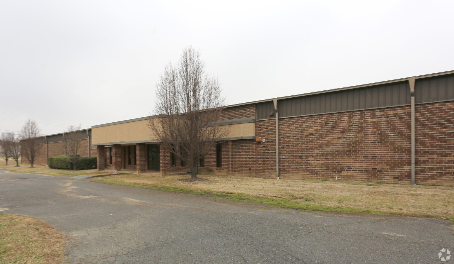
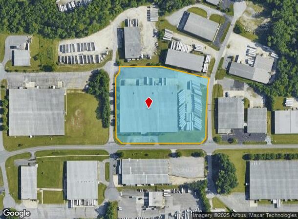
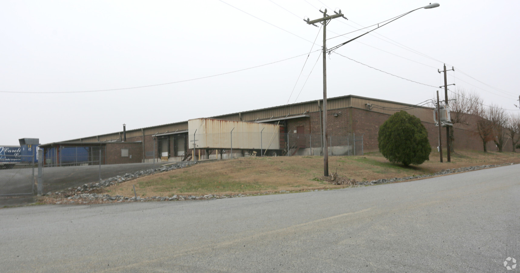
Property Record
4100 Cheyenne Dr, Archdale, NC 27263
NEARBY LISTINGS FOR SALE OR LEASE
Property Detail
4100 Cheyenne Dr
7718-61-9903
Cheyenne Dr
Warehouse
CHEYENNE DR;SEMINOLE DR NAVAJO DR PL:PB111-PG89
X
Randolph
3710771800J
North Carolina
2024
6.39 AC
2024
NW Randolph Cnty/Archdale
031504
Greensboro/Winston-Salem
112,900 SF
Greensboro-High Point, NC
DEMOGRAPHICS near 4100 Cheyenne Dr
1 Mile
3 Mile
5 Mile
2024 Total Population
3,552
21,206
50,000
2029 Population
3,650
21,715
51,120
Pop Growth 2024-2029
+ 2.76%
+ 2.40%
+ 2.24%
Average Age
43
42
40
2024 Total Households
1,497
8,596
19,980
HH Growth 2024-2029
+ 2.67%
+ 2.38%
+ 2.25%
Median Household Inc
$61,720
$58,466
$49,501
Avg Household Size
2.30
2.40
2.40
2024 Avg HH Vehicles
2.00
2.00
2.00
Median Home Value
$162,481
$155,210
$149,072
Median Year Built
1981
1978
1976
Nearby Places
- Restaurants
- Banks
- Shops
- Fitness
- Groceries
PUBLIC TRANSPORTATION
COMMUTER RAIL
High Point Station (Piedmont - North Carolina by Train (NC Train))
DRIVE
WALK
Distance
High Point Station (Piedmont - North Carolina by Train (NC Train))
11 min
5.8 mi
AIRPORT
Piedmont Triad International
DRIVE
WALK
Distance
Piedmont Triad International
34 min
21.5 mi
Freight Ports
Port of Wilmington
DRIVE
WALK
Distance
Port of Wilmington
246 min
206.3 mi
SALE & LEASE HISTORY
LISTING DATE
SALE/LEASE

Jan 18, 2019
For Lease
Nearby Properties
Address
Land Use
TOTAL SIZE
Lot Size
Zoning
Address
Land Use
TOTAL SIZE
Lot Size
Zoning
7,898 SF
68.51 AC
M2
Address
Land Use
TOTAL SIZE
Lot Size
Zoning
355,633 SF
63.42 AC
HI
Address
Land Use
TOTAL SIZE
Lot Size
Zoning
196,353 SF
13.76 AC
RC
Address
Land Use
TOTAL SIZE
Lot Size
Zoning
127,800 SF
57.35 AC
M1
Address
Land Use
TOTAL SIZE
Lot Size
Zoning
245,194 SF
23.44 AC
LI
Address
Land Use
TOTAL SIZE
Lot Size
Zoning
107,417 SF
6.46 AC
CU-RM-8
Address
Land Use
TOTAL SIZE
Lot Size
Zoning
101,612 SF
15.82 AC
CU-RM-8
Address
Land Use
TOTAL SIZE
Lot Size
Zoning
299,394 SF
8.60 AC
M2
Address
Land Use
TOTAL SIZE
Lot Size
Zoning
272 SF
15.36 AC
M2
Address
Land Use
TOTAL SIZE
Lot Size
Zoning
170,516 SF
17.08 AC
CU-SC
Address
Land Use
TOTAL SIZE
Lot Size
Zoning
7,680 SF
9.95 AC
GRD
Address
Land Use
TOTAL SIZE
Lot Size
Zoning
69,094 SF
5.47 AC
M2
Address
Land Use
TOTAL SIZE
Lot Size
Zoning
109,950 SF
28.29 AC
M1
Address
Land Use
TOTAL SIZE
Lot Size
Zoning
28.20 AC
R40
Address
Land Use
TOTAL SIZE
Lot Size
Zoning
98,287 SF
14.50 AC
CU-RM-8
Address
Land Use
TOTAL SIZE
Lot Size
Zoning
7,680 SF
7.51 AC
GRD
Address
Land Use
TOTAL SIZE
Lot Size
Zoning
150,970 SF
36.21 AC
M1
Address
Land Use
TOTAL SIZE
Lot Size
Zoning
45,224 SF
8.03 AC
OI
Address
Land Use
TOTAL SIZE
Lot Size
Zoning
21,000 SF
8.45 AC
B1
Address
Land Use
TOTAL SIZE
Lot Size
Zoning
104,623 SF
55.13 AC
R40
Address
Land Use
TOTAL SIZE
Lot Size
Zoning
5,040 SF
14.88 AC
HI
Address
Land Use
TOTAL SIZE
Lot Size
Zoning
9.70 AC
R40
Address
Land Use
TOTAL SIZE
Lot Size
Zoning
48,913 SF
2.25 AC
B1
Address
Land Use
TOTAL SIZE
Lot Size
Zoning
30,000 SF
54.80 AC
M1
Address
Land Use
TOTAL SIZE
Lot Size
Zoning
74,290 SF
7.31 AC
CU-SC
Address
Land Use
TOTAL SIZE
Lot Size
Zoning
47,822 SF
5.76 AC
SU R10
Address
Land Use
TOTAL SIZE
Lot Size
Zoning
35,620 SF
5.47 AC
M2
Address
Land Use
TOTAL SIZE
Lot Size
Zoning
240,510 SF
4.60 AC
LI
Address
Land Use
TOTAL SIZE
Lot Size
Zoning
246,972 SF
19.83 AC
HI
Address
Land Use
TOTAL SIZE
Lot Size
Zoning
53,520 SF
5.48 AC
B1
The World's #1 Commercial Real Estate Marketplace
Connect with us
© 2025 CoStar Group
The information above has been obtained from sources believed reliable. While we do not doubt its accuracy we have not verified it and make no guarantee, warranty or representation about it. It is your responsibility to independently confirm its accuracy and completeness. Any projections, opinions, assumptions, or estimates used are for example only and do not represent the current or future performance of the property. The value of this transaction to you depends on tax and other factors which should be evaluated by your tax, financial, and legal advisors. You and your advisors should conduct a careful, independent investigation of the property to determine to your satisfaction the suitability of the property for your needs.