Property Record
411 Chapel Dr, Tallahassee, FL 32304
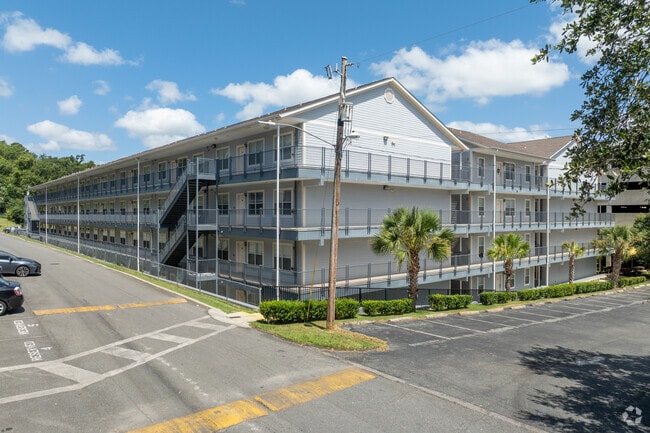


Property Detail
411 Chapel Dr
21-34-81-000-213.5
SEC 35 1N 1W PART OF LOT 2 WHITE SUB AND CAMPUS VIEW OR 4628/1358 AND 4932/2217 OR 949/7 1675/554
Multifamilydwelling
LEON
UT
Florida
B and X Area of moderate flood hazard, usually the area between the limits of the 100-year and 500-year floods.
2
2025
5.88 AC
2025
Chapel Ridge
002005
Tallahassee
1,048,414 SF
Tallahassee, FL
NEARBY LISTINGS FOR SALE OR LEASE
DEMOGRAPHICS near 411 Chapel Dr
1 mile
3 mile
5 mile
2025 Total Population
25,524
99,336
166,302
2030 Population
24,816
100,011
168,492
Pop Growth 2025-2030
(2.77%)
+ 0.68%
+ 1.32%
Average Age
26
31
34
2025 Total Households
9,080
40,445
70,833
HH Growth 2025-2030
(4.10%)
+ 0.62%
+ 1.41%
Median Household Inc
$30,150
$40,374
$50,283
Avg Household Size
2.00
2.10
2.10
2025 Avg HH Vehicles
2.00
2.00
2.00
Median Home Value
$154,148
$237,662
$257,076
Median Year Built
1985
1981
1984
Nearby Places
Map Layers
Map Styles
 Street
 Aerial
Layers
 Traffic
 Biking
Places
Listings with unknown addresses are not visible on the map
- Restaurants
- Banks
- Shops
- Fitness
- Groceries
PUBLIC TRANSPORTATION
AIRPORT
Tallahassee International
Drive
Walk
Distance
Tallahassee International
12 min
6.0 mi
Freight Ports
Port of Panama City
Drive
Walk
Distance
Port of Panama City
140 min
99.0 mi
Nearby Properties
Address
Land Use
TOTAL SIZE
Lot Size
Zoning
Address
Land Use
TOTAL SIZE
Lot Size
Zoning
1,635,322 SF
29.76 AC
UT
Address
Land Use
TOTAL SIZE
Lot Size
Zoning
6,686,582 SF
86.50 AC
UT
Address
Land Use
TOTAL SIZE
Lot Size
Zoning
4,577,528 SF
108.47 AC
UT
Address
Land Use
TOTAL SIZE
Lot Size
Zoning
3,647,358 SF
49.17 AC
UT
Address
Land Use
TOTAL SIZE
Lot Size
Zoning
3,882,850 SF
22.64 AC
CM
Address
Land Use
TOTAL SIZE
Lot Size
Zoning
1,604,893 SF
175.71 AC
MR1
Address
Land Use
TOTAL SIZE
Lot Size
Zoning
2,330,342 SF
69.26 AC
UT
Address
Land Use
TOTAL SIZE
Lot Size
Zoning
807,298 SF
145.81 AC
UT
Address
Land Use
TOTAL SIZE
Lot Size
Zoning
2,312,757 SF
10.87 AC
CCPD
Address
Land Use
TOTAL SIZE
Lot Size
Zoning
479,864 SF
19.01 AC
DI
Address
Land Use
TOTAL SIZE
Lot Size
Zoning
1,545,007 SF
44.85 AC
UT
Address
Land Use
TOTAL SIZE
Lot Size
Zoning
859,455 SF
3.79 AC
CU45
Address
Land Use
TOTAL SIZE
Lot Size
Zoning
367,978 SF
2.52 AC
RO
Address
Land Use
TOTAL SIZE
Lot Size
Zoning
704,857 SF
4.95 AC
UT
Address
Land Use
TOTAL SIZE
Lot Size
Zoning
806,710 SF
2.96 AC
CCPD
Address
Land Use
TOTAL SIZE
Lot Size
Zoning
959,505 SF
32.03 AC
M1
Address
Land Use
TOTAL SIZE
Lot Size
Zoning
664,514 SF
2.49 AC
UT
Address
Land Use
TOTAL SIZE
Lot Size
Zoning
369,383 SF
4.51 AC
UT
Address
Land Use
TOTAL SIZE
Lot Size
Zoning
899,528 SF
3.34 AC
CCPD
Address
Land Use
TOTAL SIZE
Lot Size
Zoning
758,762 SF
20.82 AC
UT
Address
Land Use
TOTAL SIZE
Lot Size
Zoning
307,884 SF
2.97 AC
CCPD
Address
Land Use
TOTAL SIZE
Lot Size
Zoning
616,484 SF
30.15 AC
UT
Address
Land Use
TOTAL SIZE
Lot Size
Zoning
428,190 SF
2.24 AC
CCPD
Address
Land Use
TOTAL SIZE
Lot Size
Zoning
452,530 SF
10.30 AC
UV
Address
Land Use
TOTAL SIZE
Lot Size
Zoning
719,149 SF
40.73 AC
MR1
Address
Land Use
TOTAL SIZE
Lot Size
Zoning
445,676 SF
23.50 AC
PUD
Address
Land Use
TOTAL SIZE
Lot Size
Zoning
249,612 SF
1.67 AC
CCPD
Address
Land Use
TOTAL SIZE
Lot Size
Zoning
652,729 SF
1.71 AC
UT
Address
Land Use
TOTAL SIZE
Lot Size
Zoning
721,205 SF
6.19 AC
UT
Address
Land Use
TOTAL SIZE
Lot Size
Zoning
414,216 SF
2.23 AC
CU45
The World's #1 Commercial Real Estate Marketplace
Connect with us
© 2026 CoStar Group
The information above has been obtained from sources believed reliable. While we do not doubt its accuracy we have not verified it and make no guarantee, warranty or representation about it. It is your responsibility to independently confirm its accuracy and completeness. Any projections, opinions, assumptions, or estimates used are for example only and do not represent the current or future performance of the property. The value of this transaction to you depends on tax and other factors which should be evaluated by your tax, financial, and legal advisors. You and your advisors should conduct a careful, independent investigation of the property to determine to your satisfaction the suitability of the property for your needs.