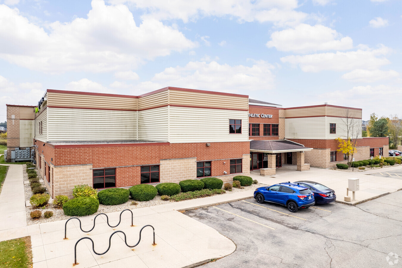
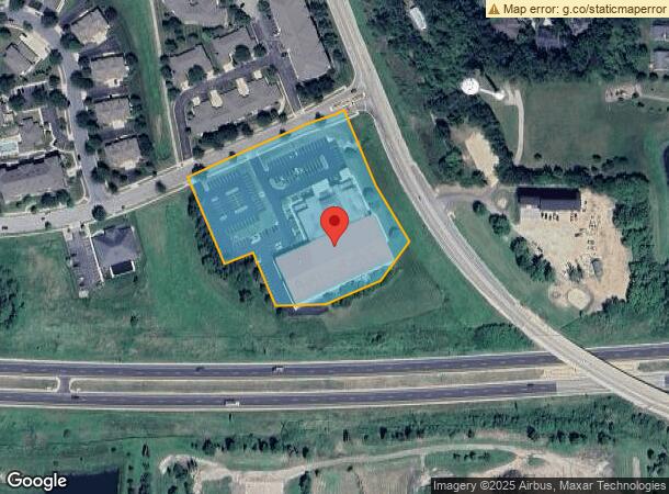
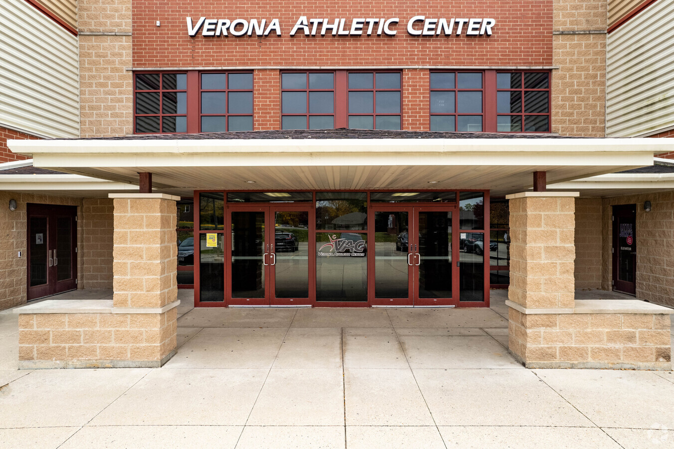
Property Record
411 Prairie Heights Dr, Verona, WI 53593
NEARBY LISTINGS FOR SALE OR LEASE
Property Detail
411 Prairie Heights Dr
Madison, WI
Prairie Crest
0608-224-6550-2
LOT 1 CSM 12490 CS78/94&96-6/30/2008 F/K/A PRAIRIE CREST LOTS 1 & 2 DESCR AS SEC 22-6-8 PRT SE1/4SE1/4 (4.284 ACRES)
Commercialnec
Dane
X
Wisconsin
55025C0557G
1,2
2023
4.18 AC
2023
Outlying Dane West
013700
Milwaukee/Madison
DEMOGRAPHICS near 411 Prairie Heights Dr
1 Mile
3 Mile
5 Mile
2024 Total Population
5,719
22,293
63,378
2029 Population
5,978
23,289
65,797
Pop Growth 2024-2029
+ 4.53%
+ 4.47%
+ 3.82%
Average Age
36
38
38
2024 Total Households
2,204
8,947
25,833
HH Growth 2024-2029
+ 4.67%
+ 4.64%
+ 3.94%
Median Household Inc
$89,274
$107,033
$98,759
Avg Household Size
2.60
2.40
2.40
2024 Avg HH Vehicles
2.00
2.00
2.00
Median Home Value
$361,243
$362,727
$351,195
Median Year Built
2004
2001
1995
Nearby Places
- Restaurants
- Banks
- Shops
- Fitness
- Groceries
PUBLIC TRANSPORTATION
AIRPORT
Dane County Regional/Truax Field
DRIVE
WALK
Distance
Dane County Regional/Truax Field
31 min
16.5 mi
Freight Ports
Port Milwaukee
DRIVE
WALK
Distance
Port Milwaukee
112 min
93.2 mi
SALE & LEASE HISTORY
LISTING DATE
SALE/LEASE

Sep 25, 2016
For Lease
Sep 23, 2016
For Sale
Mar 24, 2022
For Lease
Aug 04, 2017
For Lease
Apr 01, 2022
For Sale
Nearby Properties
Address
Land Use
TOTAL SIZE
Lot Size
Zoning
Address
Land Use
TOTAL SIZE
Lot Size
Zoning
16.87 AC
SE
Address
Land Use
TOTAL SIZE
Lot Size
Zoning
77,296 SF
4.84 AC
TR-U1
Address
Land Use
TOTAL SIZE
Lot Size
Zoning
18,242 SF
4.45 AC
TR-U1
Address
Land Use
TOTAL SIZE
Lot Size
Zoning
Address
Land Use
TOTAL SIZE
Lot Size
Zoning
6.57 AC
SR-V2
Address
Land Use
TOTAL SIZE
Lot Size
Zoning
13.06 AC
Address
Land Use
TOTAL SIZE
Lot Size
Zoning
Address
Land Use
TOTAL SIZE
Lot Size
Zoning
3.56 AC
Address
Land Use
TOTAL SIZE
Lot Size
Zoning
3.35 AC
Address
Land Use
TOTAL SIZE
Lot Size
Zoning
58,993 SF
3.29 AC
TR-U1
Address
Land Use
TOTAL SIZE
Lot Size
Zoning
6.66 AC
Address
Land Use
TOTAL SIZE
Lot Size
Zoning
3.71 AC
Address
Land Use
TOTAL SIZE
Lot Size
Zoning
5.58 AC
Address
Land Use
TOTAL SIZE
Lot Size
Zoning
17.81 AC
Address
Land Use
TOTAL SIZE
Lot Size
Zoning
20,787 SF
4.56 AC
TR-U1
Address
Land Use
TOTAL SIZE
Lot Size
Zoning
5.23 AC
Address
Land Use
TOTAL SIZE
Lot Size
Zoning
3.62 AC
Address
Land Use
TOTAL SIZE
Lot Size
Zoning
6.32 AC
Address
Land Use
TOTAL SIZE
Lot Size
Zoning
142,001 SF
4.18 AC
SR-V2
Address
Land Use
TOTAL SIZE
Lot Size
Zoning
7.77 AC
Address
Land Use
TOTAL SIZE
Lot Size
Zoning
13.42 AC
Address
Land Use
TOTAL SIZE
Lot Size
Zoning
5.77 AC
Address
Land Use
TOTAL SIZE
Lot Size
Zoning
56,146 SF
1.33 AC
PD
Address
Land Use
TOTAL SIZE
Lot Size
Zoning
5.17 AC
Address
Land Use
TOTAL SIZE
Lot Size
Zoning
Address
Land Use
TOTAL SIZE
Lot Size
Zoning
79,759 SF
1.15 AC
PD
Address
Land Use
TOTAL SIZE
Lot Size
Zoning
2.76 AC
Address
Land Use
TOTAL SIZE
Lot Size
Zoning
72,894 SF
2.14 AC
SR-V2
Address
Land Use
TOTAL SIZE
Lot Size
Zoning
13,502 SF
1.63 AC
TR-U1
The World's #1 Commercial Real Estate Marketplace
Connect with us
© 2025 CoStar Group
The information above has been obtained from sources believed reliable. While we do not doubt its accuracy we have not verified it and make no guarantee, warranty or representation about it. It is your responsibility to independently confirm its accuracy and completeness. Any projections, opinions, assumptions, or estimates used are for example only and do not represent the current or future performance of the property. The value of this transaction to you depends on tax and other factors which should be evaluated by your tax, financial, and legal advisors. You and your advisors should conduct a careful, independent investigation of the property to determine to your satisfaction the suitability of the property for your needs.