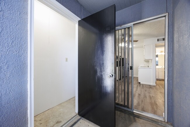
Property Record
4111 Westcity Ct, El Paso, TX 79902

NEARBY LISTINGS FOR SALE OR LEASE
Property Detail
4111 Westcity Ct
El Paso
Westside Center
El Paso, TX
El Paso
W182-999-0020-5000
Texas
Apartment
12.77 AC
231,480 SF
Mission Hills South
DEMOGRAPHICS near 4111 Westcity Ct
1 Mile
3 Mile
5 Mile
2024 Total Population
6,944
58,743
152,050
2029 Population
7,146
60,435
155,199
Pop Growth 2024-2029
+ 2.91%
+ 2.88%
+ 2.07%
Average Age
38
39
39
2024 Total Households
2,936
25,695
61,323
HH Growth 2024-2029
+ 3.03%
+ 2.93%
+ 2.09%
Median Household Inc
$49,830
$40,268
$40,283
Avg Household Size
2.10
2.10
2.40
2024 Avg HH Vehicles
2.00
1.00
2.00
Median Home Value
$276,196
$190,742
$169,605
Median Year Built
1968
1971
1971
Nearby Places
Map Layers
Map Styles
 Street
 Aerial
- Restaurants
- Banks
- Shops
- Fitness
- Groceries
PUBLIC TRANSPORTATION
AIRPORT
El Paso International
DRIVE
WALK
Distance
El Paso International
28 min
15.4 mi
Freight Ports
Port of Corpus Christi
DRIVE
WALK
Distance
Port of Corpus Christi
686 min
697.6 mi
SALE & LEASE HISTORY
LISTING DATE
SALE/LEASE

Jun 28, 2021
For Sale
Jan 28, 2019
For Sale
Nearby Properties
Address
Land Use
TOTAL SIZE
Lot Size
Zoning
Address
Land Use
TOTAL SIZE
Lot Size
Zoning
1,387,028 SF
65.27 AC
R4
Address
Land Use
TOTAL SIZE
Lot Size
Zoning
558,800 SF
1.55 AC
C5
Address
Land Use
TOTAL SIZE
Lot Size
Zoning
318,665 SF
1.43 AC
C5
Address
Land Use
TOTAL SIZE
Lot Size
Zoning
859,302 SF
21.17 AC
C2
Address
Land Use
TOTAL SIZE
Lot Size
Zoning
439,669 SF
33.95 AC
A2
Address
Land Use
TOTAL SIZE
Lot Size
Zoning
324,056 SF
1.49 AC
C4
Address
Land Use
TOTAL SIZE
Lot Size
Zoning
1 SF
5.75 AC
C5S
Address
Land Use
TOTAL SIZE
Lot Size
Zoning
347,241 SF
Address
Land Use
TOTAL SIZE
Lot Size
Zoning
89,935 SF
7.01 AC
PMD
Address
Land Use
TOTAL SIZE
Lot Size
Zoning
169,031 SF
1.22 AC
SP
Address
Land Use
TOTAL SIZE
Lot Size
Zoning
313,532 SF
5.73 AC
C1S
Address
Land Use
TOTAL SIZE
Lot Size
Zoning
289,146 SF
11.87 AC
C1S
Address
Land Use
TOTAL SIZE
Lot Size
Zoning
1 SF
45.46 AC
M1
Address
Land Use
TOTAL SIZE
Lot Size
Zoning
191,148 SF
20.29 AC
C3
Address
Land Use
TOTAL SIZE
Lot Size
Zoning
164,712 SF
4.68 AC
GM
Address
Land Use
TOTAL SIZE
Lot Size
Zoning
629,002 SF
1.22 AC
C5
Address
Land Use
TOTAL SIZE
Lot Size
Zoning
128,916 SF
1.50 AC
C5
Address
Land Use
TOTAL SIZE
Lot Size
Zoning
226,548 SF
18.50 AC
PR2
Address
Land Use
TOTAL SIZE
Lot Size
Zoning
185,273 SF
11.78 AC
C3S
Address
Land Use
TOTAL SIZE
Lot Size
Zoning
86,391 SF
1.55 AC
C5
Address
Land Use
TOTAL SIZE
Lot Size
Zoning
156,184 SF
8.39 AC
R5S
Address
Land Use
TOTAL SIZE
Lot Size
Zoning
60,057 SF
7.22 AC
SCZ
Address
Land Use
TOTAL SIZE
Lot Size
Zoning
114,289 SF
3.03 AC
R5
Address
Land Use
TOTAL SIZE
Lot Size
Zoning
185,087 SF
10.27 AC
A3S
Address
Land Use
TOTAL SIZE
Lot Size
Zoning
420,509 SF
1.02 AC
C5
Address
Land Use
TOTAL SIZE
Lot Size
Zoning
229,821 SF
10.18 AC
A2
Address
Land Use
TOTAL SIZE
Lot Size
Zoning
128,560 SF
0.72 AC
M1
Address
Land Use
TOTAL SIZE
Lot Size
Zoning
73,574 SF
0.69 AC
C5
Address
Land Use
TOTAL SIZE
Lot Size
Zoning
155,308 SF
The World's #1 Commercial Real Estate Marketplace
Connect with us
© 2026 CoStar Group
The information above has been obtained from sources believed reliable. While we do not doubt its accuracy we have not verified it and make no guarantee, warranty or representation about it. It is your responsibility to independently confirm its accuracy and completeness. Any projections, opinions, assumptions, or estimates used are for example only and do not represent the current or future performance of the property. The value of this transaction to you depends on tax and other factors which should be evaluated by your tax, financial, and legal advisors. You and your advisors should conduct a careful, independent investigation of the property to determine to your satisfaction the suitability of the property for your needs.