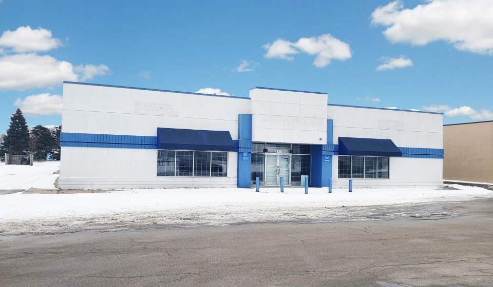
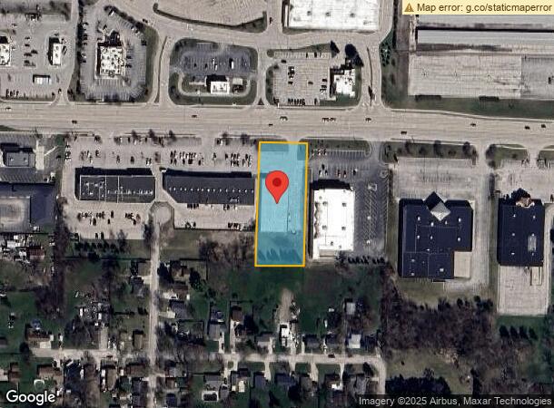
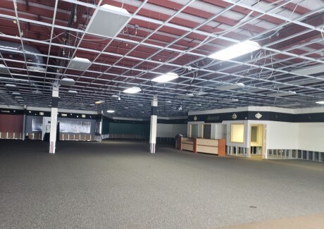
Property Record
4130 Wilder Rd, Bay City, MI 48706
NEARBY LISTINGS FOR SALE OR LEASE
Property Detail
4130 Wilder Rd
Bay City, MI
Smithville Add Bay City
09-160-016-103-023-00
PARCEL OF LAND BEING LOT 3 & W 2.50 FT LOT 2 & PT OF VAC BRAWNER ST INCLUDING FORMER PENN CENTRAL RR ROW ADJ ON N IN
Storebuilding
Bay
X
Michigan
26017C0332F
2-3
2024
1.33 AC
2024
Midland/Flint
281300
Other Market Areas
22,375 SF
DEMOGRAPHICS near 4130 Wilder Rd
1 Mile
3 Mile
5 Mile
2024 Total Population
6,164
45,704
69,612
2029 Population
6,096
45,315
68,968
Pop Growth 2024-2029
(1.10%)
(0.85%)
(0.93%)
Average Age
42
42
43
2024 Total Households
2,691
20,142
30,632
HH Growth 2024-2029
(1.19%)
(0.92%)
(0.94%)
Median Household Inc
$53,207
$49,656
$50,979
Avg Household Size
2.20
2.20
2.20
2024 Avg HH Vehicles
2.00
2.00
2.00
Median Home Value
$67,571
$87,979
$97,544
Median Year Built
1956
1953
1956
Nearby Places
- Restaurants
- Banks
- Shops
- Fitness
- Groceries
PUBLIC TRANSPORTATION
AIRPORT
MBS International
DRIVE
WALK
Distance
MBS International
25 min
16.3 mi
Freight Ports
Port of Toledo
DRIVE
WALK
Distance
Port of Toledo
185 min
160.9 mi
SALE & LEASE HISTORY
LISTING DATE
SALE/LEASE

Jul 16, 2019
For Lease
Feb 28, 2022
For Lease
Feb 28, 2022
For Sale
Nearby Properties
Address
Land Use
TOTAL SIZE
Lot Size
Zoning
Address
Land Use
TOTAL SIZE
Lot Size
Zoning
97,304 SF
3.61 AC
C-3 CTRL B
Address
Land Use
TOTAL SIZE
Lot Size
Zoning
164,241 SF
10.08 AC
RM-1
Address
Land Use
TOTAL SIZE
Lot Size
Zoning
14.34 AC
I-1
Address
Land Use
TOTAL SIZE
Lot Size
Zoning
536,802 SF
450 AC
I-2
Address
Land Use
TOTAL SIZE
Lot Size
Zoning
64,086 SF
6.78 AC
R-3
Address
Land Use
TOTAL SIZE
Lot Size
Zoning
16.52 AC
R-3
Address
Land Use
TOTAL SIZE
Lot Size
Zoning
167,100 SF
35.59 AC
M-2 GEN IN
Address
Land Use
TOTAL SIZE
Lot Size
Zoning
60,200 SF
5.30 AC
C-3 CTRL B
Address
Land Use
TOTAL SIZE
Lot Size
Zoning
169,440 SF
16.54 AC
RM-1
Address
Land Use
TOTAL SIZE
Lot Size
Zoning
1.87 AC
C-3 CTRL B
Address
Land Use
TOTAL SIZE
Lot Size
Zoning
32,759 SF
1.20 AC
Address
Land Use
TOTAL SIZE
Lot Size
Zoning
41,011 SF
8.28 AC
C-2
Address
Land Use
TOTAL SIZE
Lot Size
Zoning
57,000 SF
1.09 AC
C-3 CTRL B
Address
Land Use
TOTAL SIZE
Lot Size
Zoning
50,965 SF
0.83 AC
C-3 CTRL B
Address
Land Use
TOTAL SIZE
Lot Size
Zoning
Address
Land Use
TOTAL SIZE
Lot Size
Zoning
45,072 SF
9.60 AC
C-2B HWY B
Address
Land Use
TOTAL SIZE
Lot Size
Zoning
73.75 AC
Address
Land Use
TOTAL SIZE
Lot Size
Zoning
Address
Land Use
TOTAL SIZE
Lot Size
Zoning
163,673 SF
17.85 AC
RM-1
Address
Land Use
TOTAL SIZE
Lot Size
Zoning
156,600 SF
18.14 AC
M-1 LT IND
Address
Land Use
TOTAL SIZE
Lot Size
Zoning
7,200 SF
1.39 AC
C-3 CTRL B
Address
Land Use
TOTAL SIZE
Lot Size
Zoning
139,237 SF
5.47 AC
C-3 CTRL B
Address
Land Use
TOTAL SIZE
Lot Size
Zoning
63,200 SF
1.97 AC
C-3 CTRL B
Address
Land Use
TOTAL SIZE
Lot Size
Zoning
Address
Land Use
TOTAL SIZE
Lot Size
Zoning
32.23 AC
Address
Land Use
TOTAL SIZE
Lot Size
Zoning
12,900 SF
65.60 AC
M-2 GEN IN
Address
Land Use
TOTAL SIZE
Lot Size
Zoning
6.89 AC
Address
Land Use
TOTAL SIZE
Lot Size
Zoning
49,575 SF
4.77 AC
RM-1
Address
Land Use
TOTAL SIZE
Lot Size
Zoning
107,921 SF
10.91 AC
C-2
Address
Land Use
TOTAL SIZE
Lot Size
Zoning
The World's #1 Commercial Real Estate Marketplace
Connect with us
© 2025 CoStar Group
The information above has been obtained from sources believed reliable. While we do not doubt its accuracy we have not verified it and make no guarantee, warranty or representation about it. It is your responsibility to independently confirm its accuracy and completeness. Any projections, opinions, assumptions, or estimates used are for example only and do not represent the current or future performance of the property. The value of this transaction to you depends on tax and other factors which should be evaluated by your tax, financial, and legal advisors. You and your advisors should conduct a careful, independent investigation of the property to determine to your satisfaction the suitability of the property for your needs.