Property Record
4139 Us Highway 181 N, Floresville, TX 78114

NEARBY LISTINGS FOR SALE OR LEASE
-
-
View all Floresville listings for sale on LoopNet.com
Property Detail
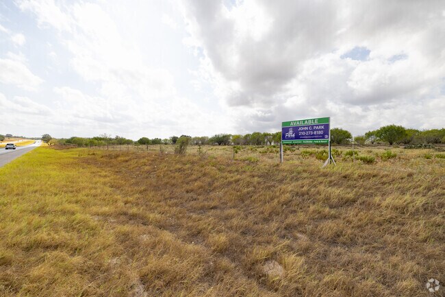
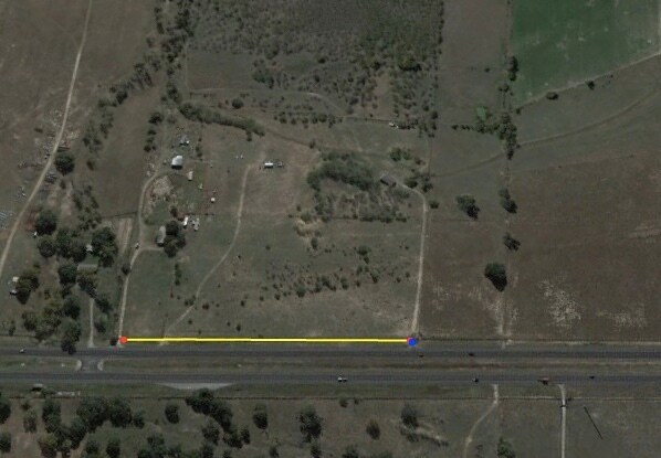
4139 Us Highway 181 N
San Antonio-New Braunfels, TX
S & J Arocha Sur
10181
A0001 S & J AROCHA SUR, TRACT 77B, ACRES 13.29
Agriculturalland
Wilson
A
Texas
48493C0300C
77b
2024
13.29 AC
2025
Wilson County
000300
San Antonio
DEMOGRAPHICS near 4139 Us Highway 181 N
1 Mile
3 Mile
5 Mile
2024 Total Population
369
4,103
14,408
2029 Population
424
4,740
16,757
Pop Growth 2024-2029
+ 14.91%
+ 15.53%
+ 16.30%
Average Age
42
41
41
2024 Total Households
130
1,409
4,944
HH Growth 2024-2029
+ 15.38%
+ 15.40%
+ 16.24%
Median Household Inc
$92,499
$113,807
$92,308
Avg Household Size
2.80
2.90
2.90
2024 Avg HH Vehicles
3.00
3.00
3.00
Median Home Value
$304,348
$331,214
$276,982
Median Year Built
2002
2003
2000
Nearby Places
Map Layers
Map Styles
 Street
 Aerial
- Restaurants
- Banks
- Shops
- Fitness
- Groceries
PUBLIC TRANSPORTATION
AIRPORT
San Antonio International
DRIVE
WALK
Distance
San Antonio International
38 min
31.5 mi
Freight Ports
Calhoun Port
DRIVE
WALK
Distance
Calhoun Port
156 min
128.5 mi
SALE & LEASE HISTORY
LISTING DATE
SALE/LEASE

Oct 28, 2020
For Sale
Nearby Properties
Address
Land Use
TOTAL SIZE
Lot Size
Zoning
Address
Land Use
TOTAL SIZE
Lot Size
Zoning
120,560 SF
33.61 AC
Address
Land Use
TOTAL SIZE
Lot Size
Zoning
36,028 SF
6.54 AC
Address
Land Use
TOTAL SIZE
Lot Size
Zoning
20,120 SF
6.96 AC
Address
Land Use
TOTAL SIZE
Lot Size
Zoning
8,302 SF
3 AC
Address
Land Use
TOTAL SIZE
Lot Size
Zoning
4,400 SF
2.99 AC
Address
Land Use
TOTAL SIZE
Lot Size
Zoning
8,630 SF
1.90 AC
Address
Land Use
TOTAL SIZE
Lot Size
Zoning
14,496 SF
4.05 AC
Address
Land Use
TOTAL SIZE
Lot Size
Zoning
18,000 SF
4.07 AC
Address
Land Use
TOTAL SIZE
Lot Size
Zoning
6,976 SF
4 AC
Address
Land Use
TOTAL SIZE
Lot Size
Zoning
6,519 SF
123.11 AC
Address
Land Use
TOTAL SIZE
Lot Size
Zoning
10,104 SF
2 AC
Address
Land Use
TOTAL SIZE
Lot Size
Zoning
19,100 SF
6.31 AC
Address
Land Use
TOTAL SIZE
Lot Size
Zoning
13,380 SF
4.53 AC
Address
Land Use
TOTAL SIZE
Lot Size
Zoning
2,000 SF
5.60 AC
Address
Land Use
TOTAL SIZE
Lot Size
Zoning
9,500 SF
5 AC
Address
Land Use
TOTAL SIZE
Lot Size
Zoning
Address
Land Use
TOTAL SIZE
Lot Size
Zoning
5,160 SF
0.99 AC
Address
Land Use
TOTAL SIZE
Lot Size
Zoning
9,230 SF
5 AC
Address
Land Use
TOTAL SIZE
Lot Size
Zoning
22,280 SF
1.01 AC
Address
Land Use
TOTAL SIZE
Lot Size
Zoning
3,605 SF
2 AC
Address
Land Use
TOTAL SIZE
Lot Size
Zoning
8,000 SF
4 AC
Address
Land Use
TOTAL SIZE
Lot Size
Zoning
4,637 SF
1.08 AC
Address
Land Use
TOTAL SIZE
Lot Size
Zoning
16,954 SF
4.15 AC
Address
Land Use
TOTAL SIZE
Lot Size
Zoning
540 SF
49.92 AC
Address
Land Use
TOTAL SIZE
Lot Size
Zoning
2,560 SF
20.84 AC
Address
Land Use
TOTAL SIZE
Lot Size
Zoning
6,348 SF
4 AC
Address
Land Use
TOTAL SIZE
Lot Size
Zoning
10,124 SF
2 AC
Address
Land Use
TOTAL SIZE
Lot Size
Zoning
3,804 SF
2 AC
Address
Land Use
TOTAL SIZE
Lot Size
Zoning
3,679 SF
1 AC
Address
Land Use
TOTAL SIZE
Lot Size
Zoning
14,904 SF
3.17 AC
The World's #1 Commercial Real Estate Marketplace
Connect with us
© 2025 CoStar Group
The information above has been obtained from sources believed reliable. While we do not doubt its accuracy we have not verified it and make no guarantee, warranty or representation about it. It is your responsibility to independently confirm its accuracy and completeness. Any projections, opinions, assumptions, or estimates used are for example only and do not represent the current or future performance of the property. The value of this transaction to you depends on tax and other factors which should be evaluated by your tax, financial, and legal advisors. You and your advisors should conduct a careful, independent investigation of the property to determine to your satisfaction the suitability of the property for your needs.